
The Kepler Track
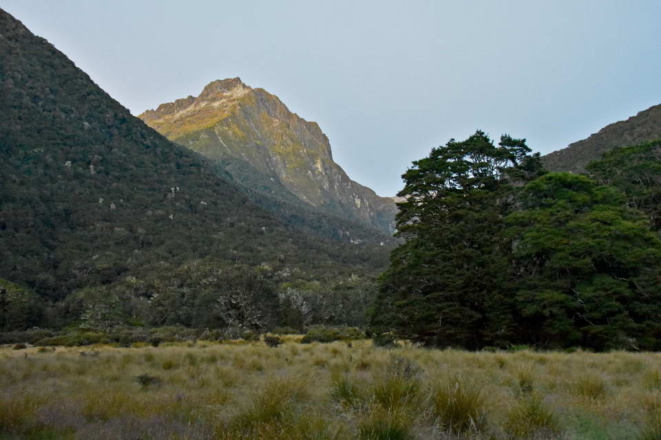
Of all New Zealands great walks, the one I've wanted to do most is the Kepler track. I have heard and read so many accounts of people that rate this track as one of New Zealands best. Last year my daughter Sarah said that she and her boyfriend were looking to book huts on the Kepler track for this summer so of course I jumped in and said do you mind if your dad comes along - so suddenly we were booked to go. Initially in January but we then had to move the date to February 18th to align with everyones leave. This was a fortunate change of plans as a storm went through during the original dates we had booked whereas the weather over the 3 days we walked the track (18 to 20 Feb) was absolutely superb.
As the date approached, NZ went into a level 2 COVID alert and New Plymouth got hit by severe winds closing the airport. Not wanting to take any chances I cancelled my flight from NP and drove down to Wellington a day early to join my daughter and fly directly from Wellington to Queenstown. Just as well as the flight I was booked on from NP to Wellington was cancelled.
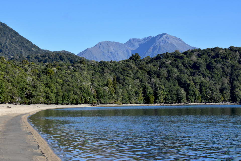
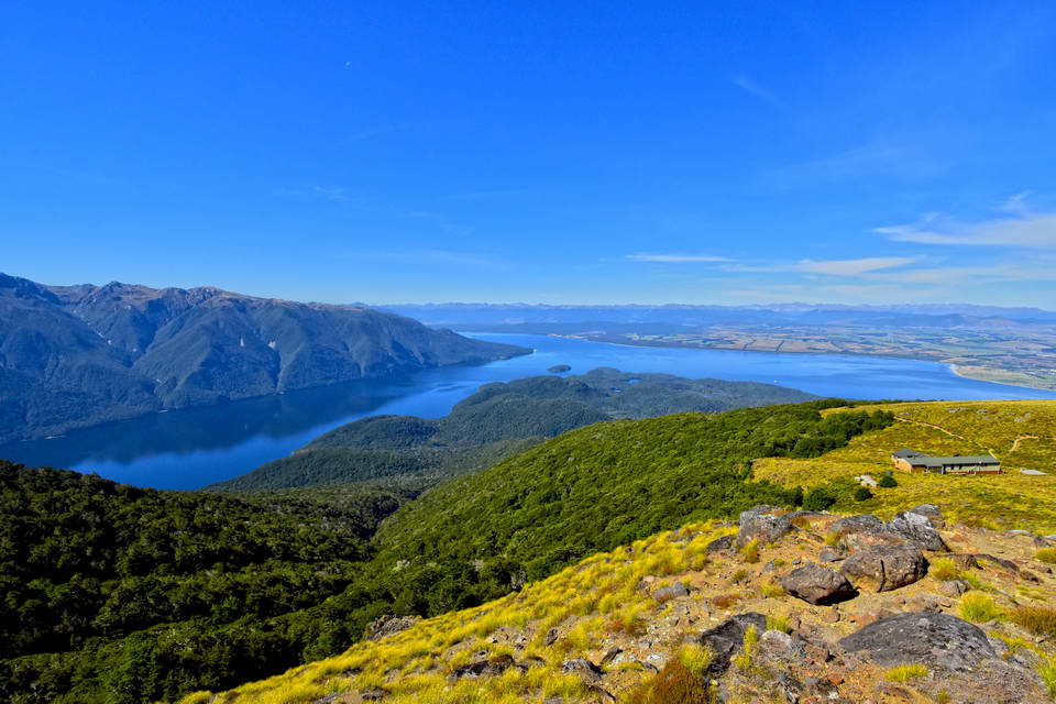
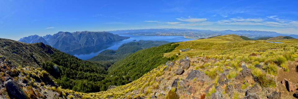
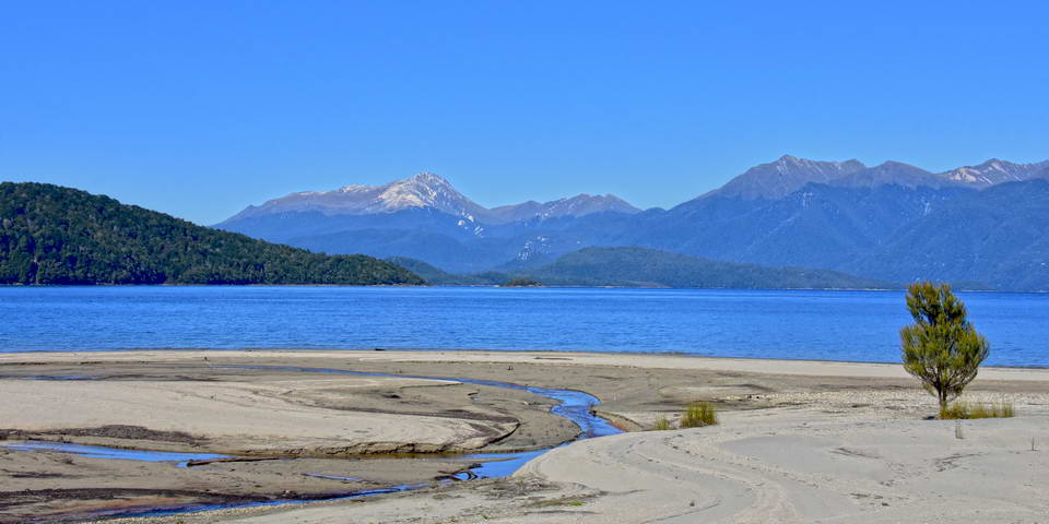
To add to the pre tramp drama, Sach's backpack didn't turn up on the baggage belt in Queenstown airport. Air NZ promised to have it delivered to our accomodation in Te Anau by 7:00pm that night so off we headed to Te Anau on a superbly clear and sunny day with great views over lake Wakitipu and the surrounding mountains.
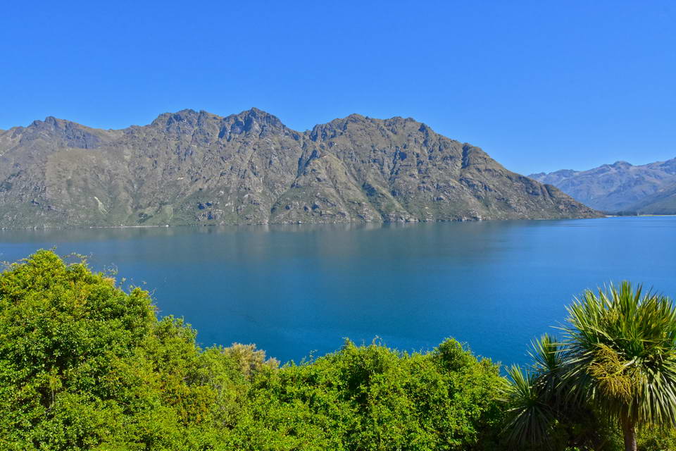
Lake Wakatipu
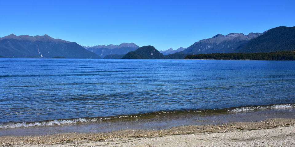
We got to Te Anau mid afternoon and confirmed our hut bookings at the visitors centre. We then checked out options for hiring tramping gear in case Sach's pack didn't turn up and went for a short walk along the lake edge.
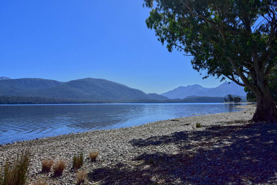
Lake Te Anau
We got a call later in the afternoon from Air NZ saying the pack had arrived in Queenstown and was on its way to Te Anau and soon after 7:00pm it arrived putting Sachs mind at ease. We could then relax and spend the evening getting ready to start the Kepler track in the morning.
Day 1: A final check of our packs and we were off to the control gate to start the track setting off around 9:00am. My dilemma on these trips is always over how much camera gear to pack. I finally settled on 2 cameras with a wide angle 10mm to 24mm lens and a 18 to 300mm zoom lens plus a small tripod - an extra 3.5kg. I'd have loved to take a 500mm lense for bird life but that was just a bit too much weight to be carrying for 3 days.
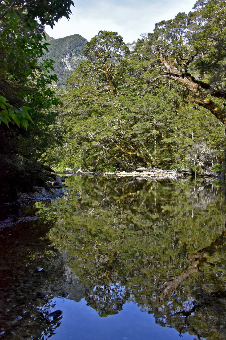
The views over lake Te Anau at the start of the track were stunning - we'd barely got started and I was already stopping to take photos.
Lake Te Anau from the start of the Kepler track.
Another shot of Lake Te Anau. The first section of the track follows the lake edge shown in this photo just inside the bush line.
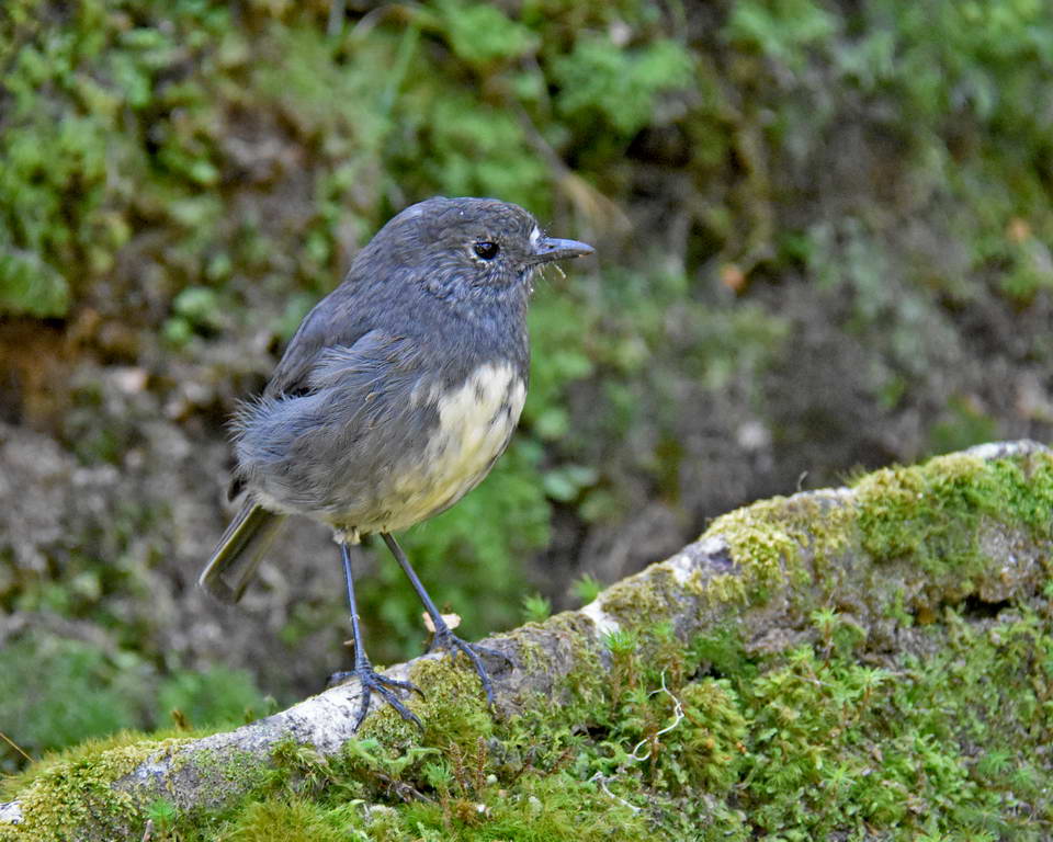
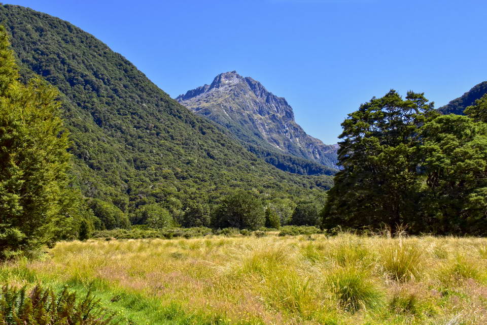
The first section of track is a pleasant flat walk through pristine beech forest around the edge of the lake to Brod bay where the track turns inland and then starts to climb up the ridge. We saw a couple of robin (toutouwai) along the track. These are beautiful friendly little birds and it was great to see them along the track.
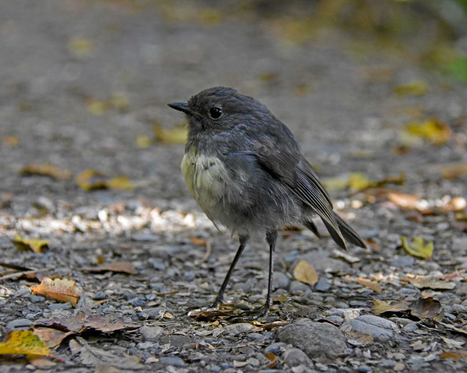
The NZ Robin - Toutouwai
The beach at Brod Bay.
We reached Brod bay at around 10:15 and after a brief stop for some water and photos (and to let the sand flies feast on our bare legs), we headed on up the track on the climb up to the limestone bluffs.
From Brod bay the track zig zags up the ridge through the beech forest at a reasonably moderate incline. As the track kept climbing I was starting to feel the weight of my pack and wondering about that second camera - too late to leave it behind now though. Instead I started looking forward to having lunch and reducing the weight by eating food.
We made really good time up the ridge and suddenly emerged from the forest in to the tussock just after midday to be greeted by some great views. The perfect place to stop for lunch.
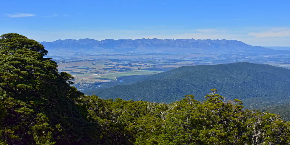
Looking east towards the Takitimu mountains.
Looking South over Lake Manapouri towards Mt Titiroa
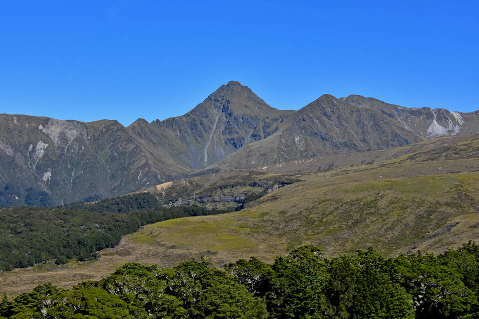
Looking southwest towards the Jackson peaks. Mt Luxmore is the higher of the 2 smaller peaks to the right.
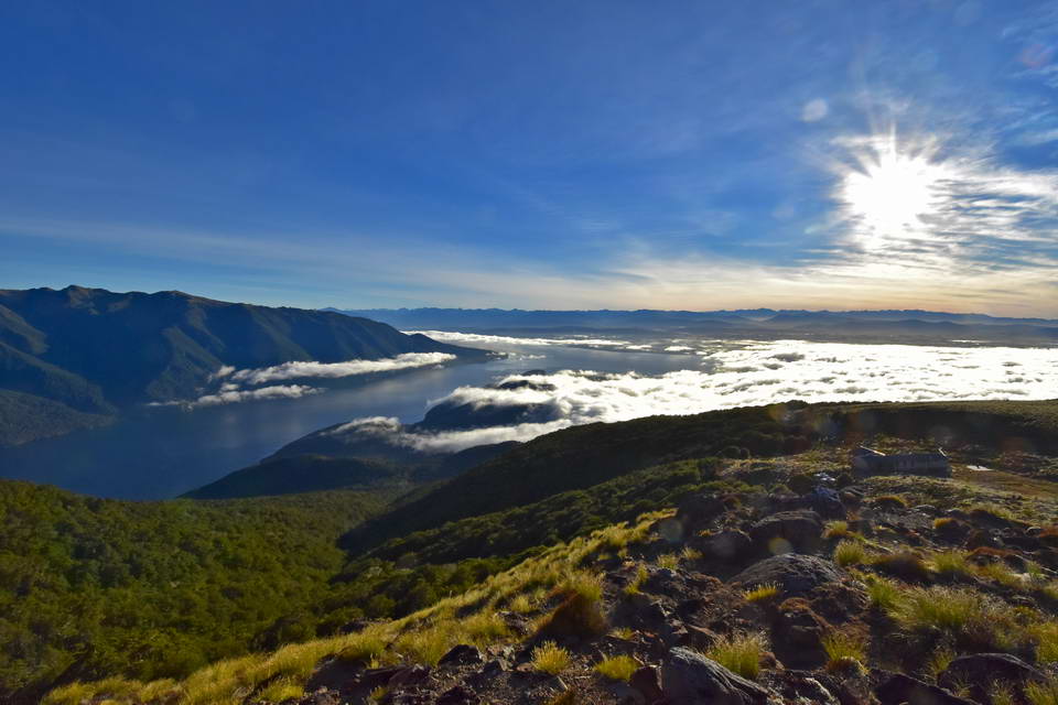
After our lunch break we carried on through the moss and tussock with amazing views spread out before us. This section of track is a great walk across the high country with just a gentle incline as you carry on up the ridge line towards Luxmore hut. With the wide open landscapes spread out before I soon became glad that I had brought an extra camera with a wide angle lens. Its so much easier to just swap cameras rather than needing to change lenses all the time.

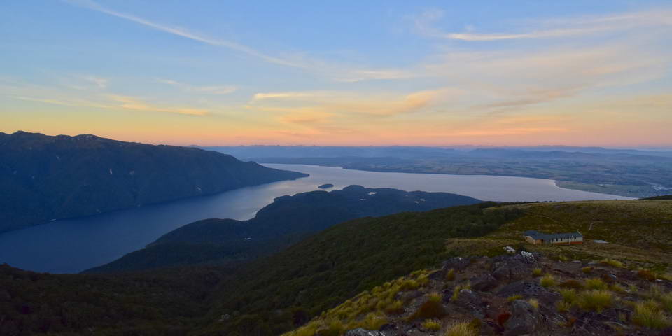
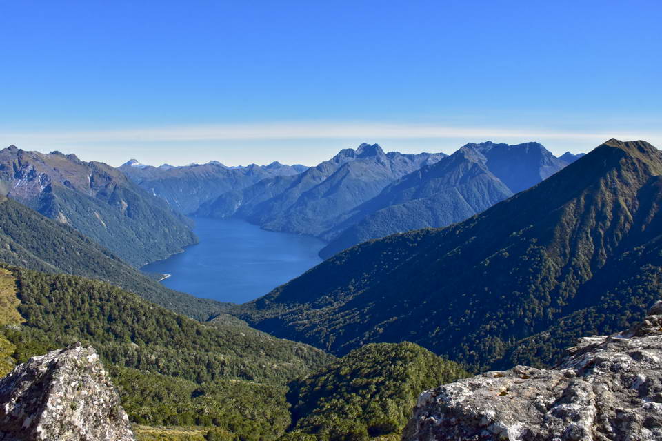
A panoramic view over Lake Te Anau with the Murchison range to the left and the Takitimu range to the right.
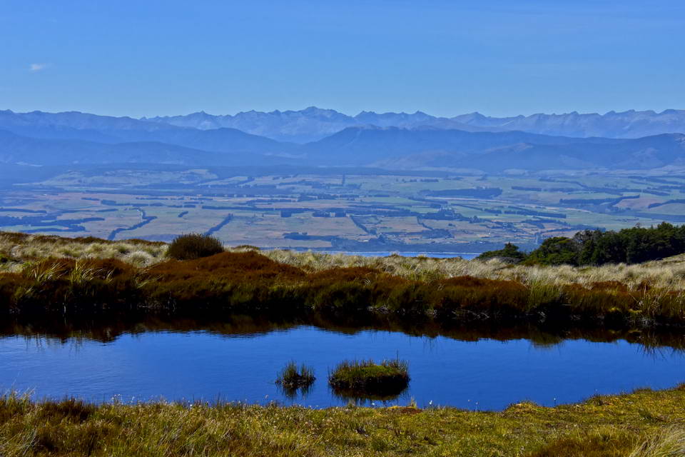
The alpine tussock zone is dotted with small tarns.
The Murchison range rising up above the southern fiord of Lake Te Anau
The Murchison range is the mountains where the Takahe were rediscovered after having been deemed extinct for over 40 years.
We arrived at the Luxmore hut at 1:00pm, checked in and claimed our bunks. This is a fantastic hut with an awesome view out over Lake TeAnau. It sleeps 54 people in two bunk rooms. Has indoor flush toilets and a large kitchen area equipped with gas cookers, sinks and water on tap.
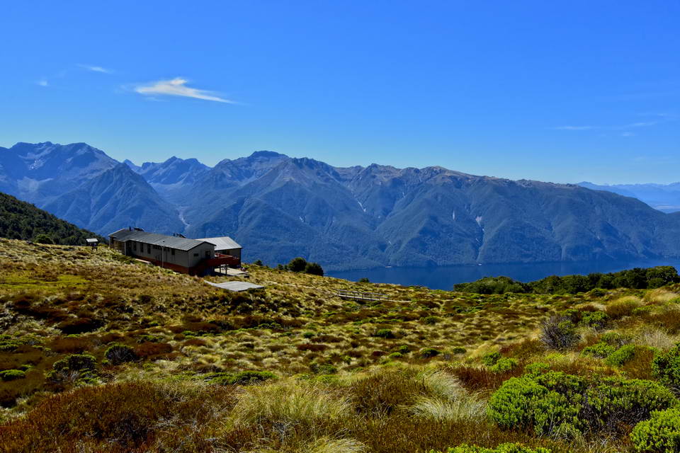
Luxmore Hut - what a spectacular location.
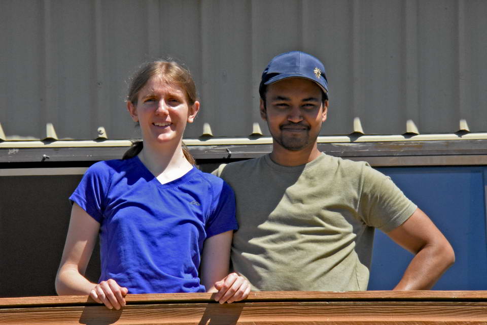
Sarah and Sach on the balcony at Luxmore Hut
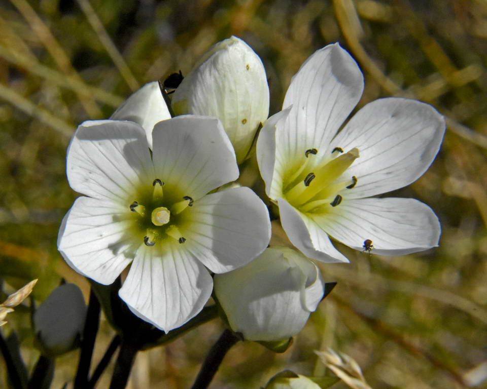
Wild Flowers Amongst The Tussock.
After a bit of a rest we headed off to the Luxmore cave which is about a 20 minute walk away from the hut. This is a small limestone cave with a small stream flowing through it and some nice formation (stalactites and stalagmites). Unfortunately much of the formation has become discoloured from people touching it but it's still very beautiful. The cave descends into the hill with a few tight spots where you need to crawl on hands and knees. We went in about 50 meters stopping above where there was a long low tunnel which you would have to crawl down. It was nice and cool in the cave after being in the hot sun out in the tussock.
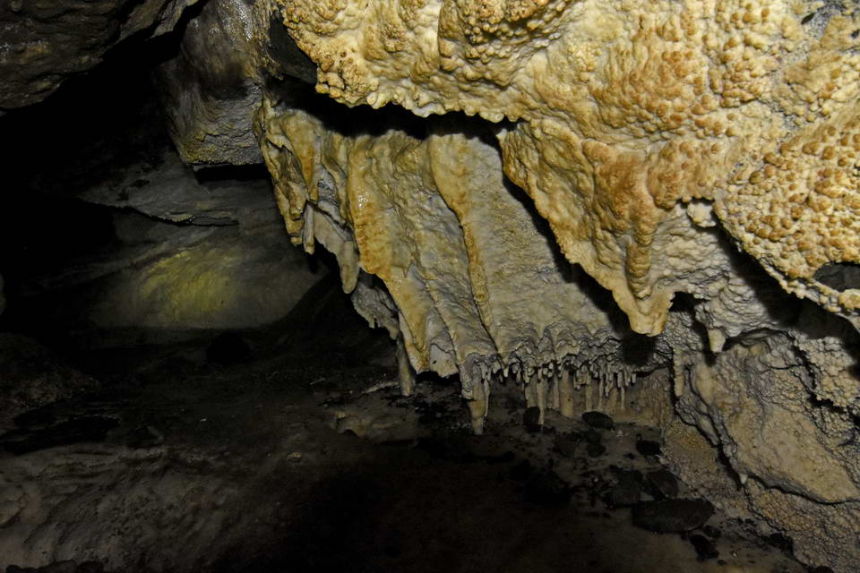
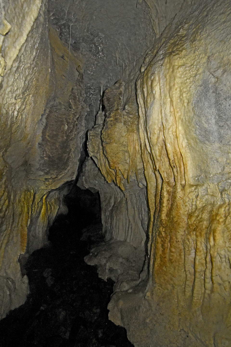
Looking down the stream with formation on both cave walls - note the discolouration on the lower bits of formation from being touched, compare this to the formation near the cave roof which is out of reach.- If you ever go into a cave - please don't touch the formation.
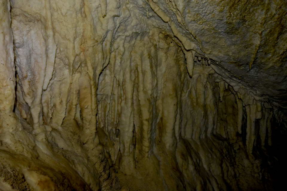
A section of formation along the cave wall.
After our caving adventure I headed further up the Kepler track above the hut to find some good spots for night photography. The moon was due to set at 1:00am which would provide some clear views of the night sky. Since I had only bought a mini tripod I needed to find some good rocky outcrops to place it on to get descent night photos.
Lake TeAnau and the Murchison range from the ridge above Luxmore hut - the hut is on the right of the photo.
A 180deg Panorama - Luxmore hut is near the center.
I spent a very relaxed hour just sitting in the rocks breathing in the view before heading back to the hut for dinner.
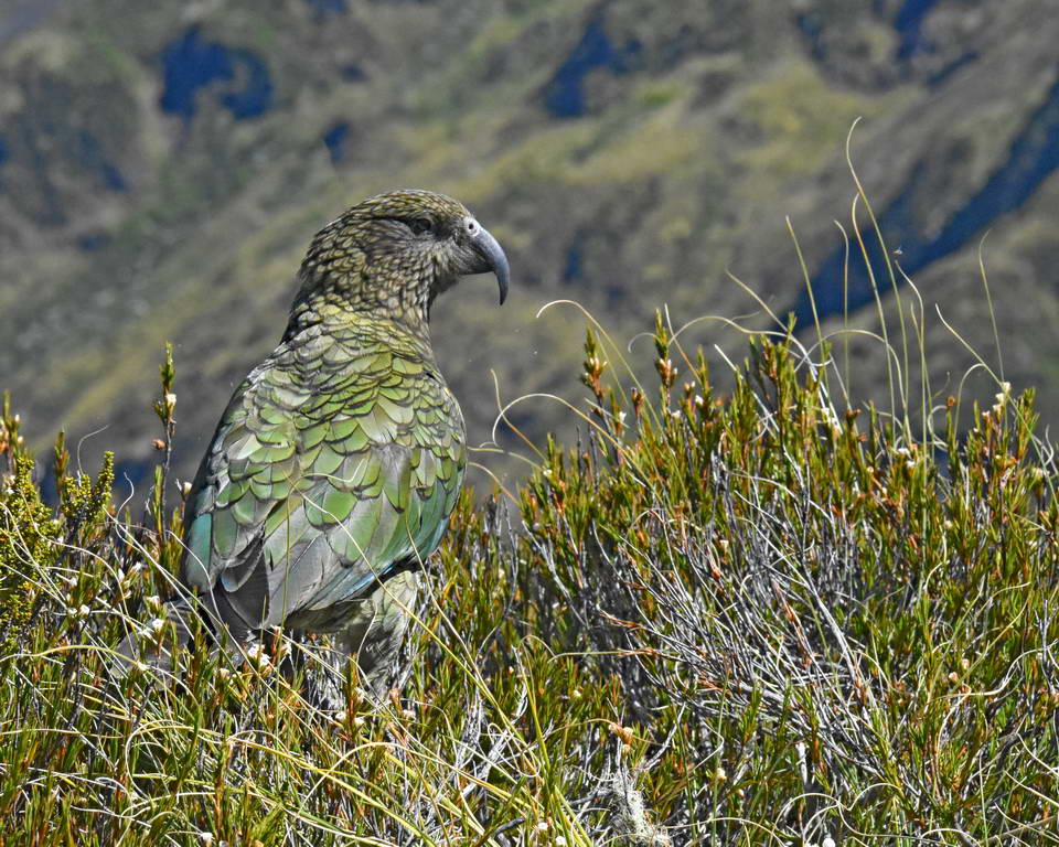
As evening approached a couple of kea turned up at the hut. These are curious and intelligent birds and will steal anything that you leave lying around.
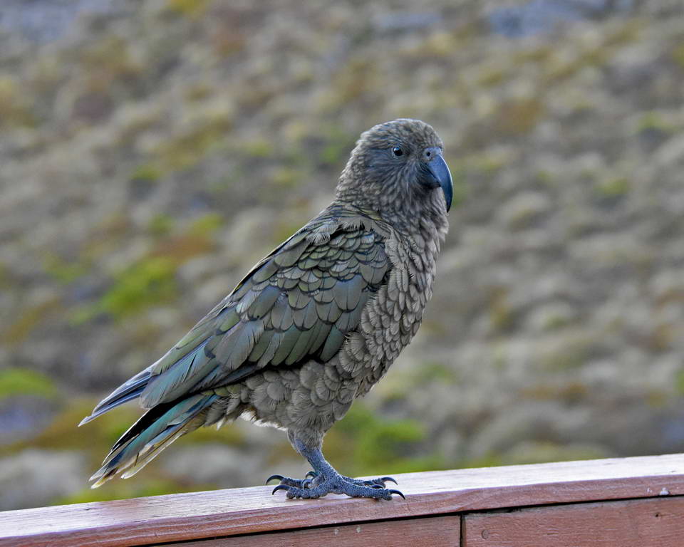
Kea - so beautiful.
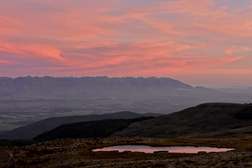
As evening approached we headed back up to the rocky point above the hut to watch the sunset and the ever changing colours over the horizon.
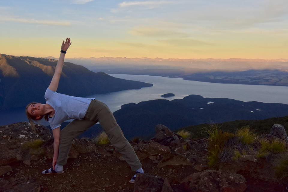
Sarah - practicing yoga
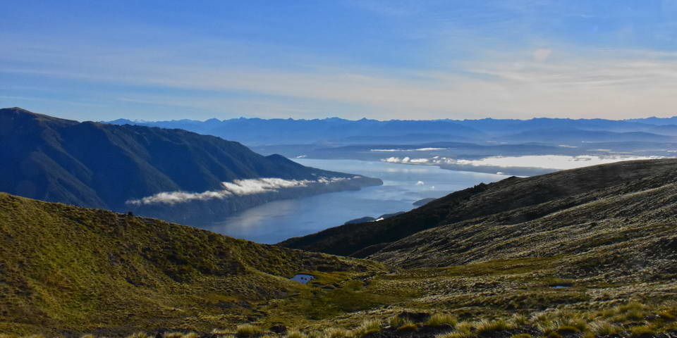
Looking north over Lake TeAnau, South Fiord and Murchison range to the left.
Wide angle shot - south west, Takitmu Mountains to the left, Mt Titiroa to the right
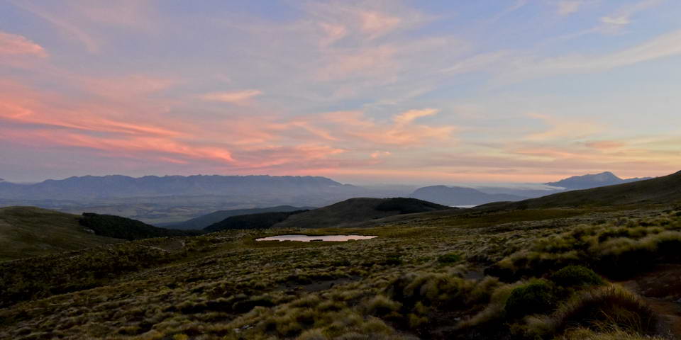
Looking West - The Takitimu Mountains over one of the alpine tarns
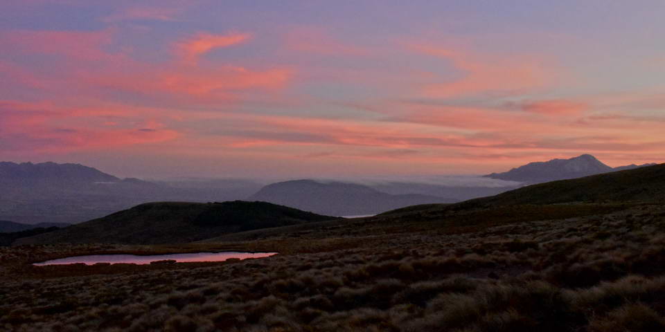
South west - Mt Titiroa to the right.
and then suddenly it was dark - time to head back to the hut and get to bed.
Day 2: This is an amazing day where your traverse the high ridges climb to the Top of Mt Luxmore and spend the day in wonder as every few minutes along the track reveals a new view. The day started early for me as I was up at 4:00am to get my night photos. The night sky was simply amazing spread out above Lake TeAnau and the mountains of fiordland. I saw numerous shooting stars as I headed up the track by torchlight to the rocky outcrops I had picked out the afternoon before.
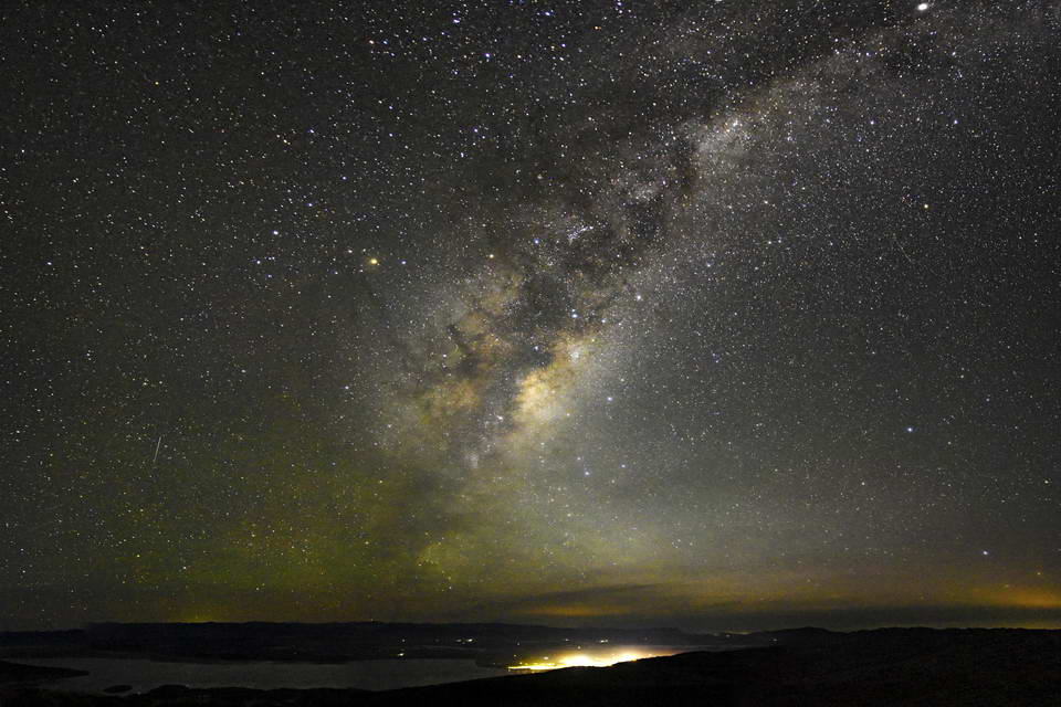
The milkyway rising up above Lake Te Anau. The lights on the lake shore are from Te Anau. The red glow over the horizon is a result of the light polution from Queenstown lighting up the thin layer of high cloud. The red glow to the right is probably from Lumsden or one of the other small Southland towns.
Having taken my night photos it was still over an hour to dawn so I wrapped my self up in my warm clothes and snuggled down in the shelter of a rock just staring up at the beauty of the night sky. As I lay there I could here some rustling coming from the tussock which got closer and closer. I was thinking it woulfd be a rabbit or a hare and turned on my headlamp to investigate and there - only a meter away was a large kiwi - just amazing. Since my headlamp was a bright white LED lamp I immediately turned it off as I didn't want to risk blinding or disorienting the kiwi. I just lay there listening to it slowly moving off as it carried on foraging in the tussock and wishing I had a red light.
As dawn approached, the stars slowly faded away, mist formed across the lake and the dawn glow grew brighter over the eastern horizon.
Dawn
The dawn sky over the Takitimu Mountains
The morning cloud at dawn over Lake Te Anau
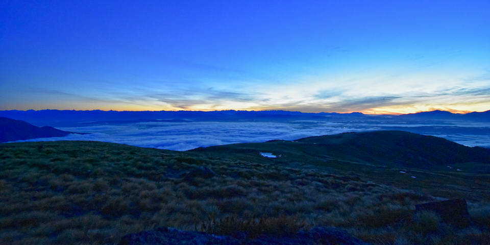
After watching the sunrise it was back to the hut for breakfast, packing up our gear and heading off on day 2 of the track. We headed off around 8:15 on a beautiful clear morning as the morning mist started to burn off the lake below.
Early morning from the ridge above Luxmore hut
From Luxmore hut the track climbs up the ridge line and then traverses across a valley and around the next ridge line to get to he base of the Mt Luxmore peak. New views just keep opening up as you walk this section of track and I was constantly stopping to take more photos.
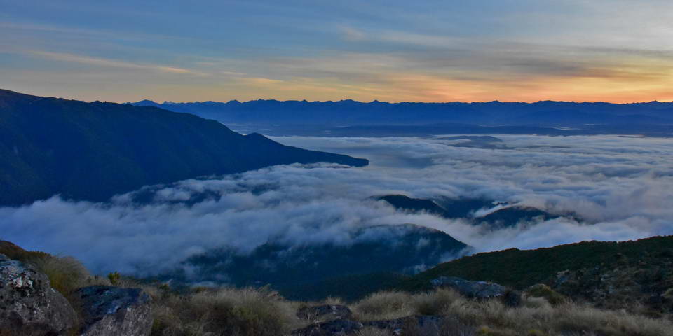
Looking down the valley and the last remnants of the morning cloud clinging on to the lake edges
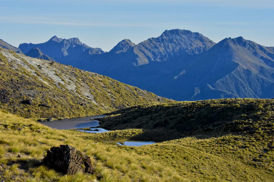
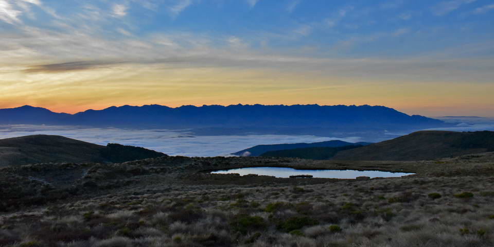
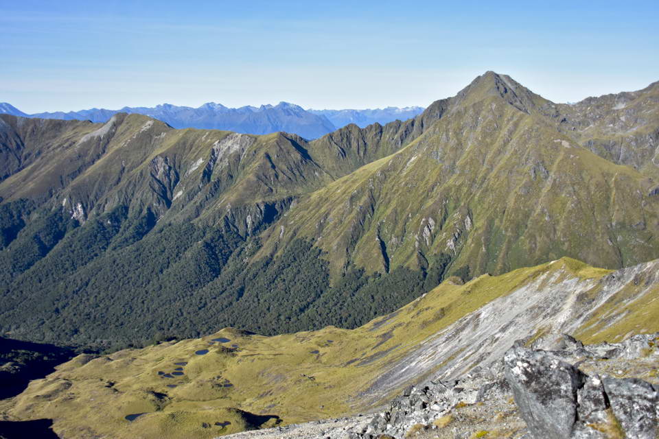
An alpine tarn with the high peaks of the Murchison Range in the background
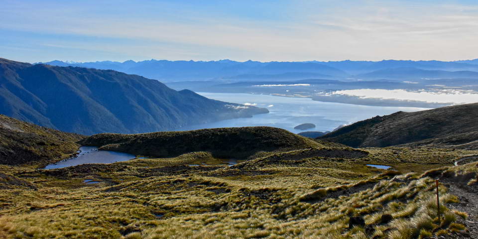
An Alpine Tarn and Lake Te Anau
The track up to Mt Luxmore is a 20 minute detour off the main track and is the high point of the traverse at 1482m. The views from the top of Mt Luxmore were stunning. We timed it well having the summit to ourselves for 10 minutes.
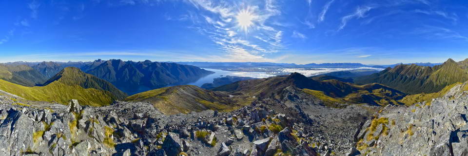
A panorama from the summit of Mt Luxmore. This is spanning around 240deg.
The Jackson Peaks from the Summit Of Mt Luxmore
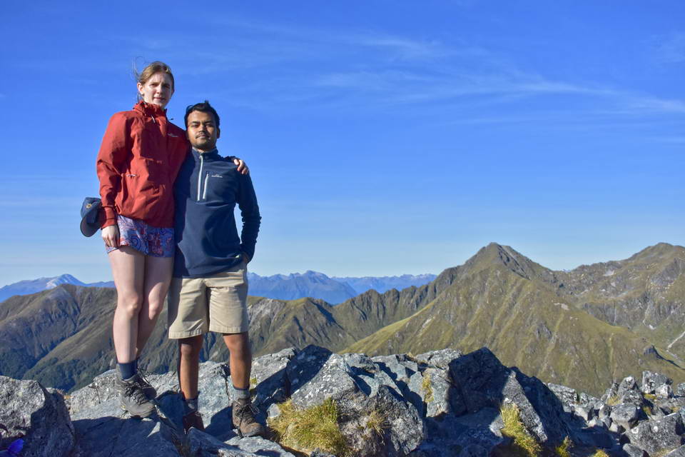
Sarah & Sach On Top Of Mt Luxmore
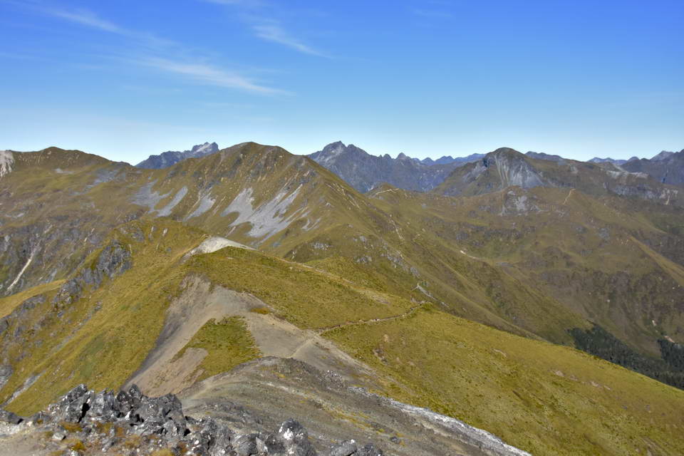
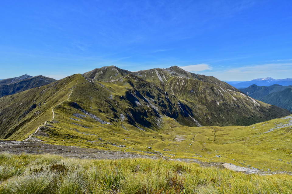
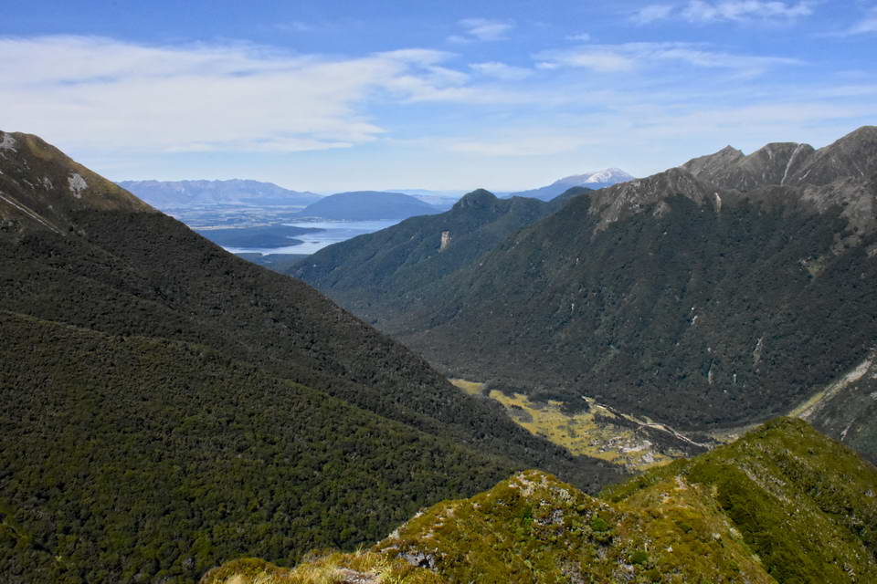
Looking west in the direction that the track heads. The track descends off the side of the ridge from Mt Luxmore to the Forest Burn Shelter then traverses around the next ridge. If you look closely you can pick up the track line again as it reappears on the far distant ridge line.
The initial descent from Mt Luxmore is quite steep as the track zigzags across a slip face. From this section of track you start to get some great views into the far end of the South Fiord of Lake Te Anau.
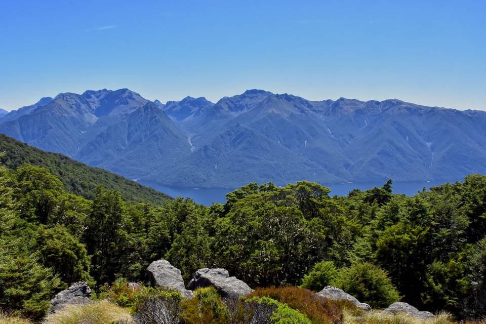
The far end of the South Fiord of Lake Te Anau.
The track carries on winding around the ridges until you regain the ridge line heading towards the Hanging Valley shelter where we stopped for a long leisurely lunch.
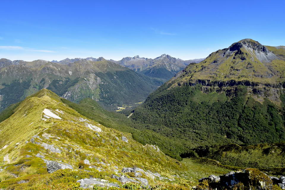
Looking back along the track. Hanging valley is the valley to the right. You can follow the track line back along the ridge to the left and in the far distance, the triangular peak on the sky line on the left is Mt Luxmore.
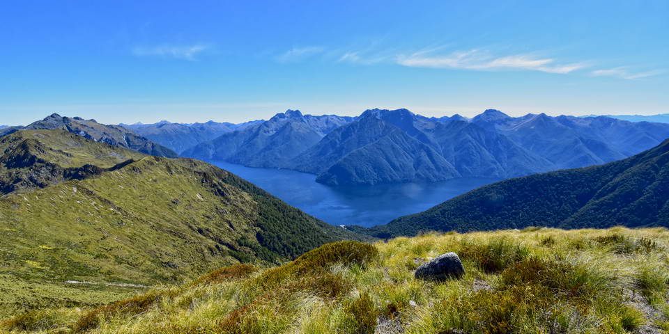
The South Fiord of Lake Te Anau and the Murchison Range.
From the hanging valley shelter the track descends down the ridge line quite steeply in places with a number of flights of wooden steps.
Mt Tinsley is the peak to the right. The track descends along the ridge on the left. The small clearing in the bottom of the valley is where the Iris Burn Hut is located.
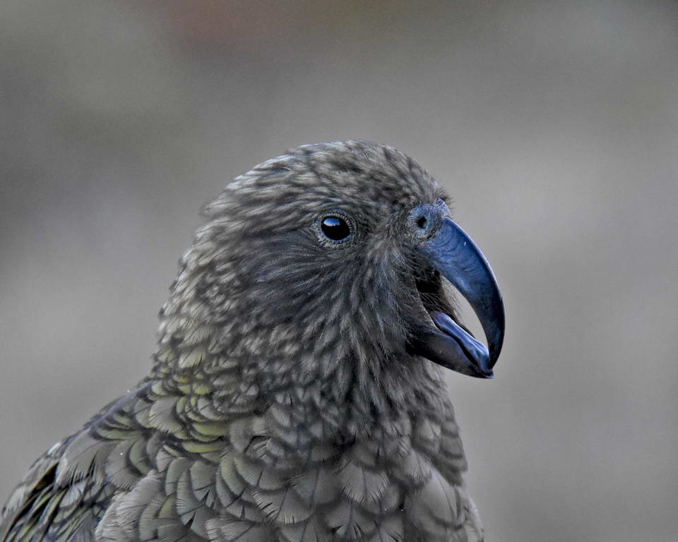
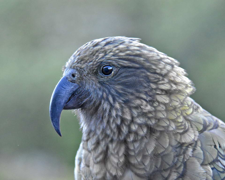
Halfway down the ridge we were graced by a visit from a kea.
A kea - looking magnificent.
At the bottom of the ridge there is a small detour to a look out point with views down the iris burn valley to lake Manapouri.
The Iris Burn valley - Lake Manapouri in the distance.
From the lookout point the track descends steeply over a series of zigzags down into the beech forest and keeps on going down all the way to the bottom of the valley. There is plenty of bird life though the birds tend to stay out of site up in the canopy of the trees. I did however see several robin on the track and a brief glimpse of a South Island tomtit (miromiro).

NZ robin - Toutouwai
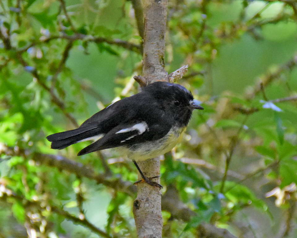
South Island tomtit - miromiro
The view from the door of the Iris Burn Hut - The mountain in the middle is Spire Peak
We got to the Iris Burn hut around 2:00pm. This is another great hut with good facilities and internal flush toilets. I had a bit of a sleep when we arrived as I was pretty tired having been up since 4:00am, before heading off for a walk down to the iris burn water fall. The beech forest here and the pristine river were really beautiful. There were a few sand fly about though my insect repellent proved to be pretty effective.
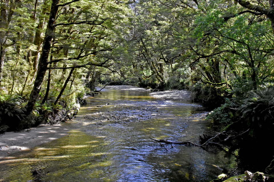
Iris Burn river
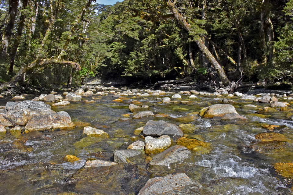
The river just below the falls.
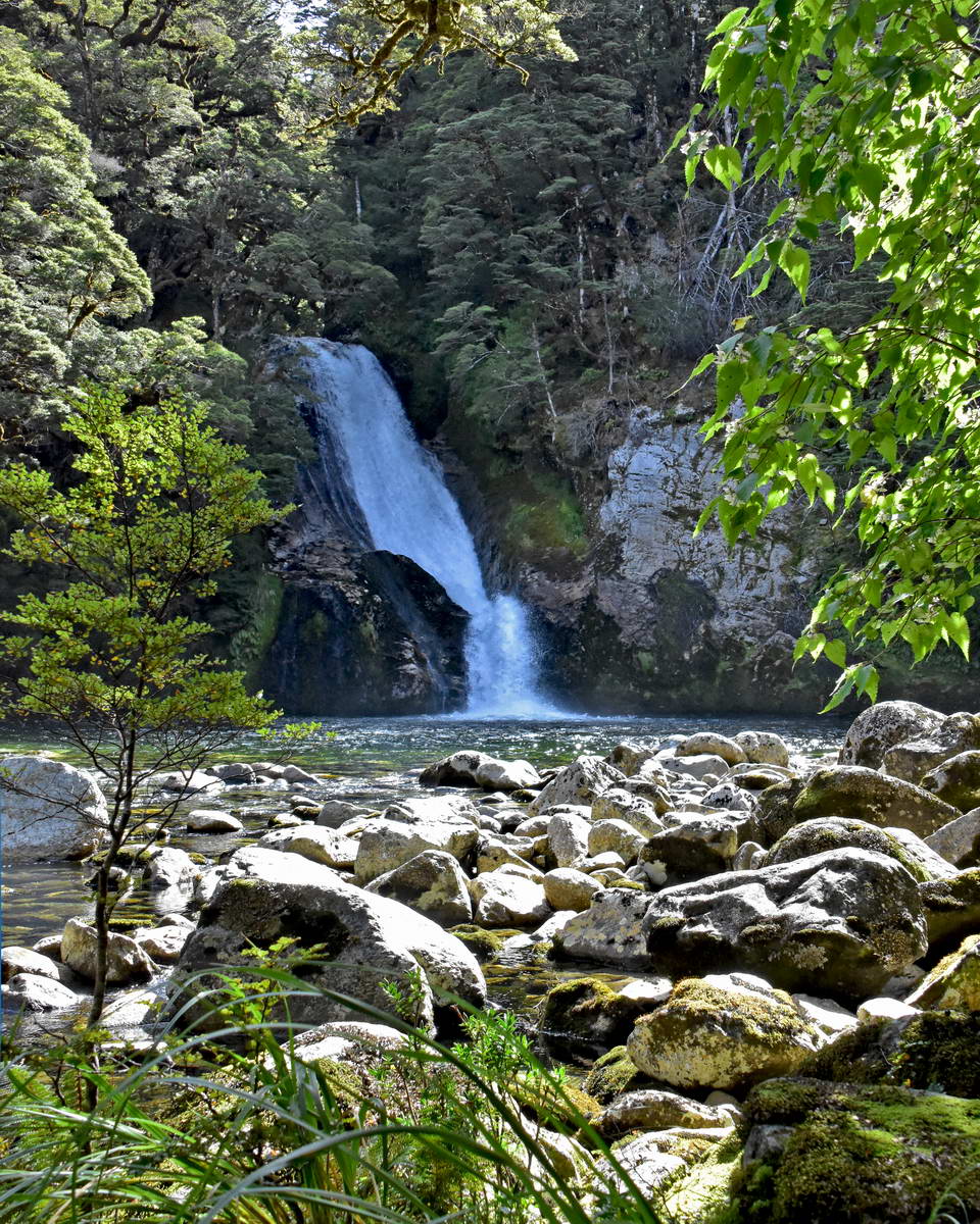
The Iris Burn Falls.
There were a few people who went in for a swim here but they didn't stay in for long - the water was pretty cold.
Some beautiful tall beech trees reflected in a quite stretch of the river.
Then it was back to the hut for an evening meal and to listen to the daily briefing from the hut ranger. He said that there had been plenty of kiwi sightings in the tracks around the hut and suggested that anyone with a red light (you need a dim red light to watch kiwi at night as it doesn't disturb then or risk blinding them) to go back along the waterfall track after dark. Sach did have a red light so he and Sarah went kiwi spotting but were unlucky and didn't spot anything. With the night setting in it was time for bed. It was a quiet night and I slept well after a fantastic day hiking over the ridge lines.
Day 3: Most of day 3 is spent hiking out through the beech forest following the iris burn valley. There are a few short climbs but most of the track is either flat or gently descending until you come out and walk around the edge of Lake Manapouri to the Moturau hut. We had breakfast and got packed up and set off by 8:15 and arrived at Moturau hut at about 12:15.
Spire peak at dawn lit by the first rays of the morning sun
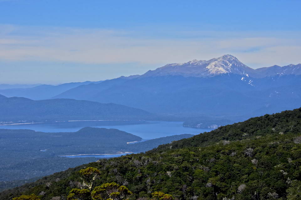
Lake Manapouri - looking south towards Mt Titiroa
Lake Manapouri from Moturau hut.
We had a long relaxed lunch break at Moturau hut, swimming and wading in the lake and enjoying lying in the warm sun before finally heading off to Rainbow reacjh sometome after 2:00pm. I stopped for quite a while on the way at the Kepler wetlands where I spent ages trying to photograph dragonfly in flight.
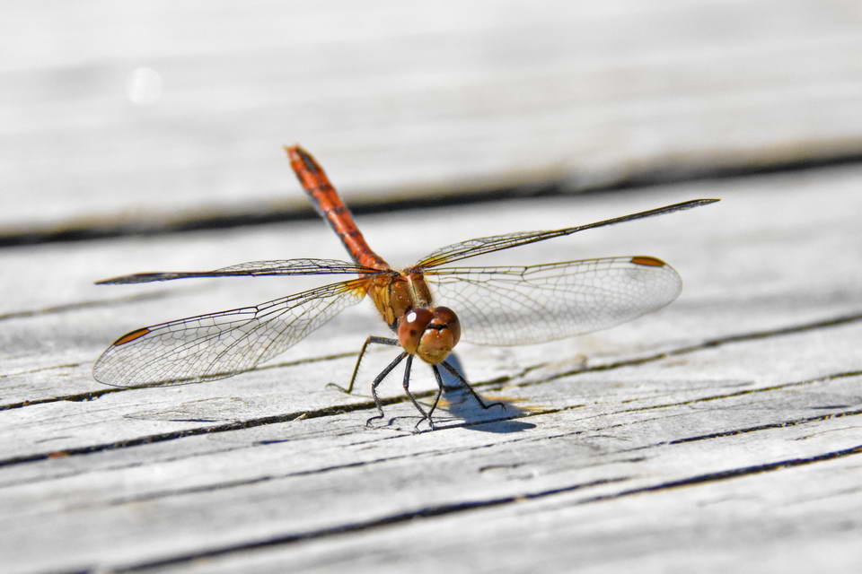
A beautiful little dragon fly - there were plenty of dragon fly and damsel flies at the small lake in the wet lands
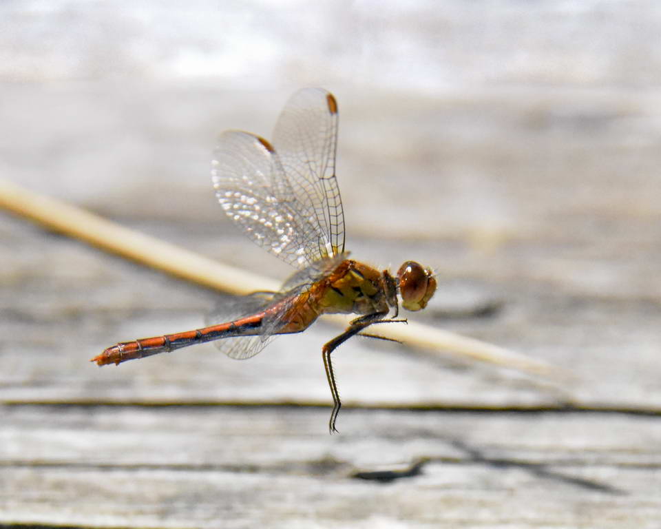
Patience pays off - I'm not saying how many shots I took before I got this one.
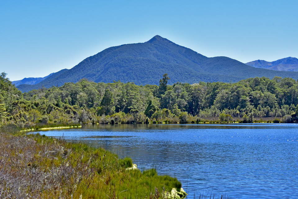
The small lake in the Kepler wetlands.
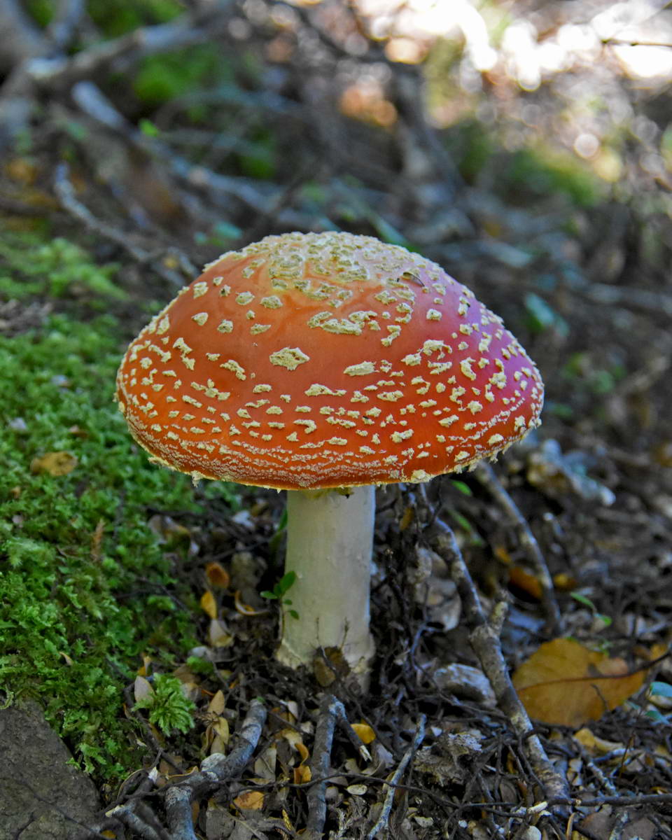
There were several of these large toadstools in this section of beech forest - and no doubt, somewhere out of sight, fairies lurking about.
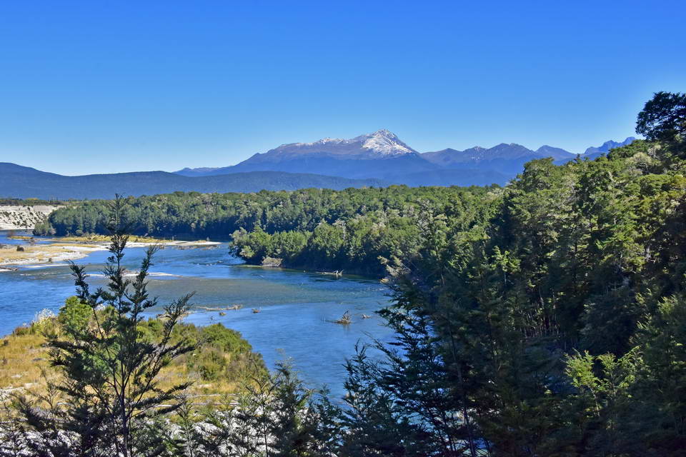
The view down the Waiau river with Mt Titiroa in the background. This was about 10 minutes before reaching Rainbows Reach.
We arrived at Rainbows Reach at 3:45 after a bit of a rush along the last section of track since we didn't know how close we were and had a shuttle booked for 4:00pm to take us back to the control gate.
Then suddenly we were out of the wilderness and back in the real world after three superb days on the Kepler Track. I would thoroughly recommend this track. It really is a great walk through the stunningly beautiful landscapes of the Fiordland national park.
If you are thinking of walking this track some must haves are:
- sunscreen - you're in the sun a long time on day 2
- Insect repellent - unless you're keen on keeping the sand fly population fed
- a red light for kiwi spotting
- a good quality head lamp for going into the Luxmore cave - don't touch the formation!
- plenty of camera gear - the more the better, don't worry about the weight.
- good quality wet weather gear. we struck it lucky but I've talked to people who have been caught in blizzard conditions on this track in the middle of summer.
Recent Posts
-

The Milford Track
For the last few years my daughter Sarah, her fiance Sach and myself have been completing a great w …13th Feb 2024 -

The Waikaremoana Great Walk
We had originally planned to walk the Waikaremoana track in Februrary 2022 but with uncertainty over …31st Jan 2023 -

The Routeburn Track
We were going to walk the Waikaremoana Track this February but had concerns that the track might not …27th Feb 2022