
The Routeburn Track
We were going to walk the Waikaremoana Track this February but had concerns that the track might not reopen so we cancelled and booked the Routeburn instead for the 10th to 12th Feb. As the date approached, the West Coast was hit by a major storm front with another storm forecast just when we were about to head off. Fortunately, as we were heading off to Queenstown, the 2nd storm was being pushed further north and it looked like we would get some fine days. When we arrived in Queenstown on Wednesday afternoon, it was still showery with showers forecast for our first day on the Routeburn.
It was Fergburgers for tea and I was about to hit the sack early when I looked out the window of our apartment and saw a stunning sunset over Lake Wakitipu so hurriedly got dressed again and rushed out with my camera to capture this stunning shot.
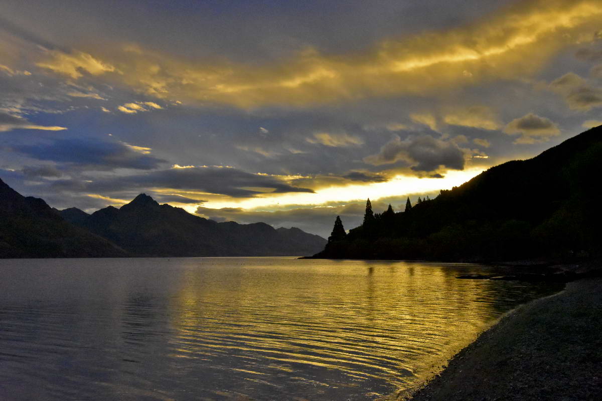 Lake Wakitipu at Sunset
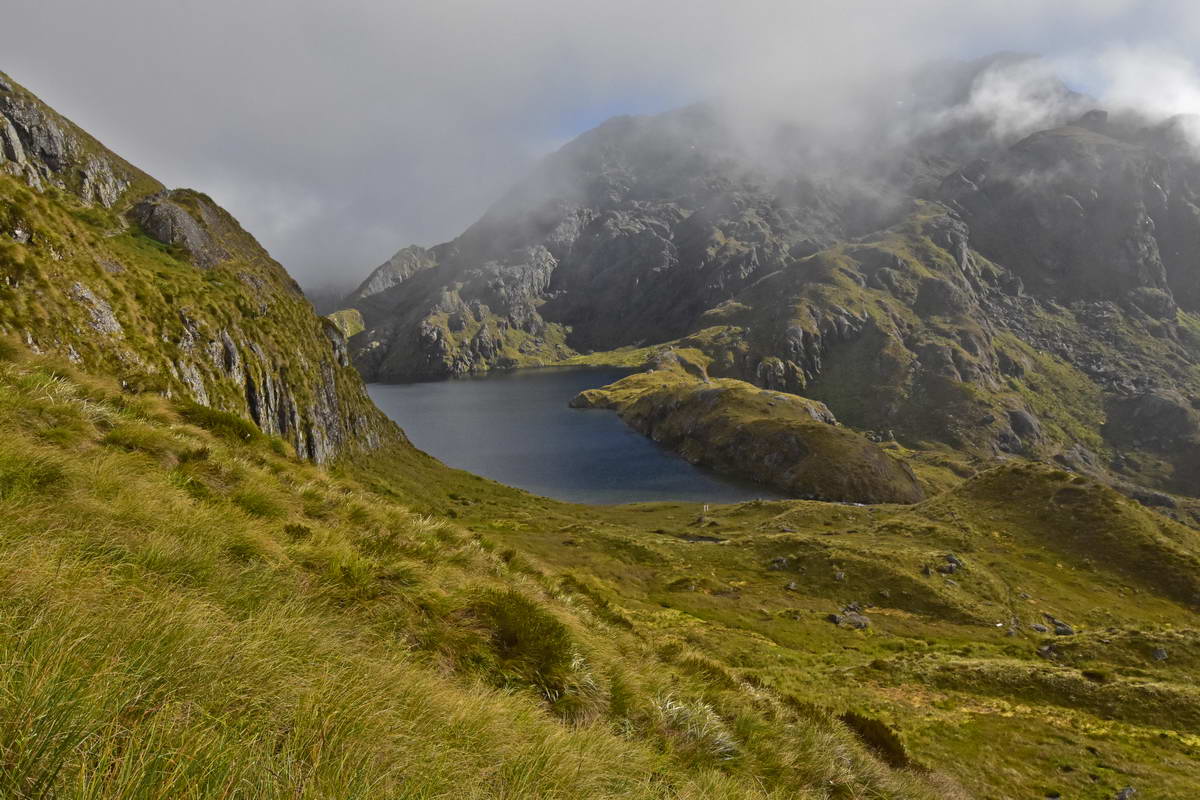
Thursday dawned cloudy with fog over the lake. We sorted out our packs and headed off to the Info & Track shop to catch the bus to the start of the track. As we headed off in the bus towards Glenorchy the lake was mostly obscured by cloud and when we arrived at Glenorchy for a 5 min break there was thick fog everywhere. From Glenorchy the road heads up the Dart river valley and then up the Route burn valley to the Routeburn Shelter. As we approached the shelter we suddenly drove out of the fog into bright sunshine with clear blue skies over the mountains ahead.
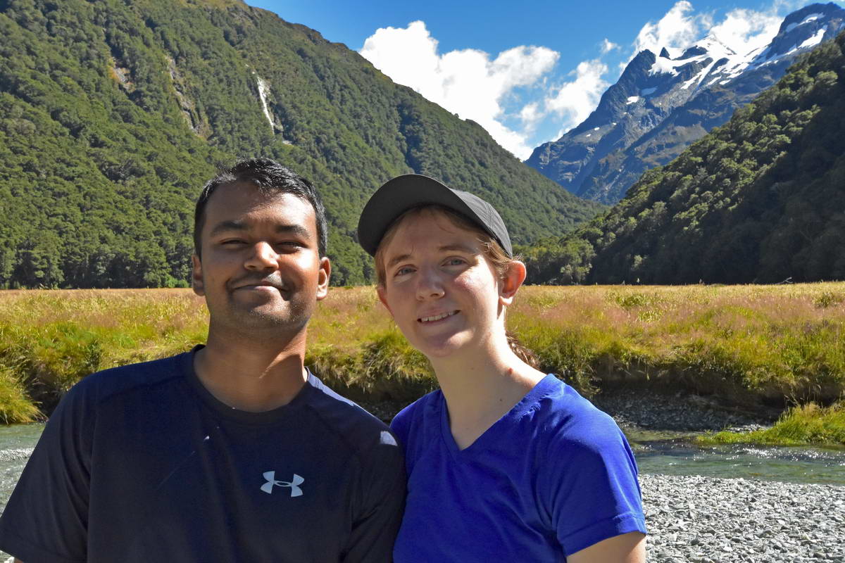
The conditions couldn't have been better as we made our final preparations to head off on the track.
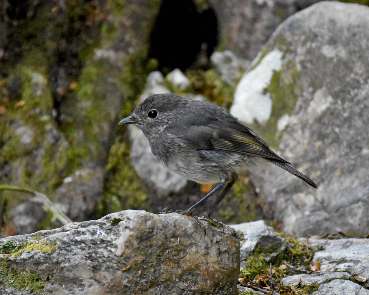
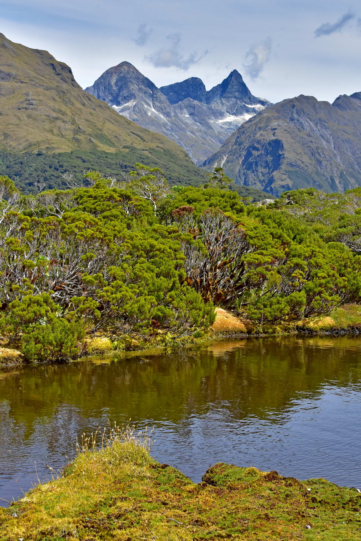
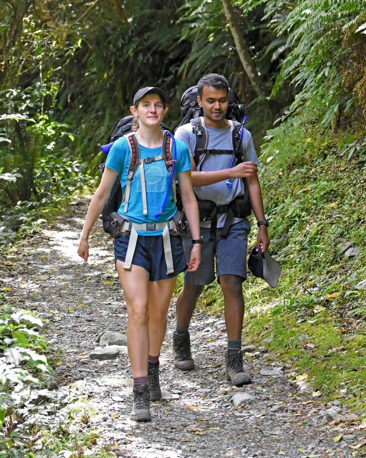
The first section of the track follows the Route Burn (where burn is Scottish for river) through some pristine beech forest. I was hoping to get some photos of titipounamu (rifleman) in this section of beech forest and ha my camera to hand but though we heard them calling in the canopy and caught a brief glimpse of one I failed to get any photos though I did get some good shots of the SI Robin (toutouwaui).
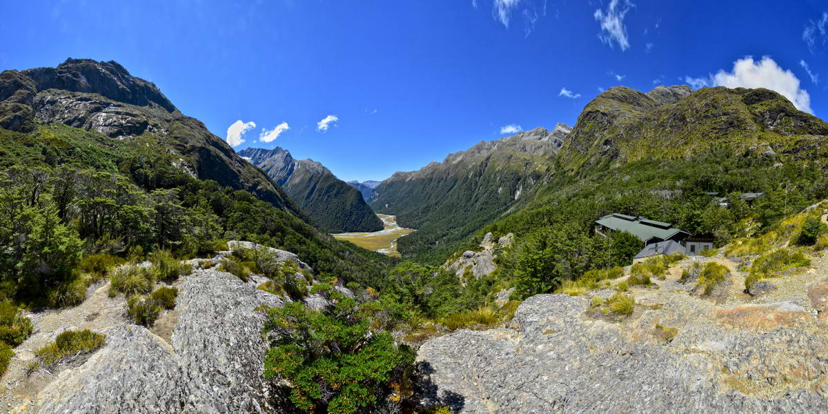
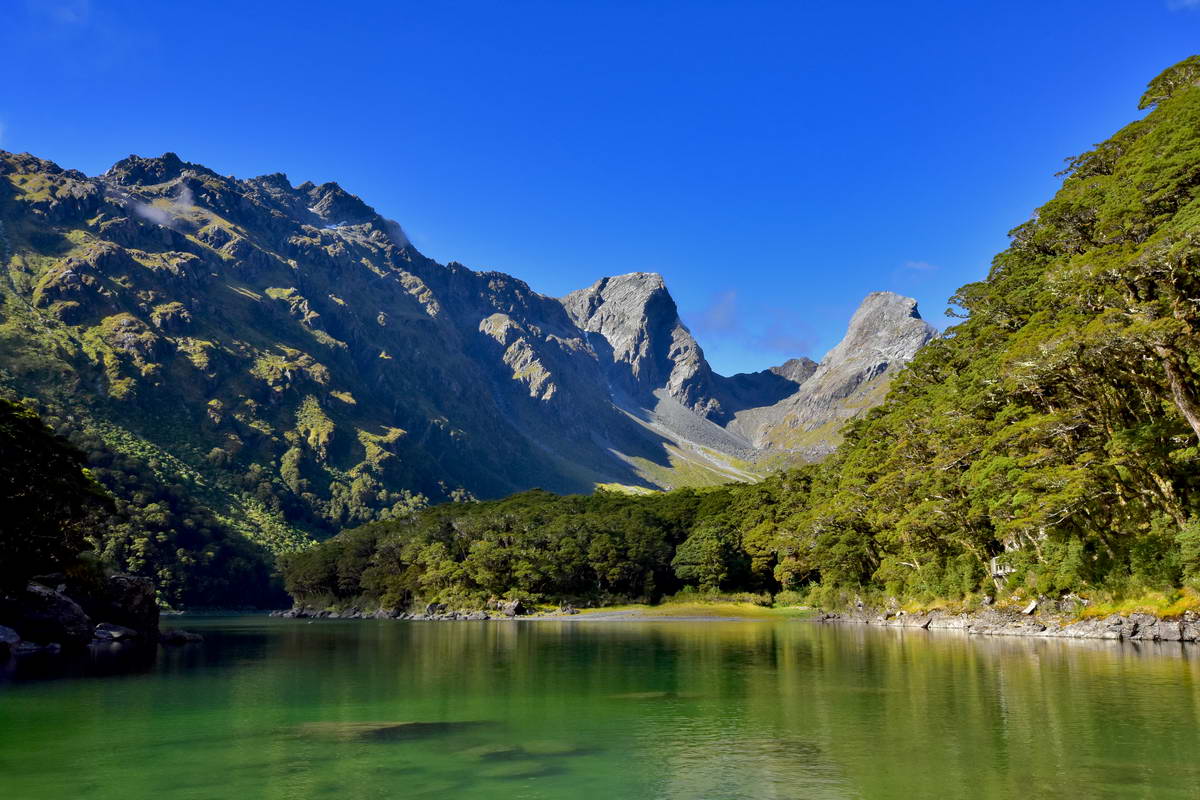
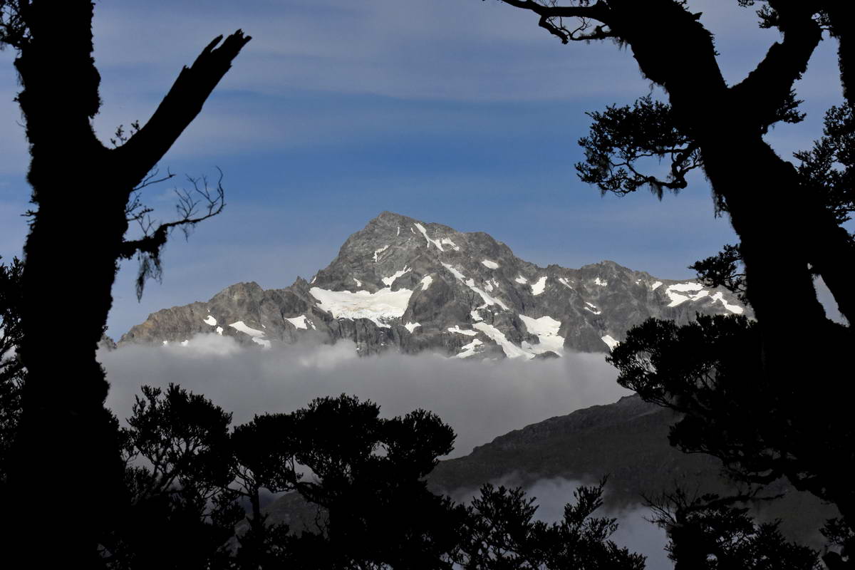
Looking Up The Route Burn Towards The Humbolt Mountains from the bridge at the start of the track.
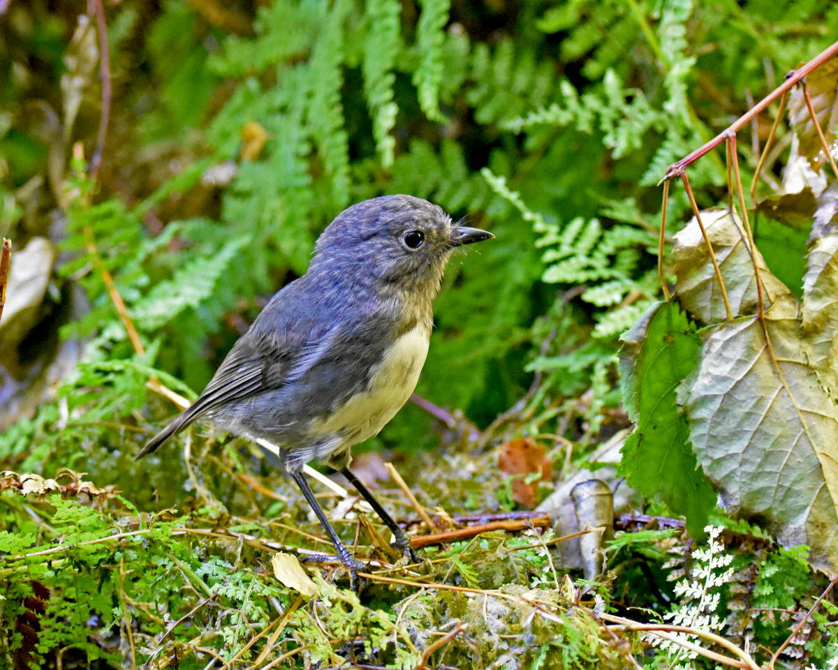
A Beautiful little toutouwai (robin)
Toutouwai are very friendy and inquisitive birds making it easy to get a close up shot.
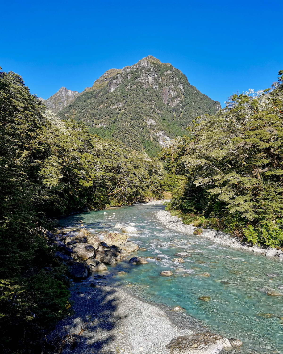
We took a little detour to get down tot he river. The water was crystal clear.
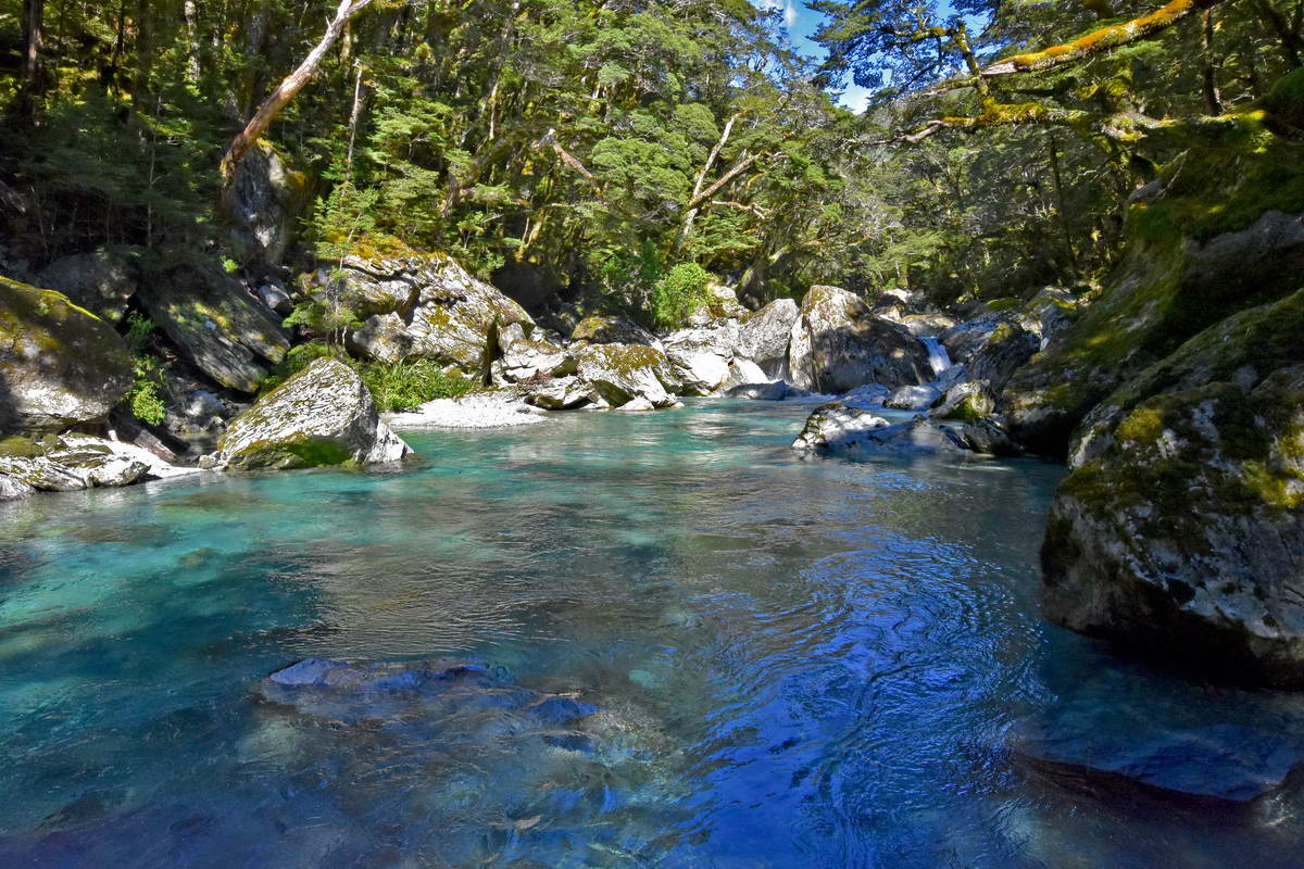
Crystal Clear Water Of The Route Burn
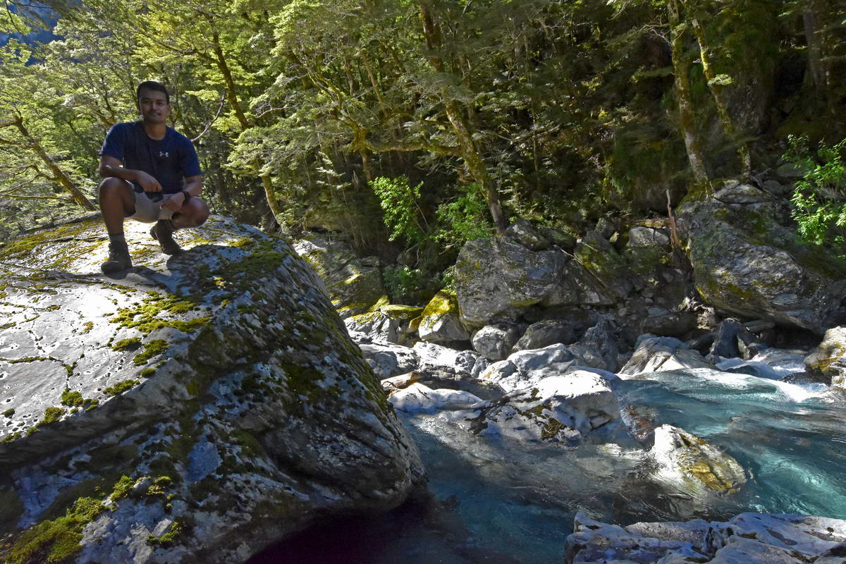
Sash at the rivers edge.
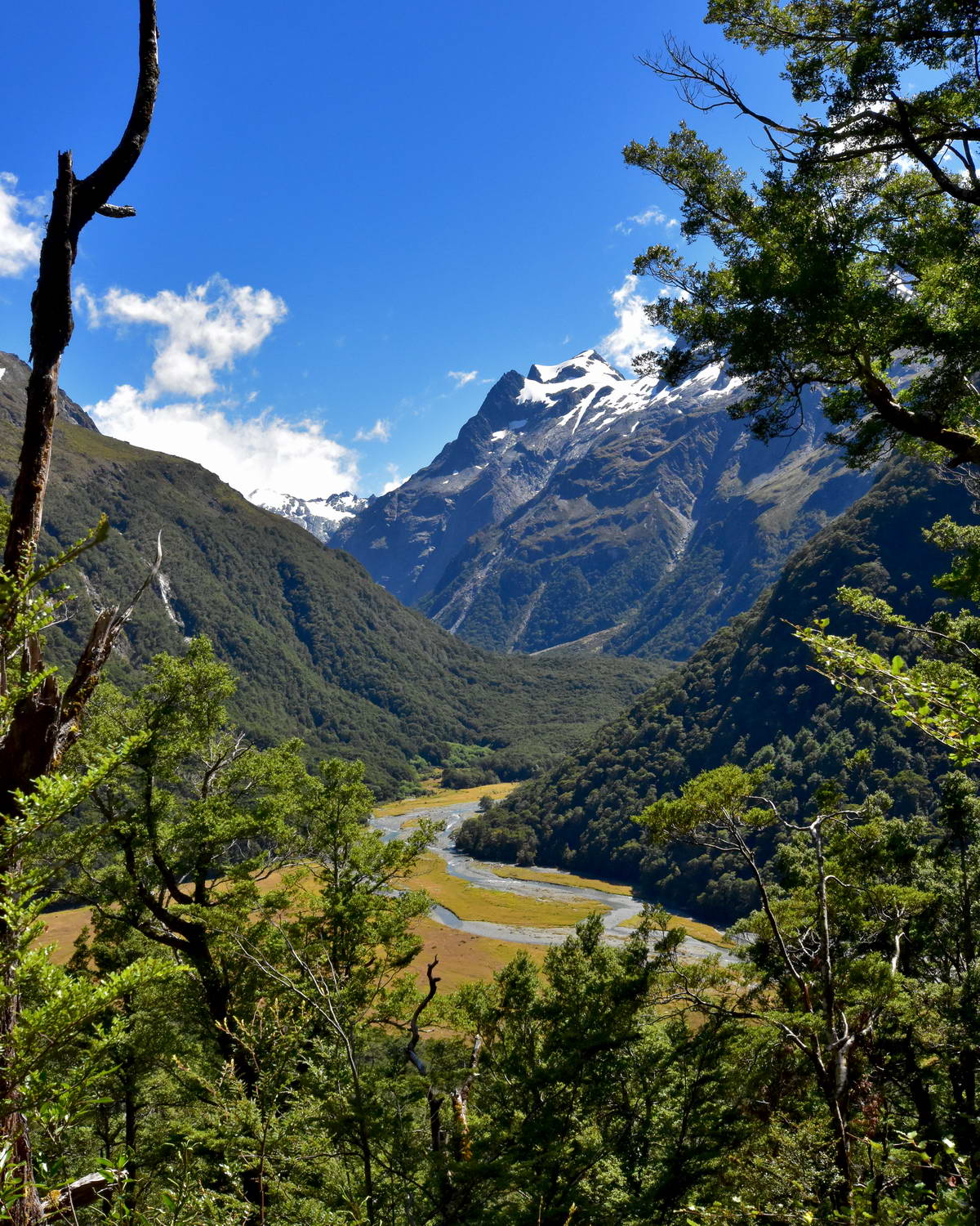
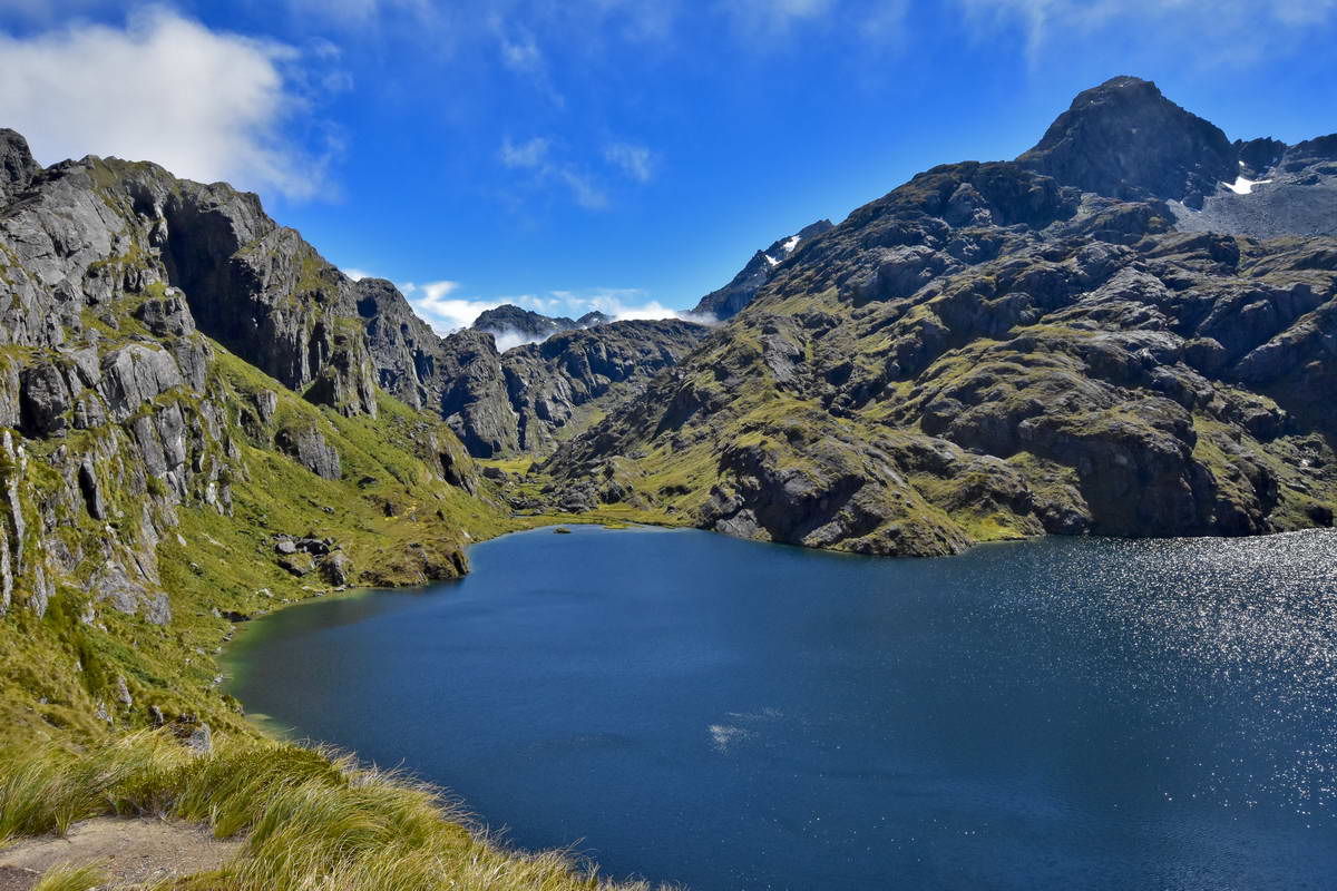
After about 1 & 3/4 hrs easy tramping we emerged into the open grassland of the Routeburn Flats. The Routeburn Flats hut is a 5 minute detour off the track so we stopped off to have a short break and a bight to eat. I had put some new innersoles in my boots which were proving not to be too comfortable so I spent some time hacking bits of rubber off the inner soles to try and get a better fit.
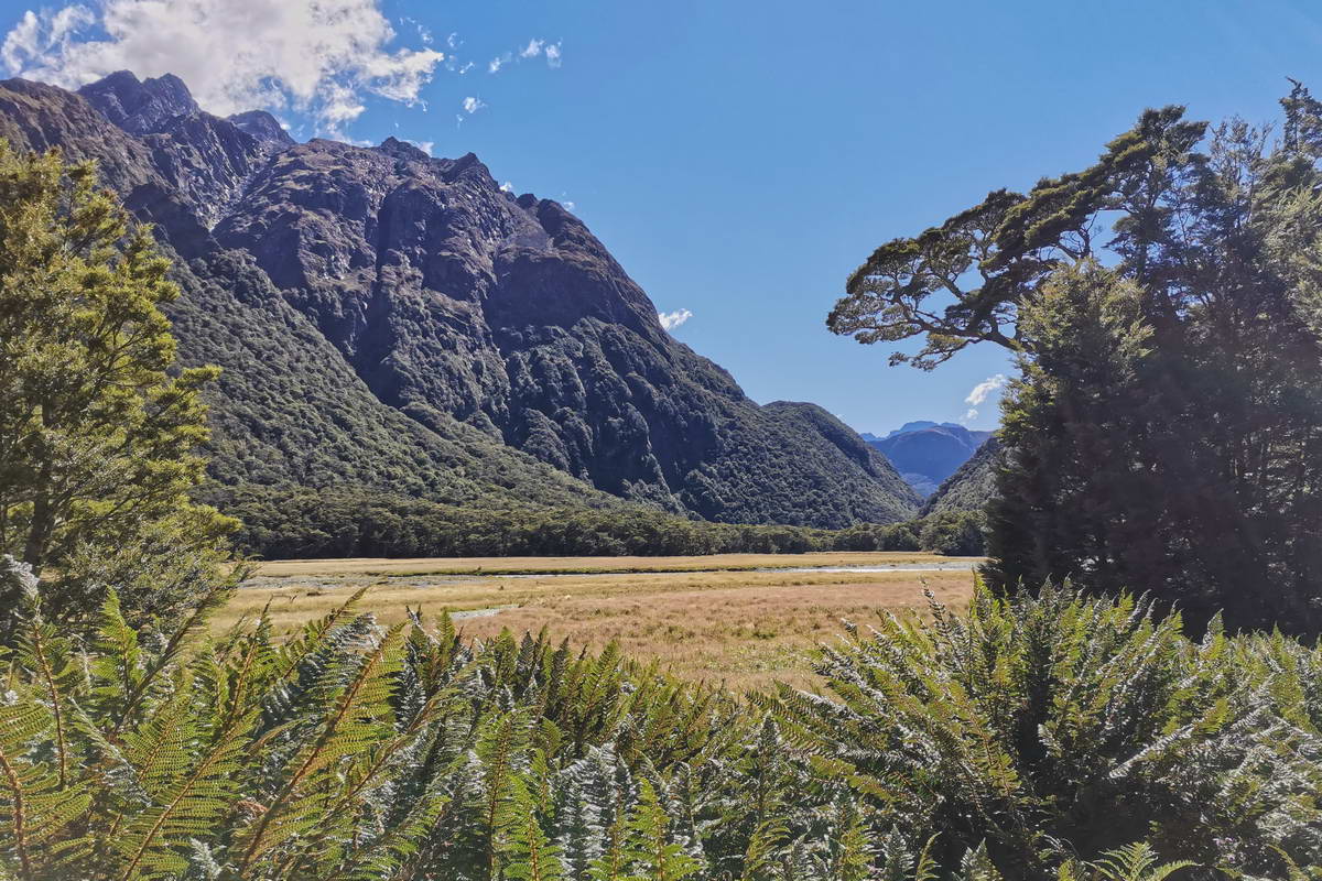
The Routeburn Flats - Looking east back down the valley towards the start of the track
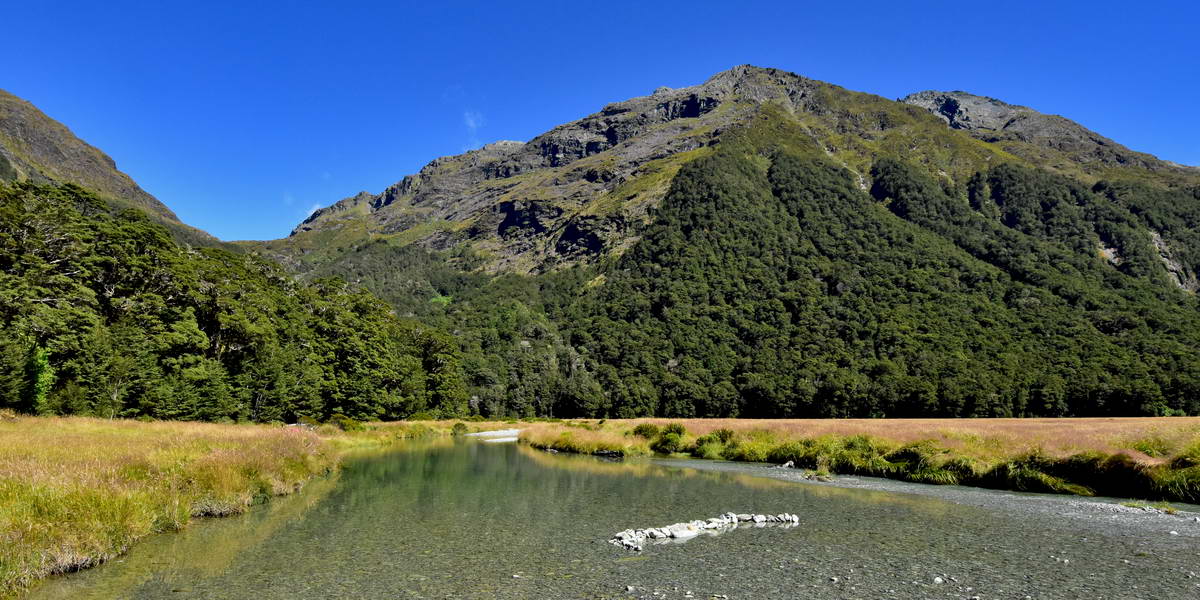
Looking west towards Mt Xenicus form outside the Routeburn Flats hut

The Routeburn Flats Hut. Emily Peak is in the background above the hut.
Sash & Sarah at the Routeburn Flats, looking north into the Humbolt Mountains
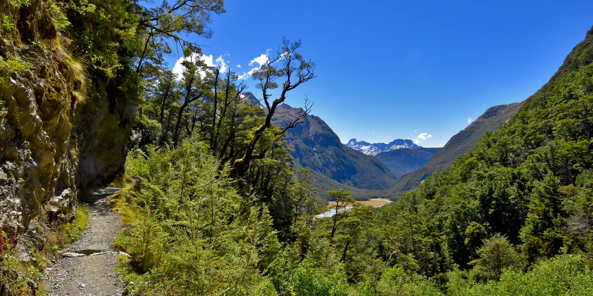
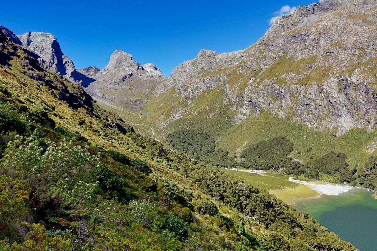
From teh Routeburn flats the track climbs steadily up the side of the valley towards the Routeburn Falls hut. We saw several titpounamu in the beech forest as we made our way this section of track but unfortunately I had traded my 300mm bird lenses for a wide angle so wasn;t able to get any photos of them however I did get some good scenic views as we gained height and got glimpses of the valley through gaps inthe trees.
Looking north up the northern branch of the Route Burn.
Looking East off the track and down over the Routeburn Flats
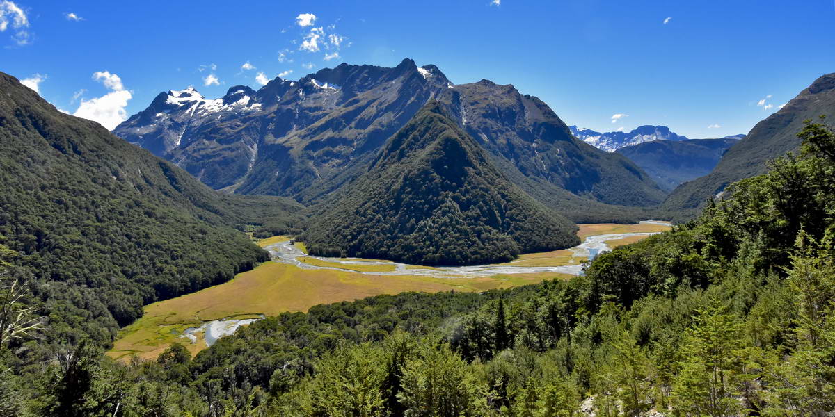
A wide angle shot of the Routeburn Flats and the Humbolt mountains
We were expecting it to be at least an hours tramp from teh Flats hut to the Falls hut but suddenly we found ourselves at the hut after about 40 minutes. The Routeburn Falls hut is nestled in the beach forest on the edge of the valley with great views down over the Routeburn Flats and the Humbolt mountains. It's a really well set up hut - we voted this our favourite hut of any we had been in on tracks in NZ.
We unpacked our overnight gear, had some lunch and went off to explore the views and the Routeburn falls. I also had another go at hacking morre rubber off my inner soles.
The Routeburn Falls Hut and the fantastic view of the Humbolt mountains and the route burn valley.
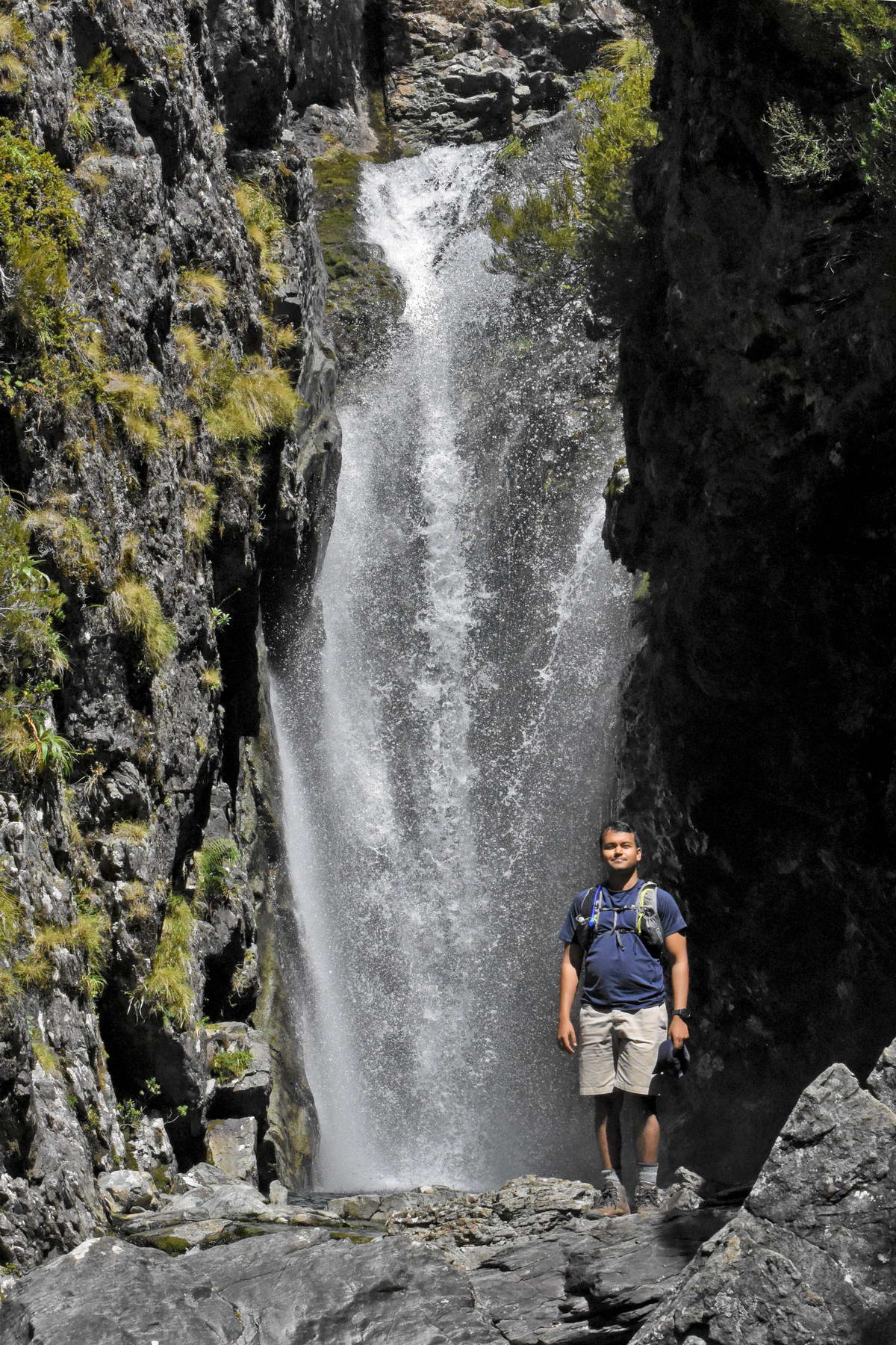
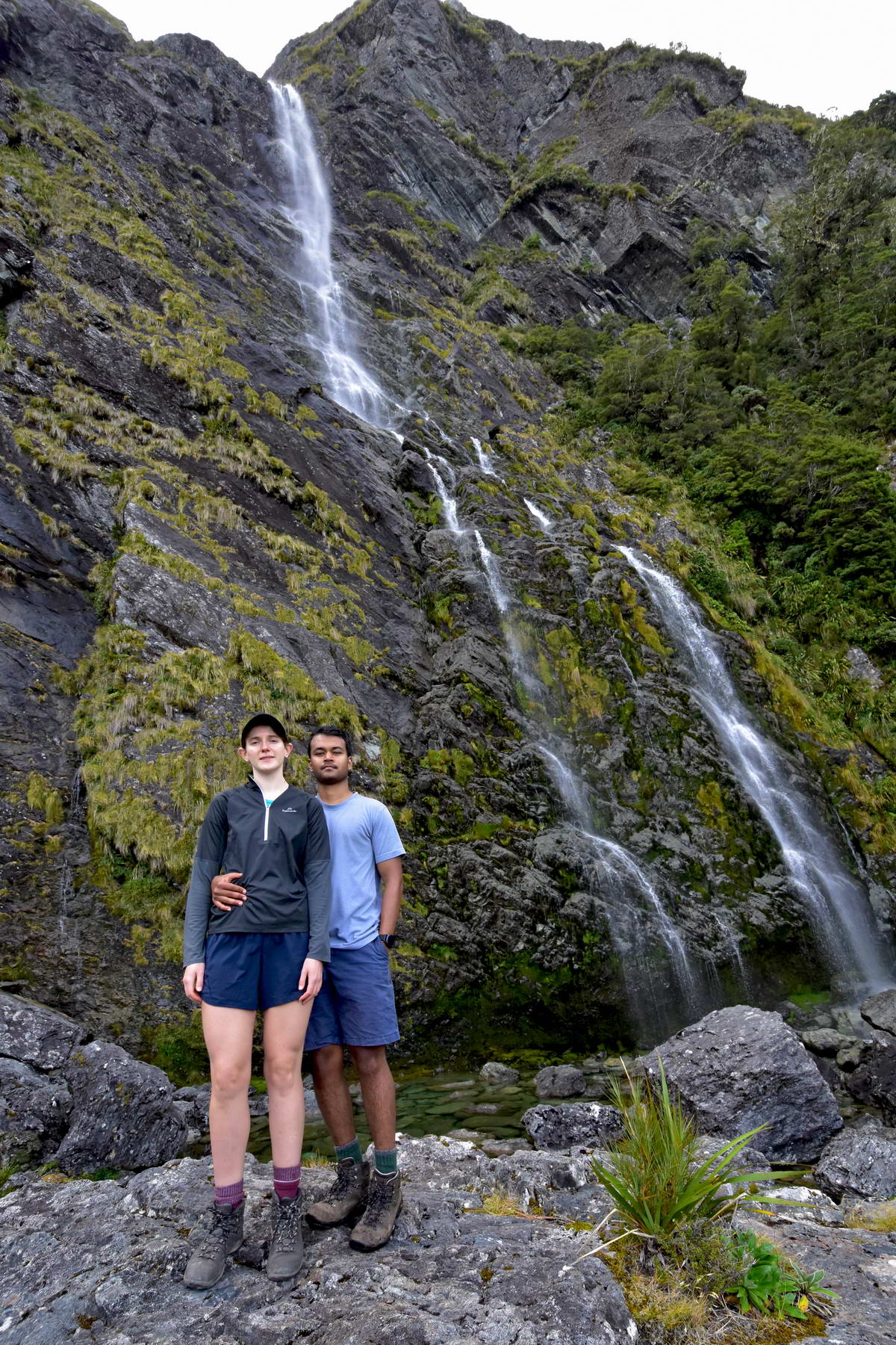
Sash at the base of the Routeburn Falls.
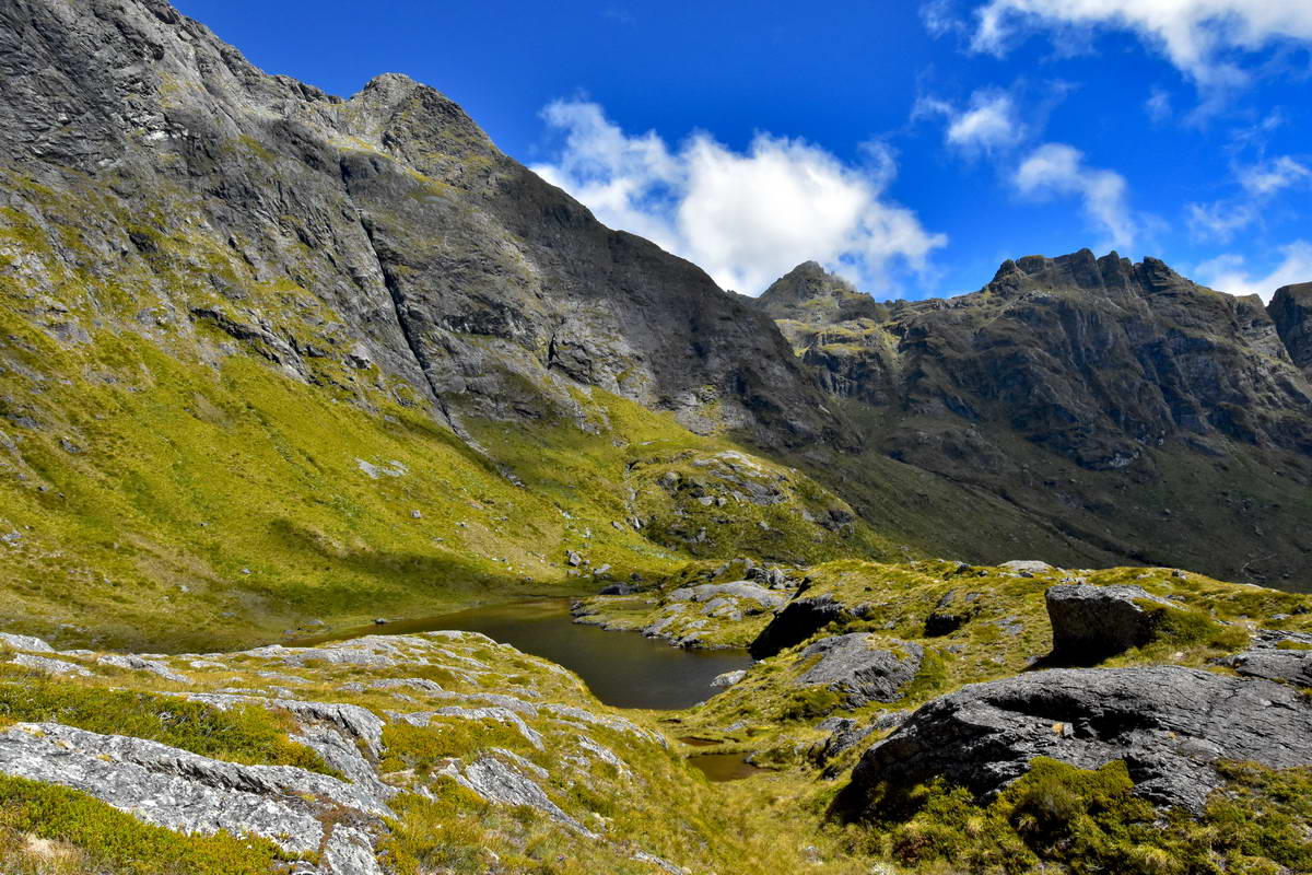
After a bit of a break at the falls (Sarah went for a quick dip in the cold water) we went back to the hut to sort our gear out ready to explore the track up above the hut. We knew that there was a side track to some tarns to the right of the track above the hut and Sash also wanted to explore the valley below Ocean peak.
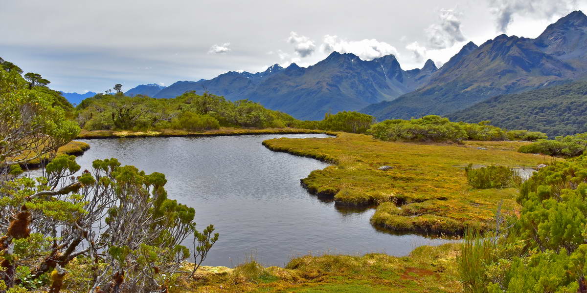
Sarah and I headed up the side track to the tarns which proved much better than we expected with the track carrying on to a rocky outcrop above the tarns where we got spectacular views both over the tarns and out over the Routeburn valley. The start of the tarns track is not well marked but it cuts off to the left a couple of meters past the avalanch warning sign before you cross the small stream that flows down from the tarns.
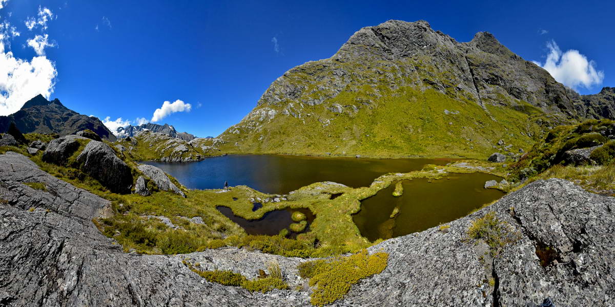
A great view of the tarns and the unnamed peak behind them.
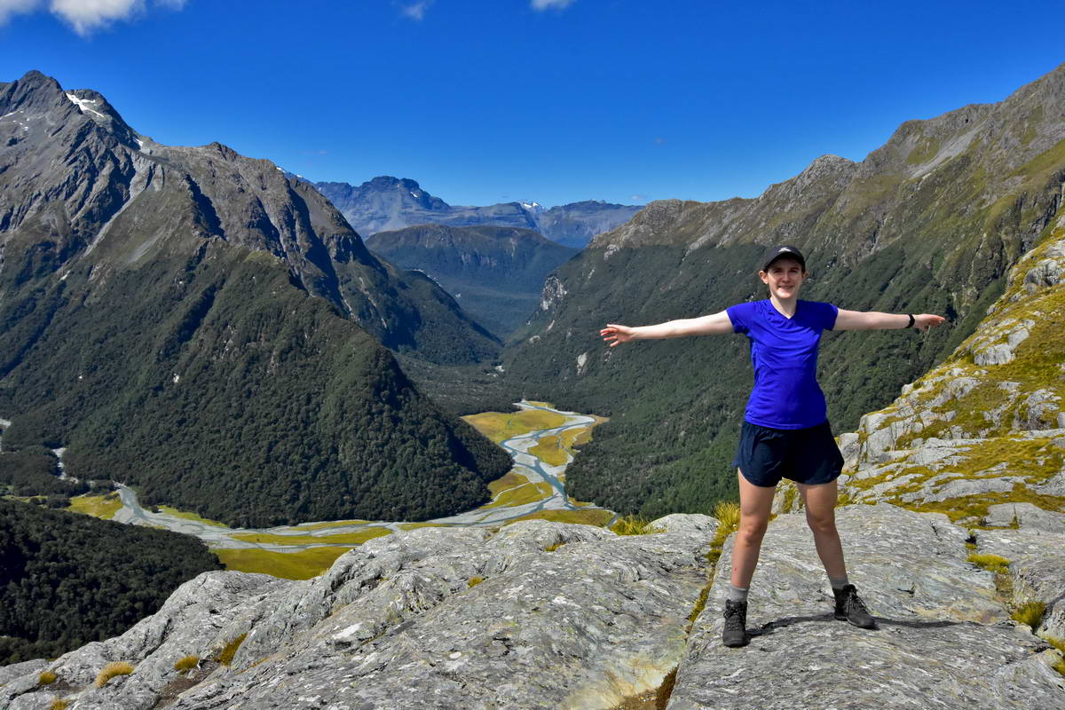
Sarah and the spectacular view of the Routeburn valley and Humbolt Mountains behind her.
Looking west over the main tarn towards Ocean Peak (the triangular peak to the right of center)
Looking east down over the Routeburn flats.
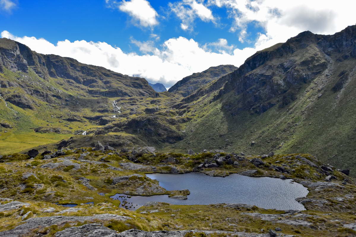
Looking west over the upper section of the Routeburn valley towards the Harris Saddle. The routeburn track carries on up the left side of this valley.
Sarah and I spent a good hour up at the tarns then headed back down onto the Routeburn track and returned to the hut. Sash hadn't returned so I headed back up to look for him but met him on the track coming back down after havin a very enjoyable exploration of the hanging valley below Ocean Peak.
By the time we got back to the hut it was time for dinner and then the evening talk from the ranger. We also had a talk from teh Kea Conservation trust who were doing some work trapping and tagging kea to get a better understanding of their population int he area.
I headed back out at dusk hoping to get some dusk shots of the views over the valley but the cloud came in. I did however get some long exposure shots of the route burn falls.
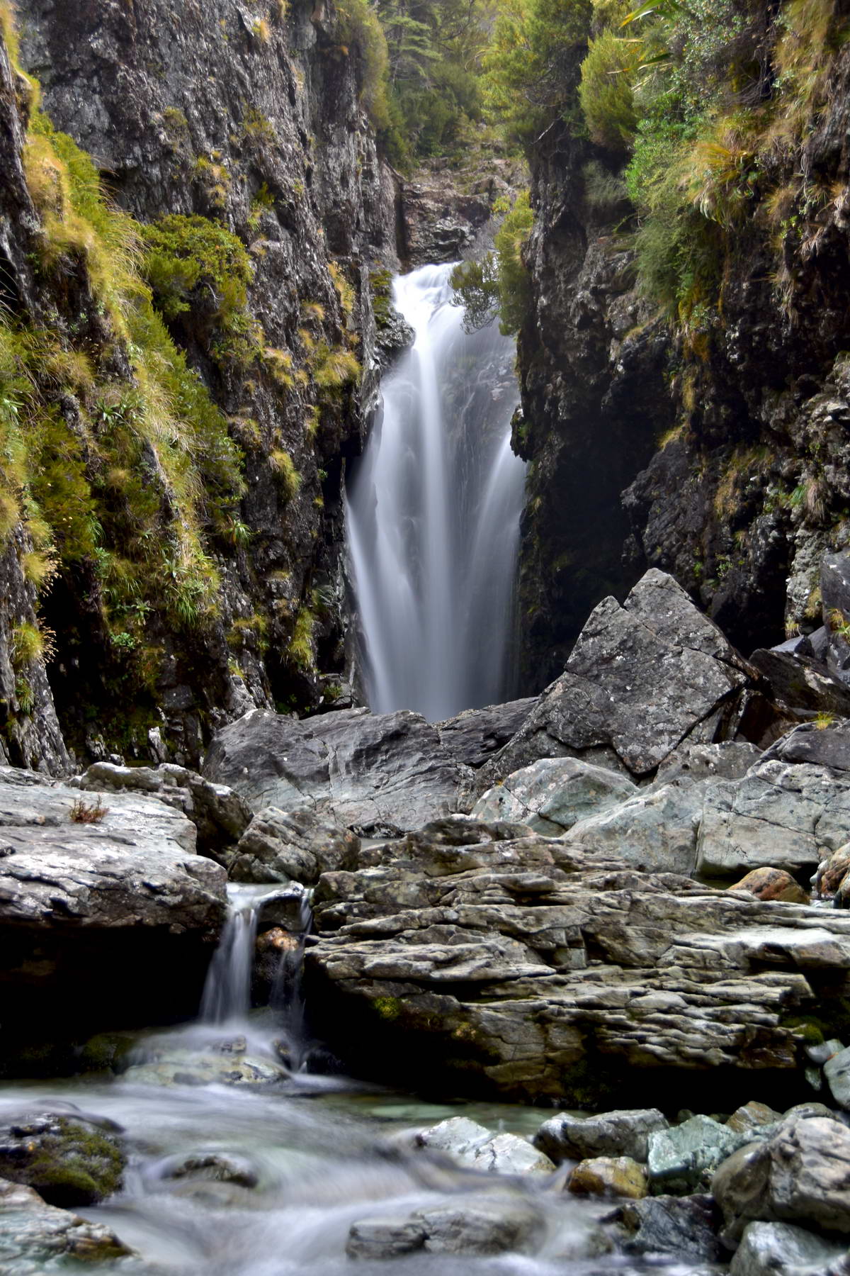
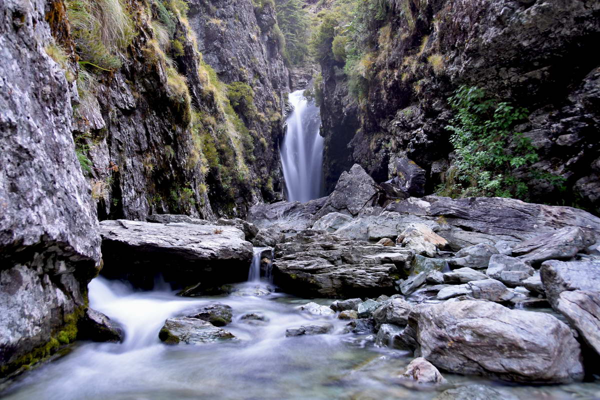
The Routeburn falls - approx 10 second exposure.
By the time I got back to the hut it was nearly dark and time for bed. A great first day on the Routeburn track.
Day 2 Route Burn Falls Hut To Lake Mackenzie hut.
I got up early and climbed up to the rocks beside the hut to get some dawn photos looking down over the Routeburn valley. While I was sitting on the edge of the rocks, the Kea COnservation Trust team came and set up a kea trap just a few meters away. They use a small mat covered in loops of string which they put something shiny in the middle of to attract the kea. If the kea goes to investigate it gets its feet caught in the loops s the team can then capture the bird, tag it, weigh it etc.
Once they had set up the trap they started playing kea calls to lure in some kea. After a few minutes the first kea approached but though it played with the mat it wasn't lured onto it hopping around the rocks then coming down to check me out and exploring around in front of the camera I'd set up on a small tripod to take my dawn photos coming within a meter of me a couple of times. I had brought a 70-300mm zoom lense with me on this trip for bird photography which I had left in the hut but since it came so close I didn't need my zoom.
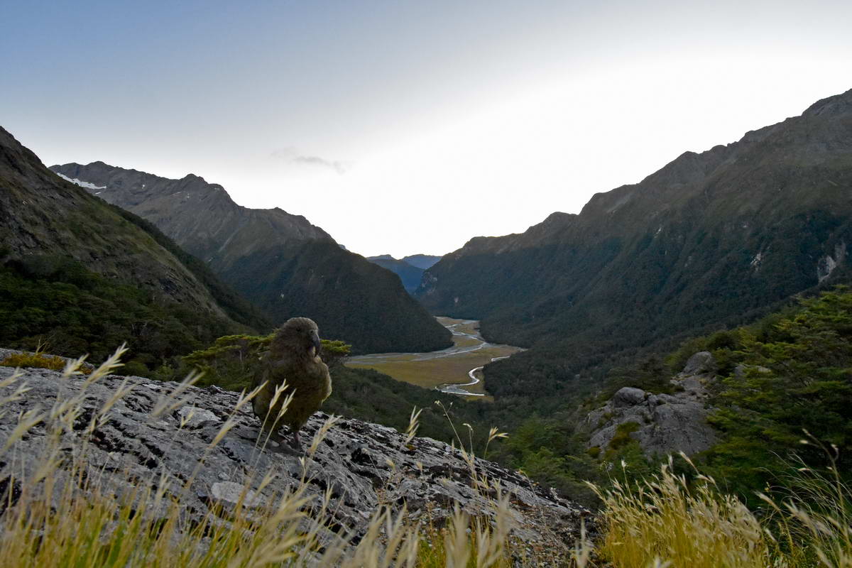
Kea - photo bombing my dawn landscape photo. It's only half meter from teh camera, but the wide angle 10mm lens makes it seem further away.
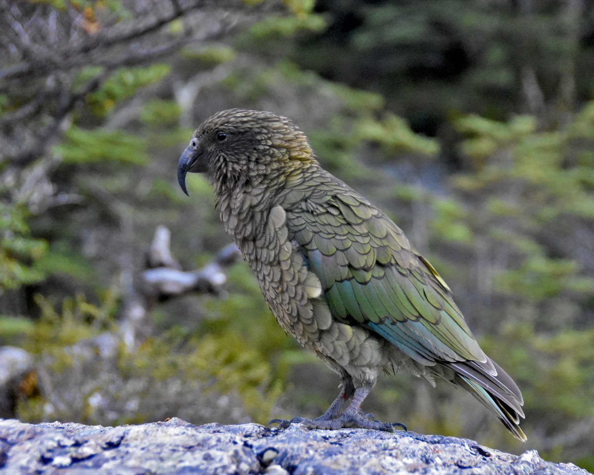
Our wonderful alpine parrot - the Kea, just a few meters away from me
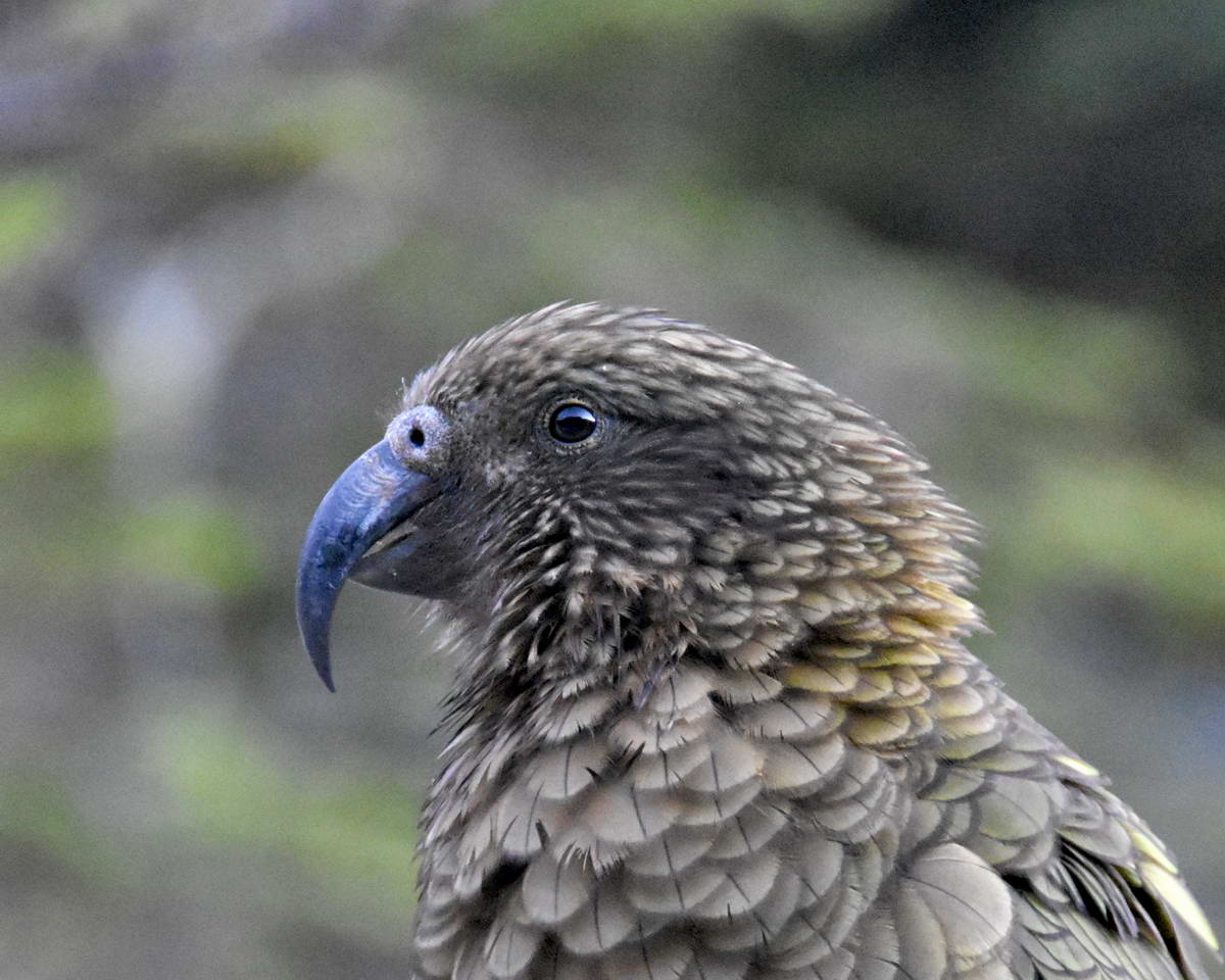
and a close up portrait shot.
This kea flew off and i don't think got caught but while we were having breakfast a flock of 4 or 5 birds came in and we saw them catch and tag a couple.
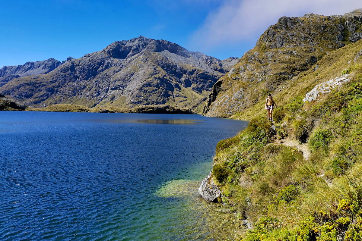
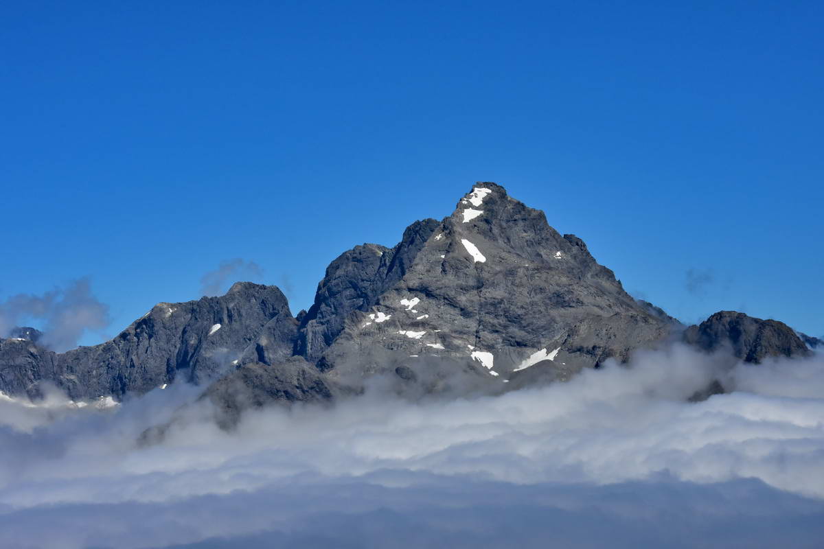
Sash had gone up to the tarns to watch the sunrise so it wasn't until about 8:50 that we were ready to leave and head up to the Harris saddle. Though the cloud had cleared to the north, there was cloud clinging to the peaks around the Harris saddle so as we approached the final traverse out of the upper Routeburn valley to the saddle we were constantly in the drifting cloud with intermittent views through the cloud of Harris lake.
Lake Harris from the upper Routeburn valley with Mt Xenica partially hidden in the cloud.
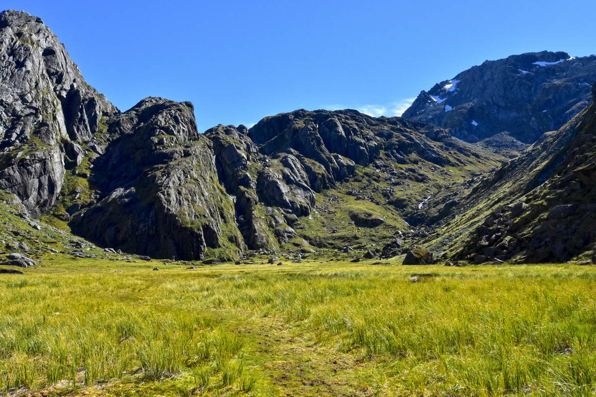
From the Harris saddle we had planned to take a side trip down into the valley of the trolls on a DOC conservation track that drops from the saddle down to the lake edge then traverses around to the valley to the north of Lake Harris. There is a route that carries on up the valley of the trolls and climbs up to lake Wilson. We had only planned ot get into the bottom of the valley of the trolls so that we still had time to climb conical hill before heading off to Lake MacKenzie.
Once we got to Harris saddle the cloud was blowing over us but it looked like it was lifting over the lake and in the valley of the trolls so we set off down the DOC track.
Sarah on the track traversing around lake Harris. The cloud started clearing up as we made our way around this track.

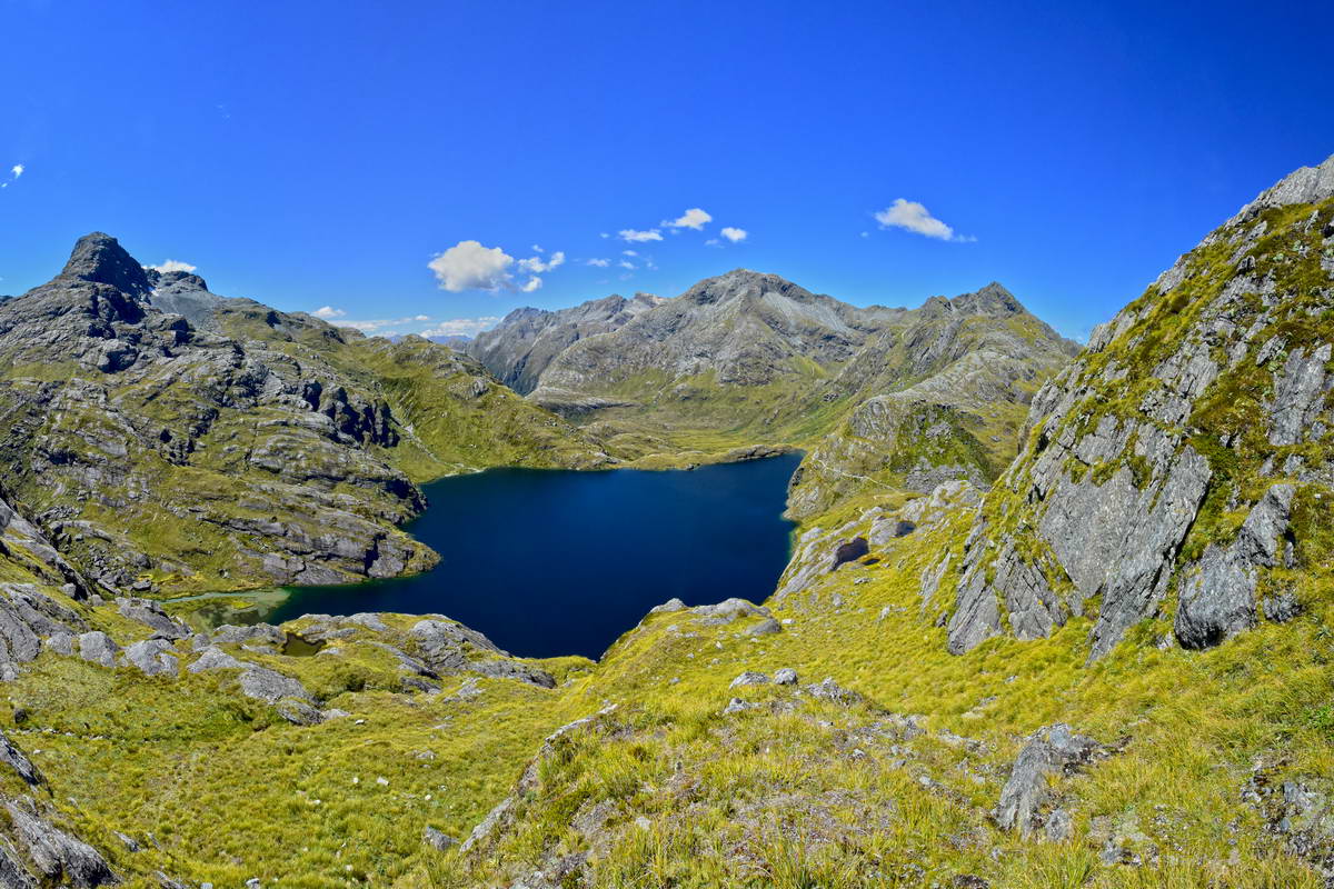
The pristine clear stream that flows into Lake Harris from the valley of the trolls.
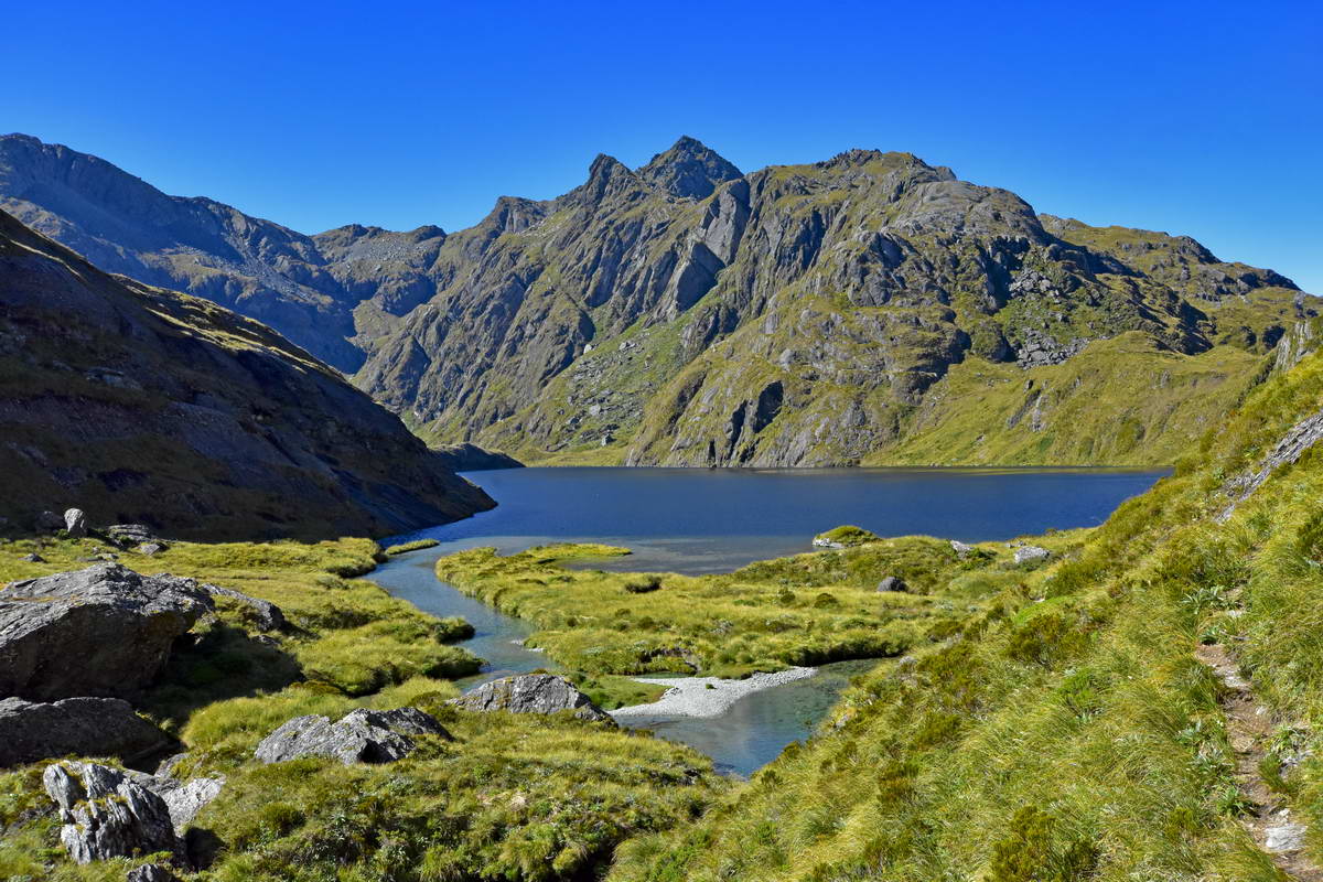
Looking back over Lake Harris towards Ocean Peak. You can see the Routeburn track line traversing around the slope below Ocean peak making its way towards Harris saddle.
The Valley Of The Trolls. Lake Wilson is directly above the rocky ridge line. The route up to Lake Wilson is just to the right of the water fall up to the ridge line more or less in the center of this image.
Looking back over Lake Harris towards the valley of the trolls from the Harris Saddle - on our return after the cloud had more or less cleared.
Following our detour to the Valley Of The Trolls we arrived a the Harris Shelter at around 11:30 and left some of our overnight gear here to lighten our packs as we headed up to the top of conical hill. The cloud closed in a bit again as we climbed and people we met coming down said it was cloudy on top with just an odd glimpse of the mountains, however we had our timing right because as we arrived at the top of Conical Hill at about 12:30, the cloud cleared and we had spectacular views in all direction, watching the cloud continue to clear over the Darren Mountains while we had lunch.
Mt Gifford floating above the cloud
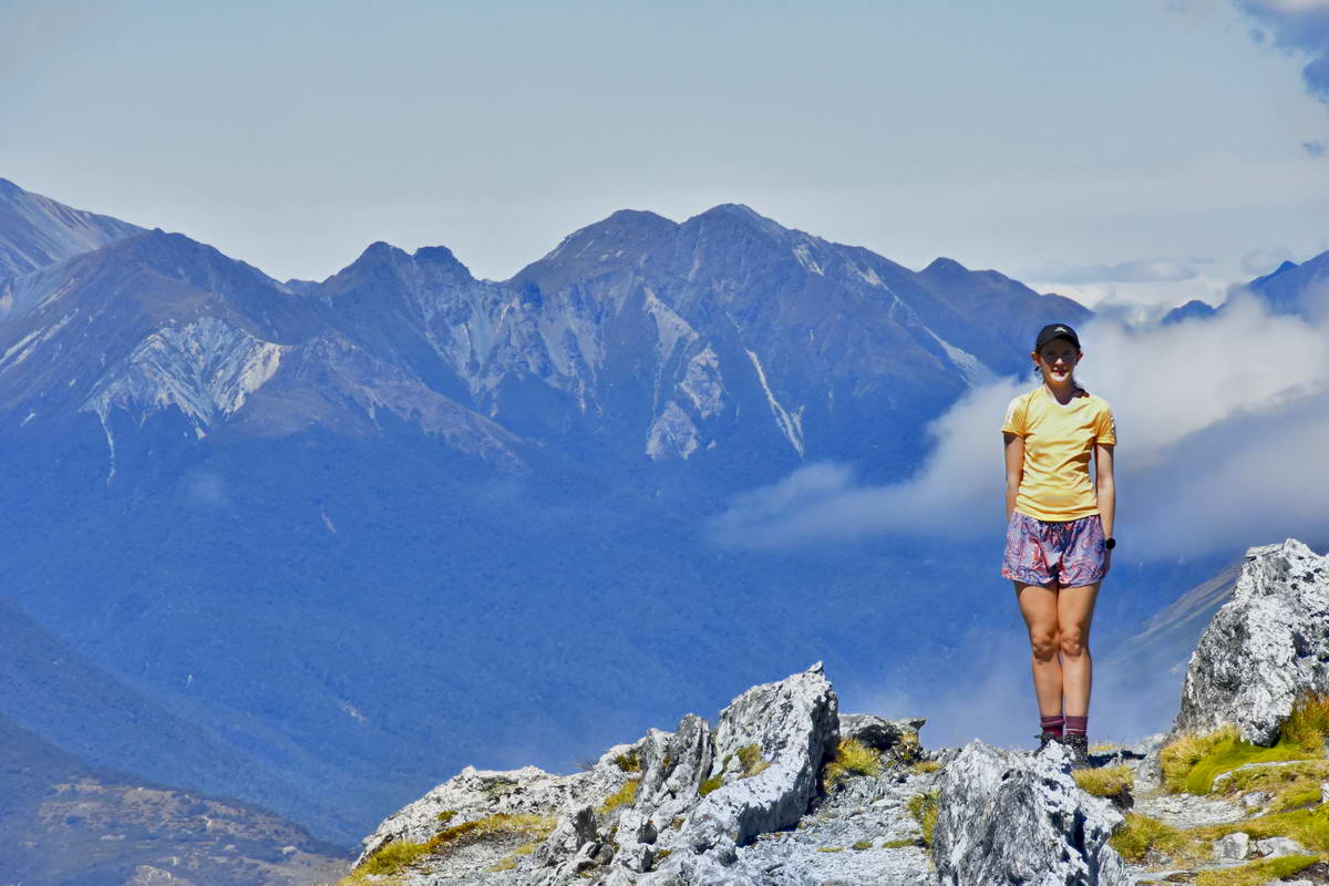
Sarah on top of Conical hill looking south into Fiordland
Sarah & Sash on Conical hill - looking north towards the unnamed peak above Lake Wilson
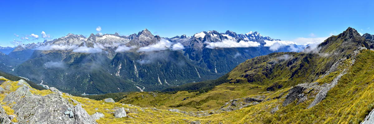
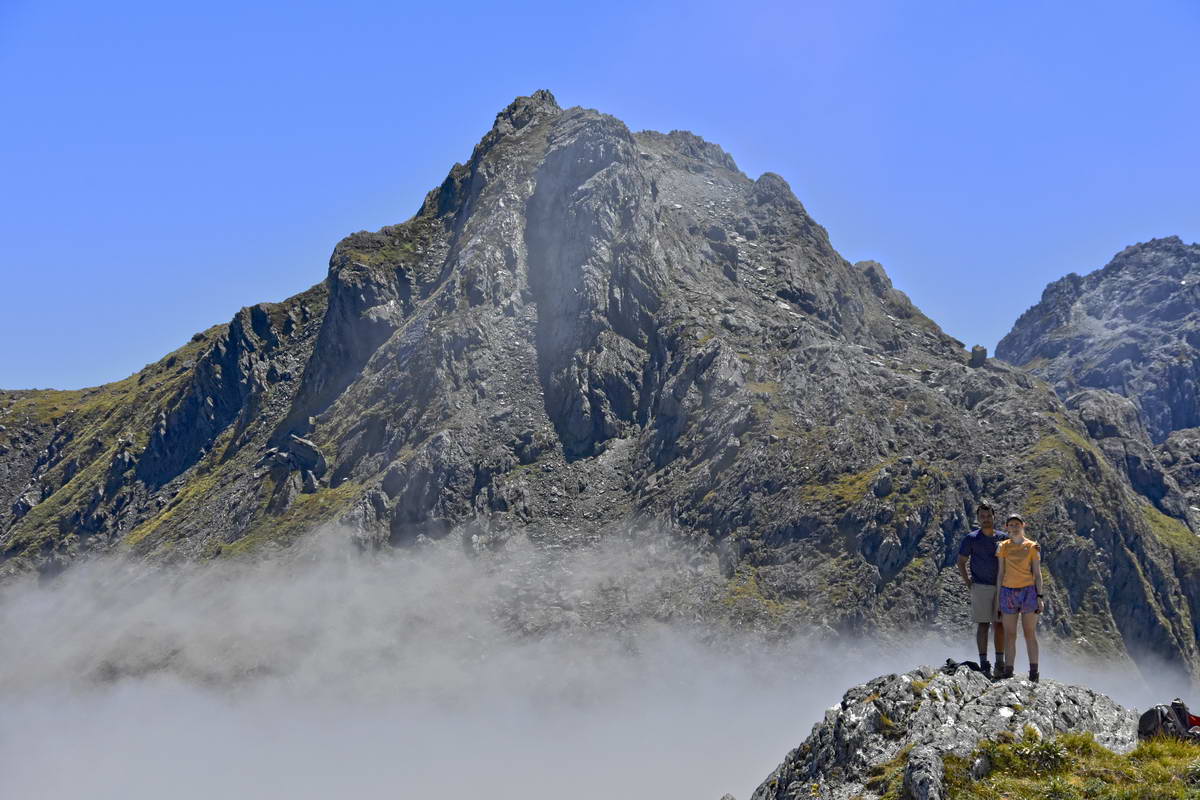
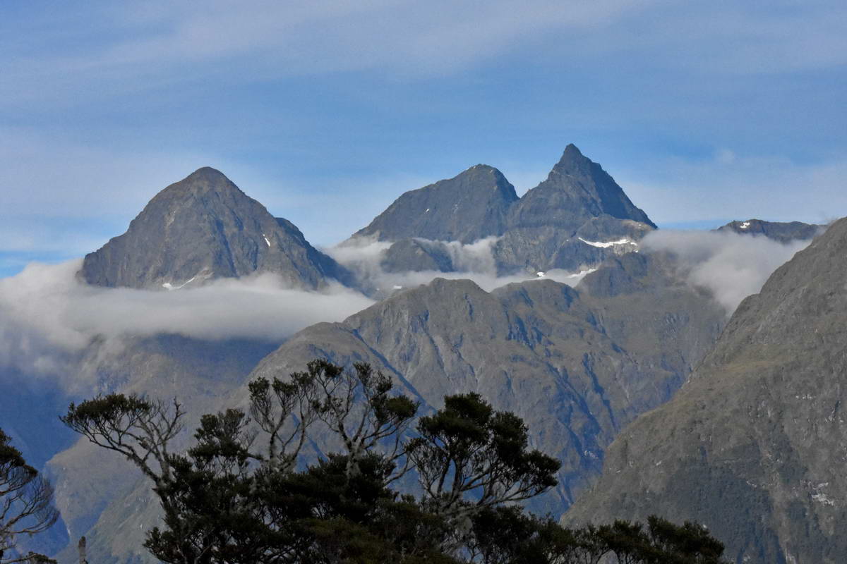
The full spread of the Darren mountains with Mt Christina to the left and the highest point in Fiordland, Mt Tutoko to the right.
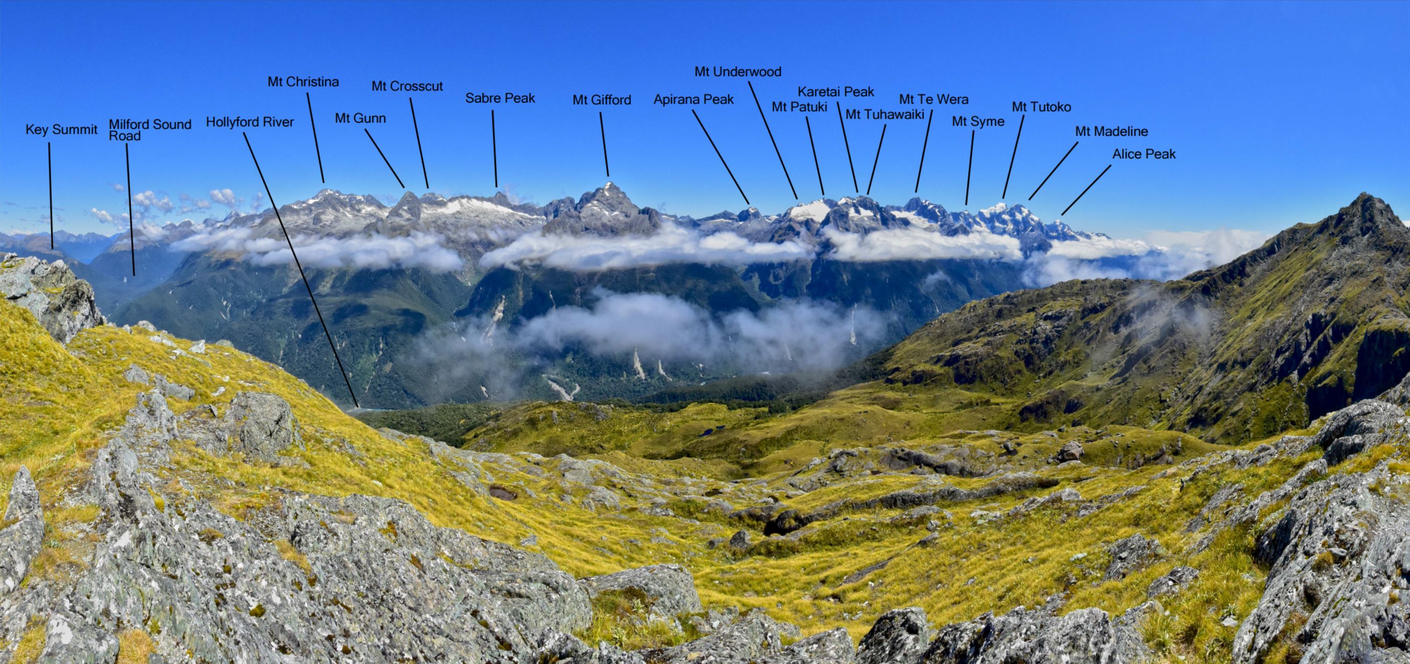
Showing the peaks of the Darren Mountains.
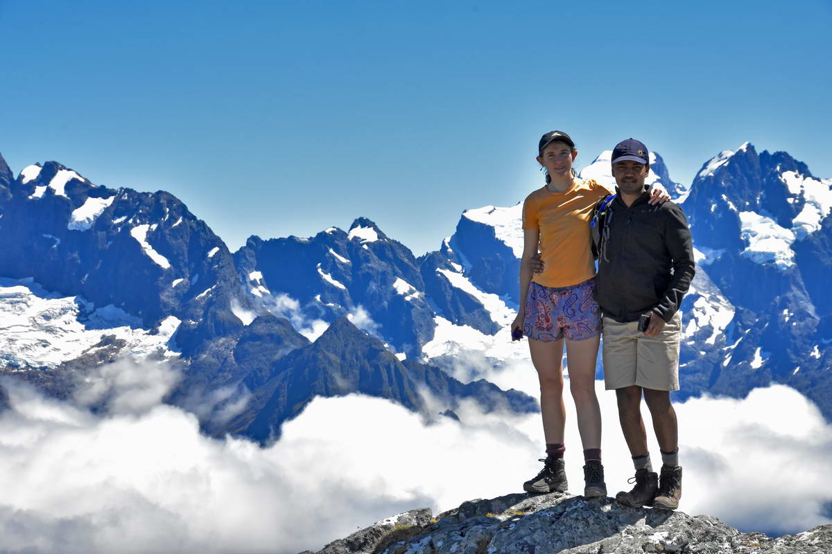
Sash & Sarah, Mt Tutoko behind, Mt Madeline to the right.
Lake Harris. Mt Xenica to the left, Ocean peak to the right above the Harris saddle.
We spent a leisurely hour on top of Conical hill having our lunch and enjoying the views having the peak completely to ourselves before heading back down to the Harris saddle, collect our gear and head off towards Lake MacKenzie.
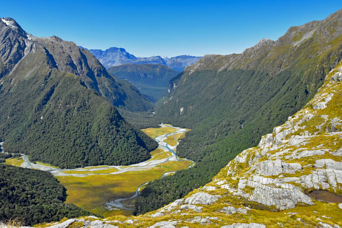
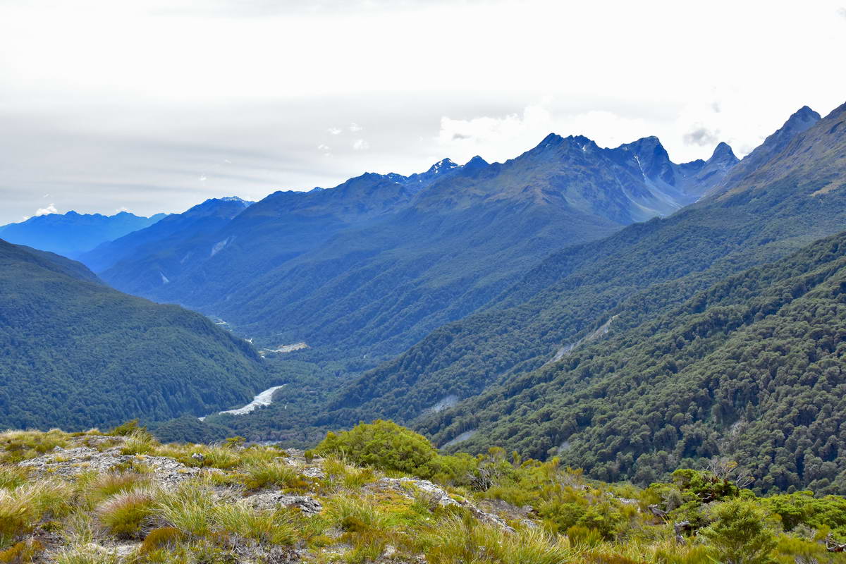
From the Harris shelter the Routeburn Track traverses the ridge line high above the bottom of the Hollyford valley as it heads towards the valley in which Lake MacKenzie is nestled. This section of track seems to go on forever. Each time we rounded a ridge line we were expecting to look down on Lake MacKenzie but the track just stretched on to the next ridge. It took nearly two hours before we finally rounded the ridge that revealed Lake MacKenzie below. The views from teh track were amazing with the Hollyford river down in the valley below and the entire Darren mountains stretched out above the Hollyford valley to the west. There were plenty of alpine flowers and we crossed several streams.
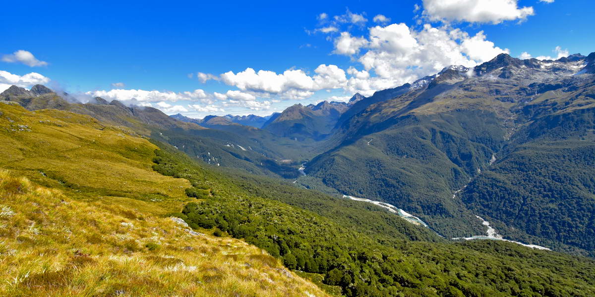
Looking South up the Hollyford valley
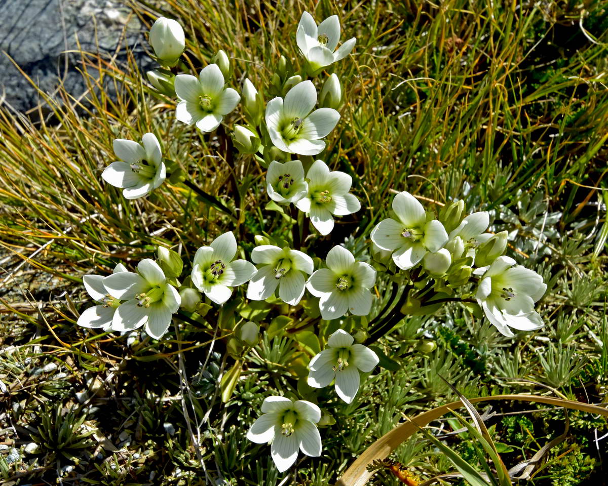
Some alpine gentians beside the track
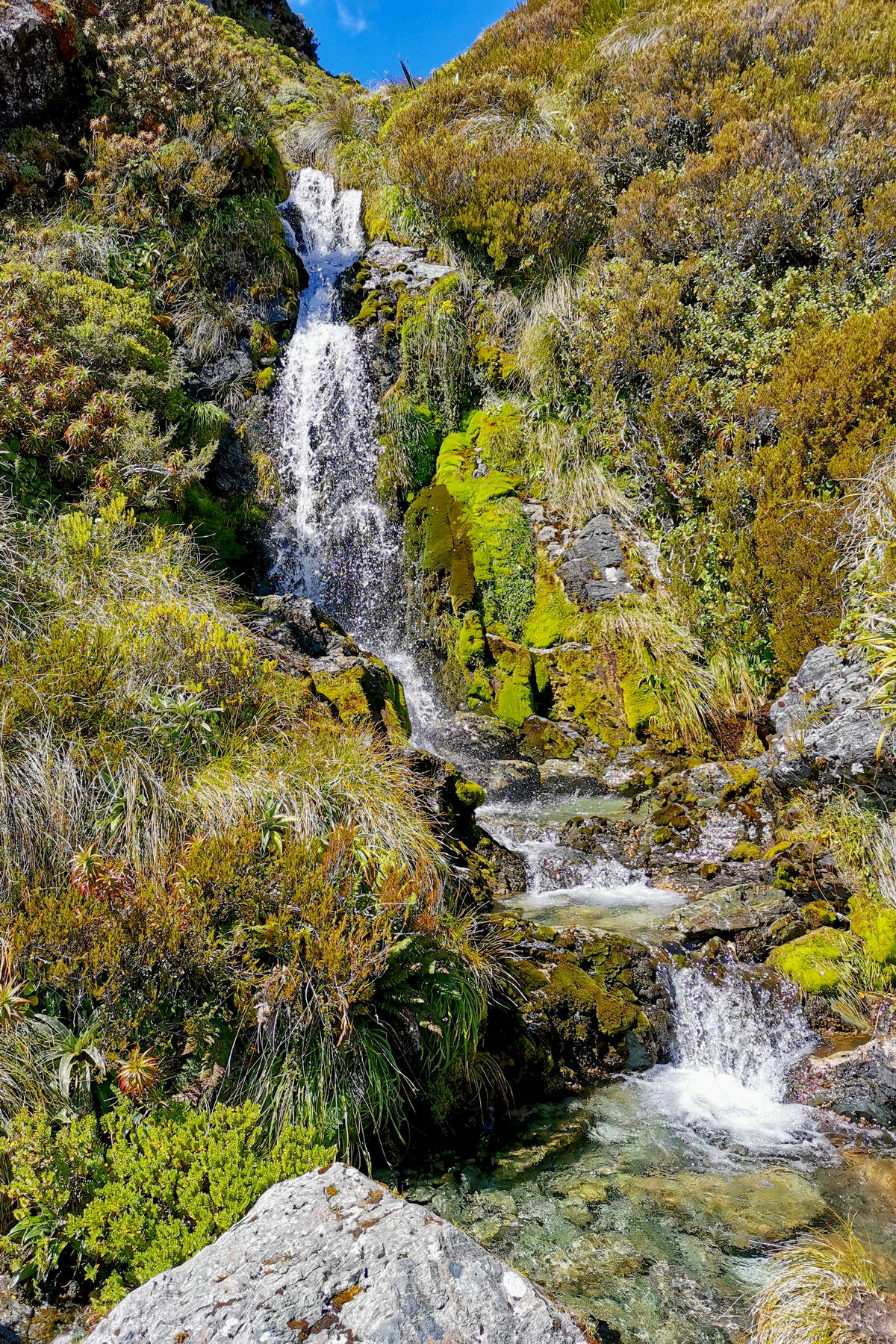
One of the little waterfalls beside the track
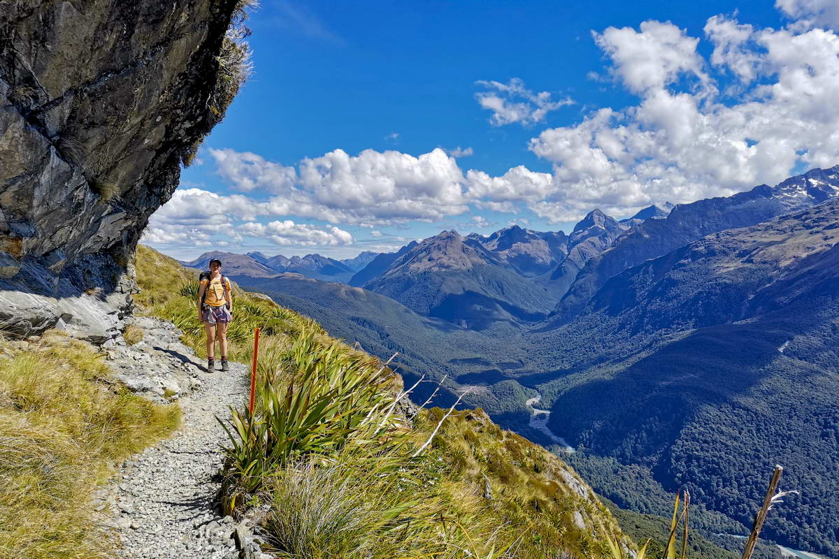
Sarah on the track with the Hollyford valley below.
Finally at around 4pm, we rounded the ridge that revealed lake MacKenzie nestled in the valley below. From here the track descends into the head of the valley above lake MacKenzie then zigzags back to go around the western end of the lake to the hut.
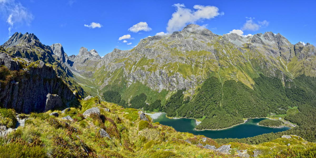
Lake MacKenzie taken from teh top of the ridge before the track descends into the valley.. Ocean peak to the left and Emily Peak at the head of the valley.
Looking up to the head of the valley to Emily Pass and Emily Peak. Note the ribbon wood in flower in the fore ground.
As the track descended towards the bush line we dropped through a large grove of ribbon wood in full blossom. It was very beautiful with plenty of small birds flitting around amongst the ribbon wood and the track covered in white blossom.
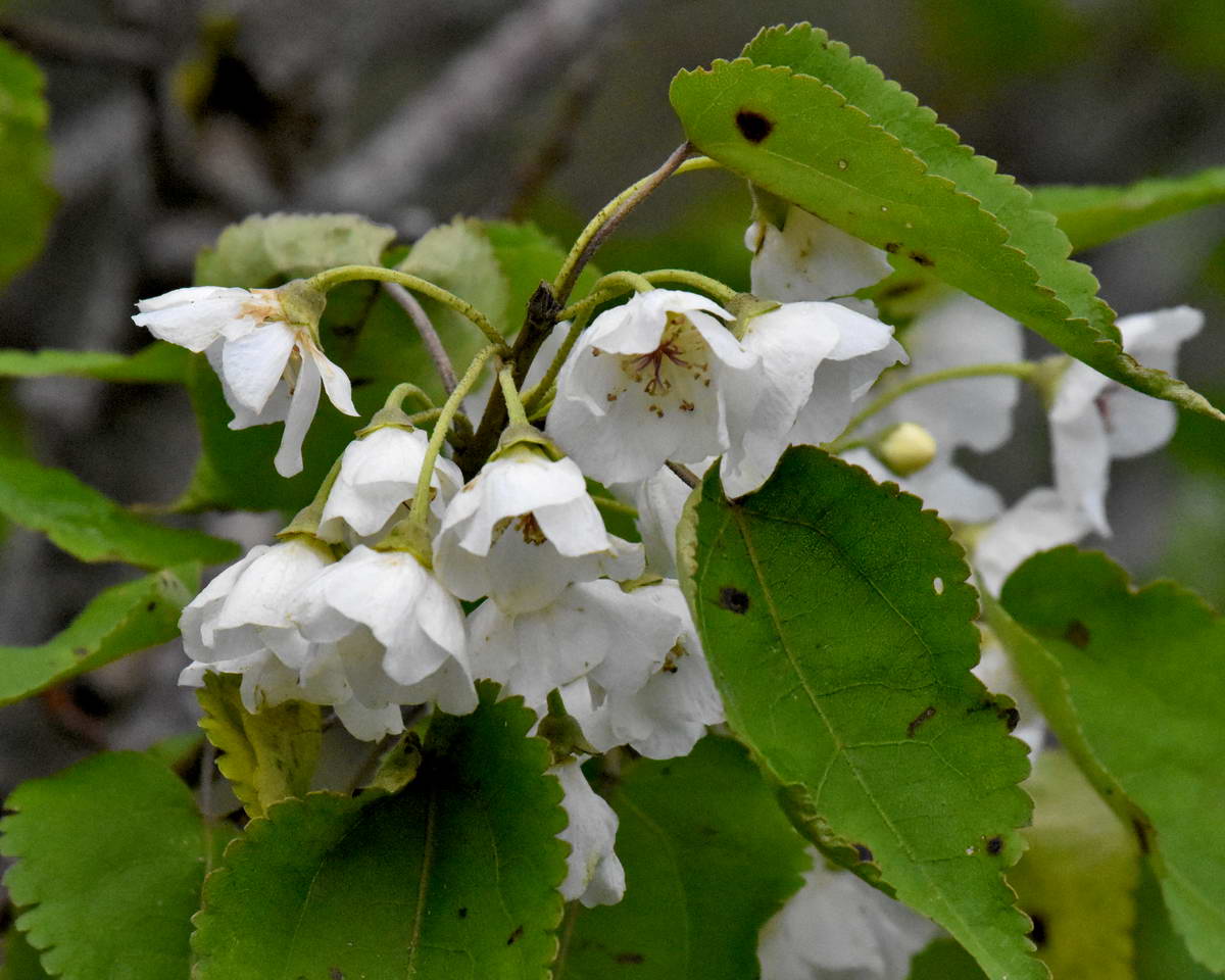
Ribbonwood blossom
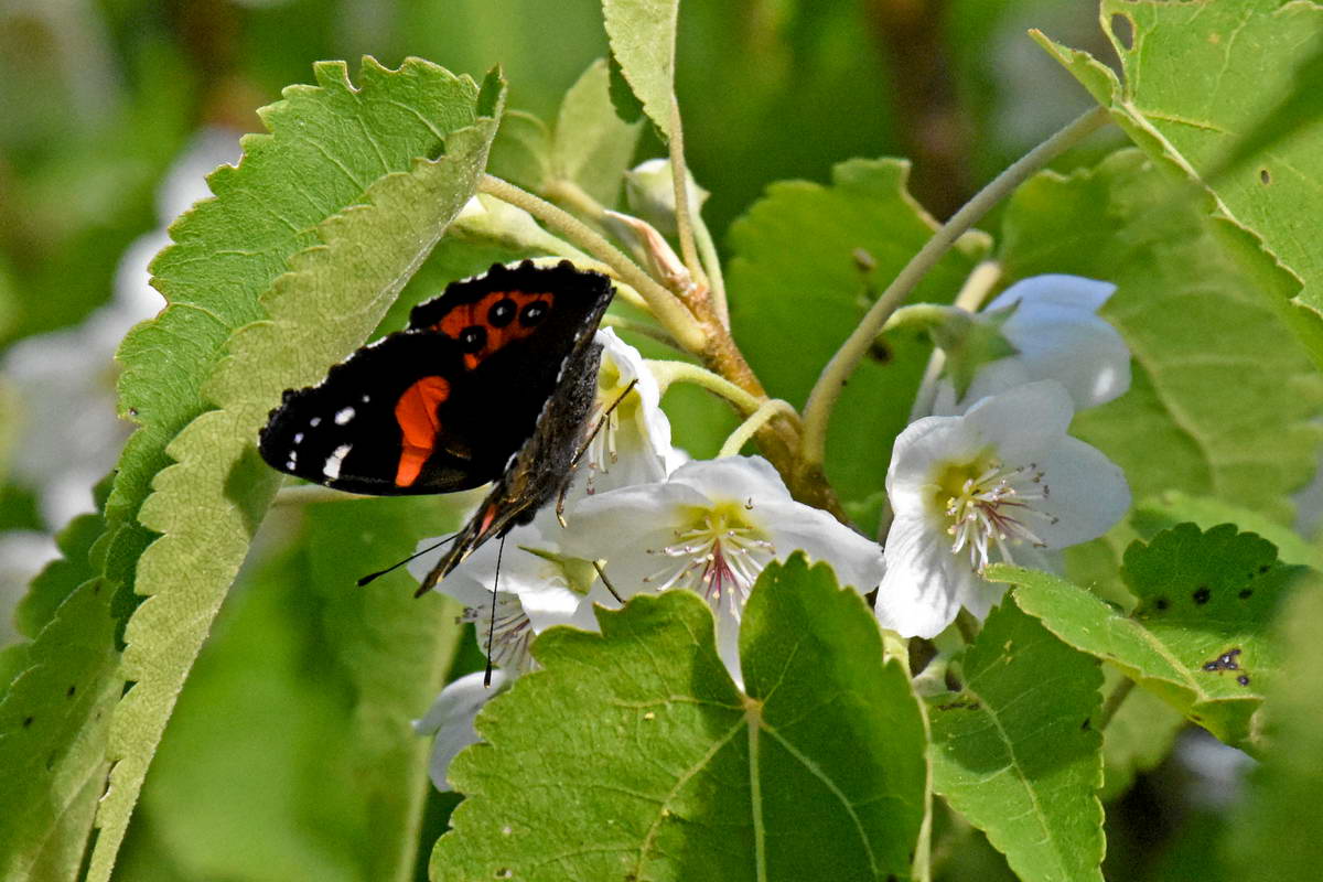
A red admiral feeding on nectar in the blossom.
After decending through the ribbon wood the track dropped down through the beech forest eventually emerging at the southern end of Lake MacKenzie and arriving at the Lake MacKenzie hut.
Lake MacKenzie with Emily Peak to the right at the head of the valley.
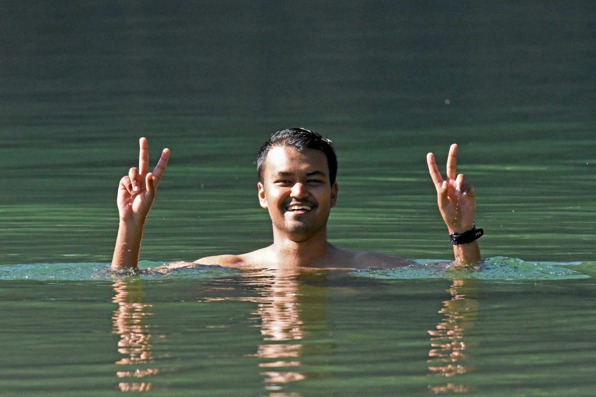
Sash enjoying the cool 10deg waters of Lake MacKenzie. We all had a dip which wsa very refreshing but I didn't stay in for long. After our brief swim we spent a long time lying around in the sun drying off before heading back to the hut to cook dinner. After we'd eaten, Clive the DOC ranger, gave an entertaining talk explaining some of the history of the region and we finished the day with a stroll along the lake edge up past the camp ground.
This had been a really fantastic day. We had been so lucky with the weather. While we were enjoying near perfect weather in the mountains the top of the South Island was being battered by another storm front which caused significant damage.
Day 3, Lake MacKenzie to The Divide.
We awoke to low cloud hanging over the lake and valley with the water incredibly still and clear.
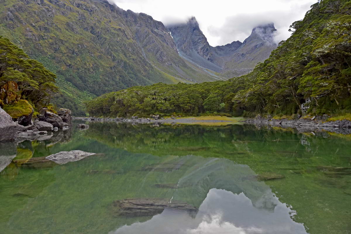
Lake MacKenzie at dawn. Cloud around the peaks but note how still and reflective the water is
We set off from Lake MacKenzie around 8:00am
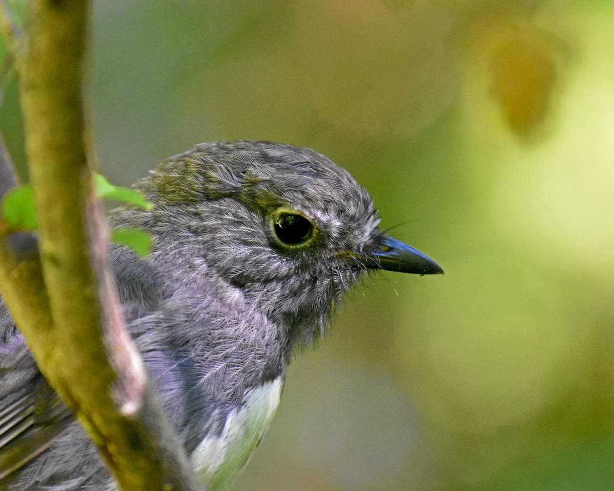
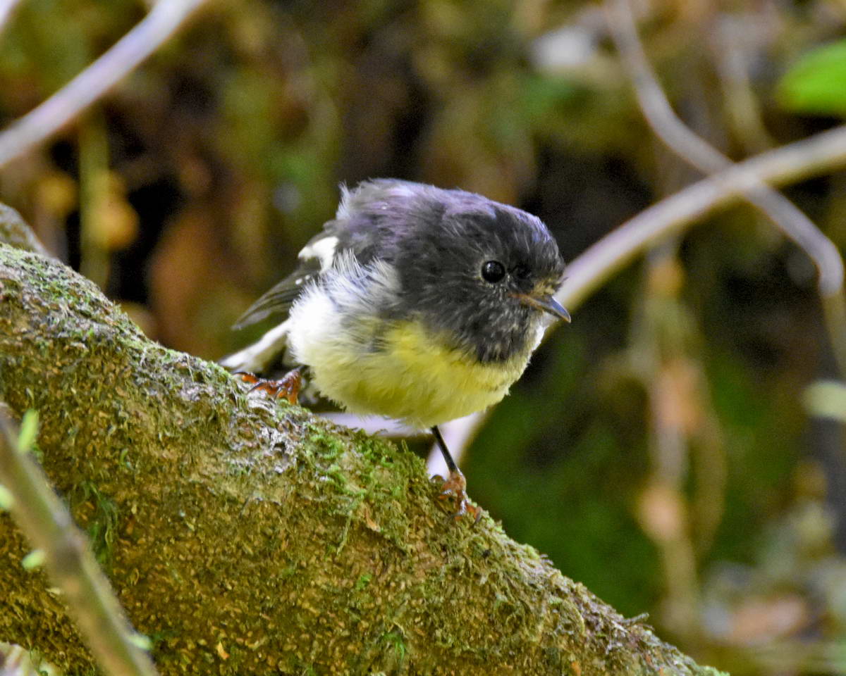
From lake Mackenzie the track carries on in the Beech forest traversing along the side of the ridge above the Hollyford valley as it heads to Lake Howden. This section of track is fairly level with a few ups and downs but no major climbs. The track passed through several patches of ribbonwood and there was plenty of birdlife. We saw toutouwai (robin), miromiro (tomtit) and titpounamu (rifleman) alng this section of track and often heard kea calling out in the valley.
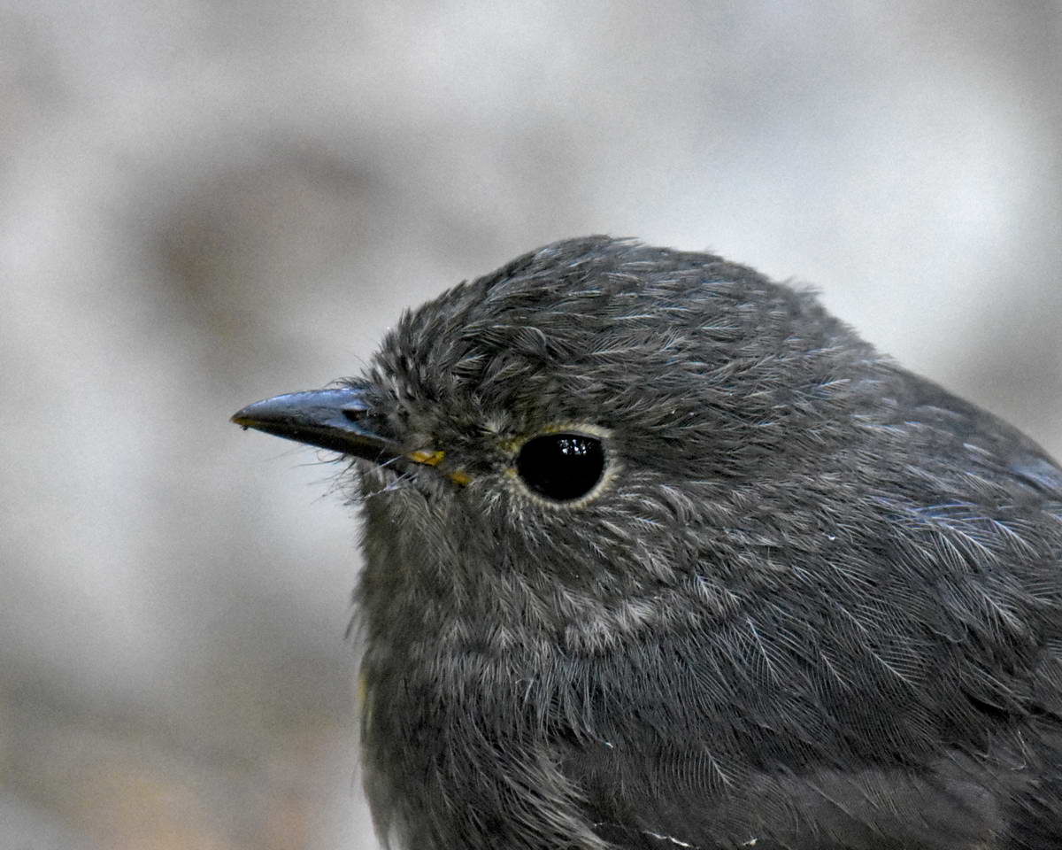
Toutouwai - South Island Robin
Toutouwai
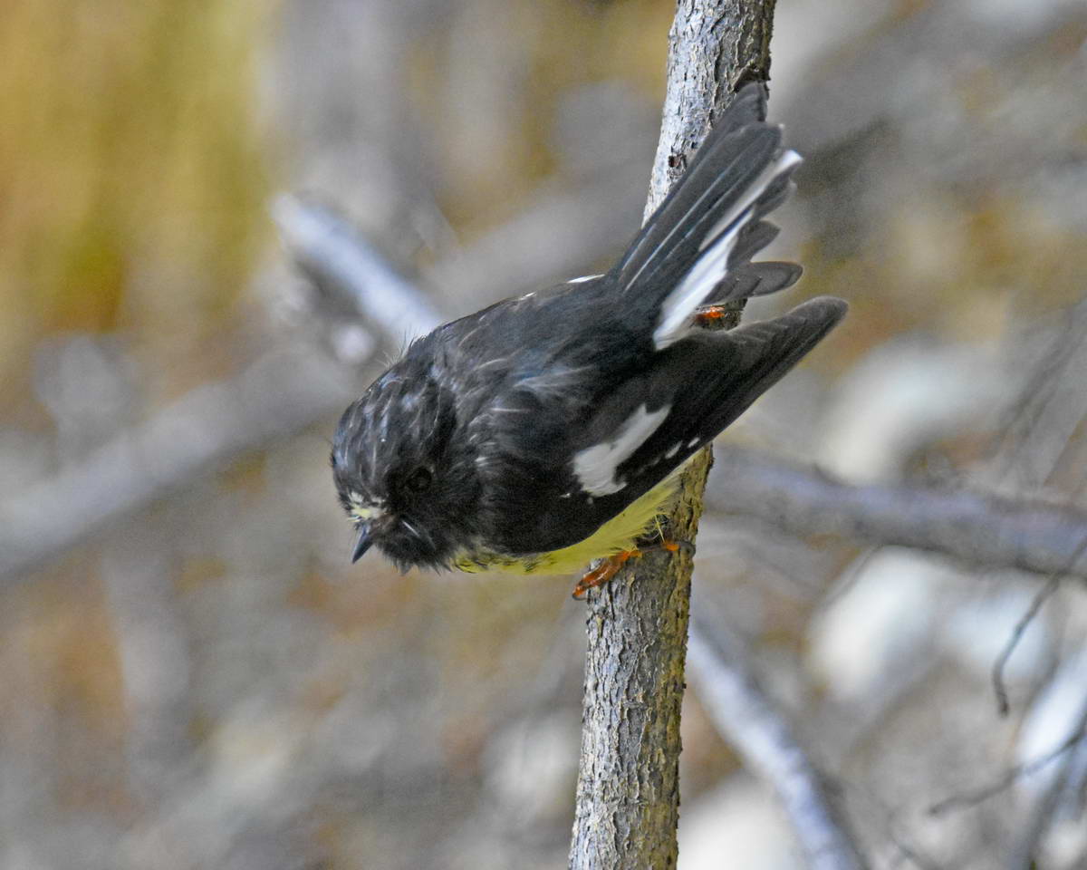
Miromiro (tomtit)
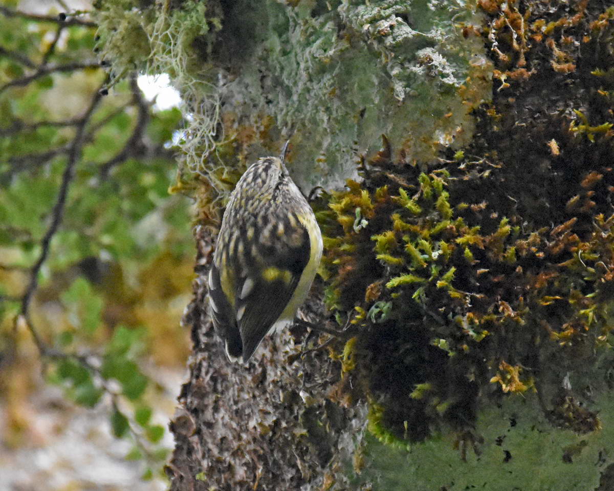
titipounamu - rifleman
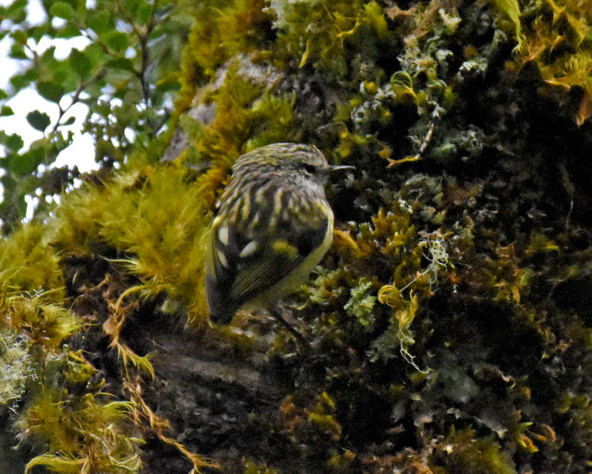
titipounamu - rifleman
The titipounamu were a bit far away for good photography with a 300mm lense but I was still stoked to capture these shots. There was small flock of a bout a dozen birds foraging through the trees next the track.
As we carried on along the track we got regular glimpses of the Darren mountains through the trees. Sash & Sarah left me behind here as I kept stopping to take photos.
Mt Christina
From left, Ngatimamoe Peak, Flat Top Peak and Pyramid Peak.

Mt Gifford
The full spread of the Darren Mountains. Ngatimamoe, Flat Top and Pyramid Peaks to teh left, then Mt Christina, Mt Little, Mt Gunn, Mt Gifford, Mt Te Wera and Mt Madeline on the far left. Mt Tutoko can just be seen behind Mt Te Wera.

Looking north down the Hollyford valley towards Mt Madeline.
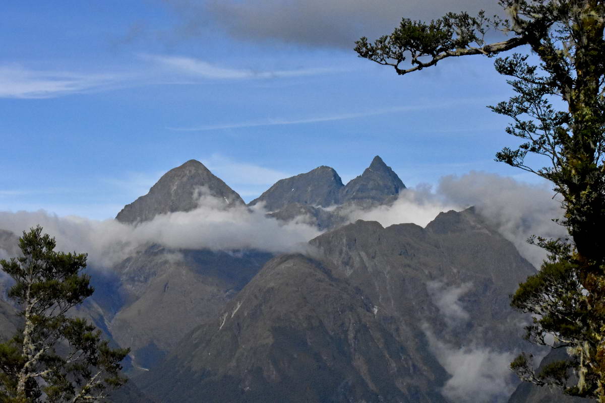
I thought these three peaks (Ngatimamoe, Flat Top and Pyramid) were very photographic so kep taking shots of them every time they appeared through gaps in the trees.
After 2 hours tramping through the beech forest we arrived at the 174m high Earland falls.
Sash & Sarah at Earland falls
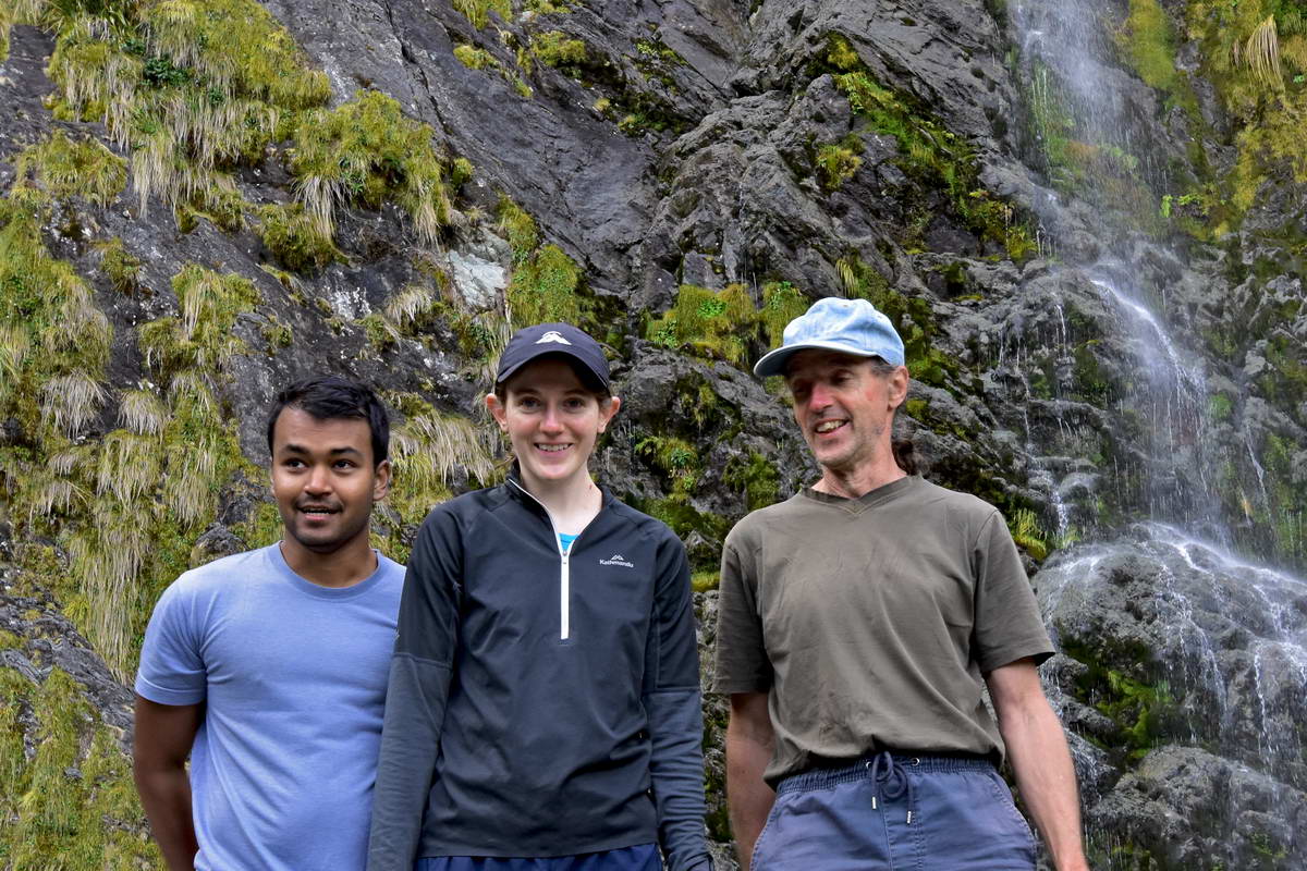
Sash, Sarah and me.
From Earland falls the track carried on through the beech forest and after about another hour we arrived at Lake Howden where we stopped for a brief rest and a snack.
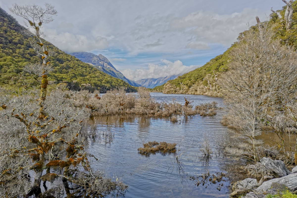
Lake Howden
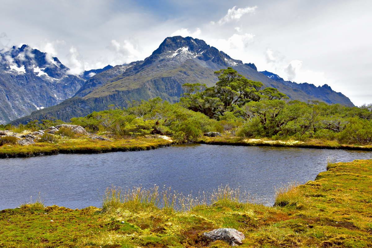
The Lake Howden hut was hit by a slip in the major storm event in 2020 and has now been removed. From lake Howden the strack climbs over the ridge and then descends down to the Divide on the Milford road with a side trip up to the Key Summit. The bus back to Queenstown wasn't due until 3:15 so we had plenty of time to explore the Key Summit and have a leisurely lunch next the tarn.
Mt Little from the Key Summit
Ngatimamoe, Flat Top and Pyramid Peaks from the Key Summit
The view north from the key summit looking back towards Lake MacKenzie and Conical Hill. Lake Mackenzie is in the valley approx a quarter in from teh right hand side of this image with Emily peak visible on the skyline. Conical hill is near the centre, just under the patch of cloud.
Looking north up the Hollyford valley from the Key Summit. Emily peak is the 2nd peak from the right.Ocean peak is the 4th from right and then Conical hill.
After descending from Key summit the Routeburn track descends down to the The Divide on the Milford rd and the end of the track. Just before we reached the rd we were greated by this friendly miromiro.
Sarah & Sash about 100m from the end of the track.
After 3 days in the wilderness it was a bit of a shock to emerge on the Milford rd and be confronted by the noise of traffic. Our walk was over and after a short wait the Tracknet bus turned up to take us back to Queenstown.
I was supposed to fly back to New Plymouth on Sunday but the storm had now moved on to the North Island cause flight disruptions to both Wellington and New Plymout. My flights were cancelled but I managed to get on the ssame flight up to Wellington as Sarah and Sash but couldn't get a flight to New Plymouth until Tuesday so had to have an extra couple of days off work and stay with Sarah and Sash in Wellington. I spent Monday doing some bird photography in Zealandia.
We really enjoyed the Routeburn track. We were extremely lucky to get three fine days. The scenery was spectacular, it really was a great walk.
Recent Posts
-

The Milford Track
For the last few years my daughter Sarah, her fiance Sach and myself have been completing a great w …13th Feb 2024 -

The Waikaremoana Great Walk
We had originally planned to walk the Waikaremoana track in Februrary 2022 but with uncertainty over …31st Jan 2023 -

The Routeburn Track
We were going to walk the Waikaremoana Track this February but had concerns that the track might not …27th Feb 2022