
The Waikaremoana Great Walk
We had originally planned to walk the Waikaremoana track in Februrary 2022 but with uncertainty over when the track would reopen after being closed in 2021, we cancelled and walked the Routeburn instead. This year we were determined to get to Waikaremoana. We had initally booked for new years weekend but had to change our booking to the 20th Jan due to clashes with work commitments. Then cyclone Hale struck causing extensive damage in the Tairawhiti region with a nother storm front due to hit on the 19th Jan however the roads to Waikaremoana were still open and it looked like the storm would clear as we started our walk so on the morning of the 19th I set out from New Plymouth and Sash and Sarah set off from Wellington heading for the Ureweras and the Wiakaremoana great walk. This is a walk that my father always wanted to do but never made it. Finaly, at the age of 60, I was on my way.
It's a long drive from New Plymouth to Lake Waikaremona. I took the southern route via Palmerston North, Woodville and Napier, meeting Sarah and Sash in Woodville on their way up from Wellington. It was slow going from Napier to Wairoa due to the recent storm damage and multiple road works on state highway 2 but we finally got to the cottage we had booked in Tuai just after 6:00pm having driven in the rain for the last few hours.
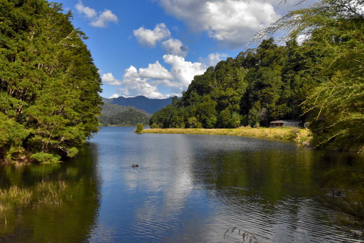
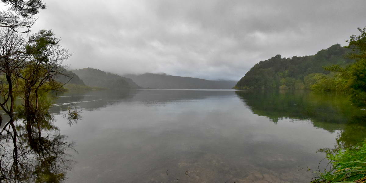
We were planning to walk the track anti clockwise taking the water taxi from Onepoto to Whanganui at 8:30am to start the track. We woke early on the morning of the 20th Jan to see the cloud lifting and by the time we reached Onepoto the sun had broken through. We sorted out our packs and headed off to the pick up point for the water taxi. Even before we started we were struck by how remote and peaceful Waikaremoana was
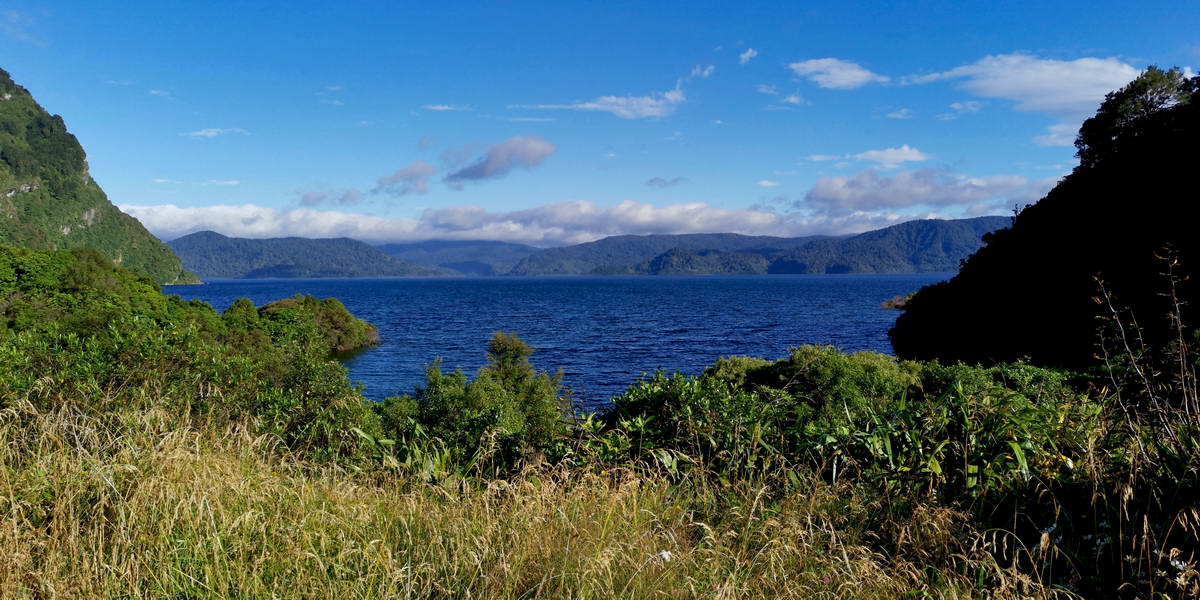
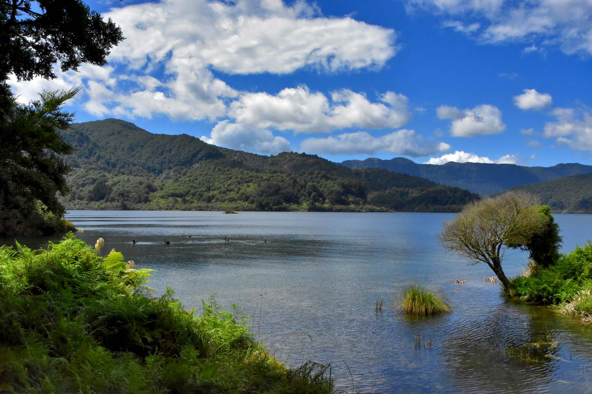
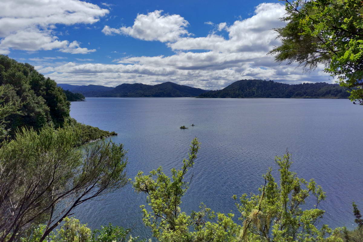
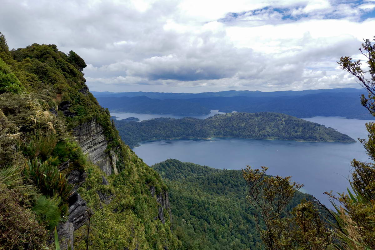
Waikaremoana from the carpark at Onepoto.
Panekiri bluff from Onepoto
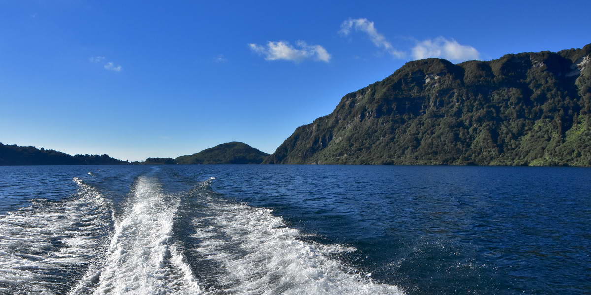
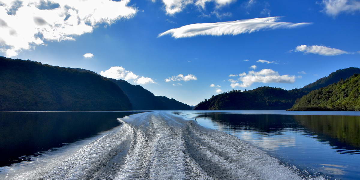
8:30am came and went and there was no sign of the water taxi. I was just beginning to worry that I had booked it for the wrong day when we spotted it out on the lake making its way towards us and a few minutes later it pulled up and we were on board heading out across the lake.
Waikaremoana is the deepest lake in the North Island. at 256m deep It was formed around 2200 years ago when a slip, possibly triggered by an earthquake, blocked the deep raviine that the Waikare - Tahelke river flowed through flooding the upper valley. It all happened so fast that apparantly the floor of the lake is still covered in petrified forests, preserved in the deep cold water.
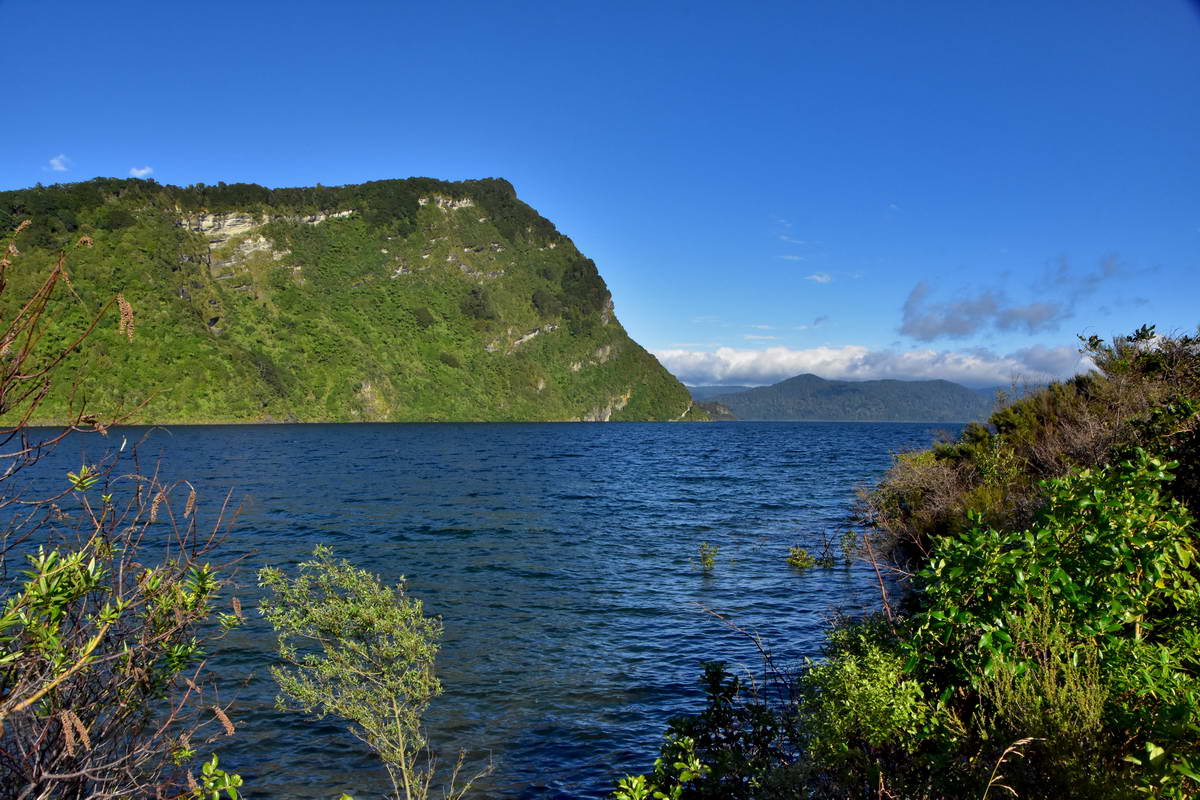
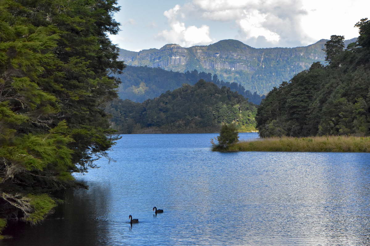
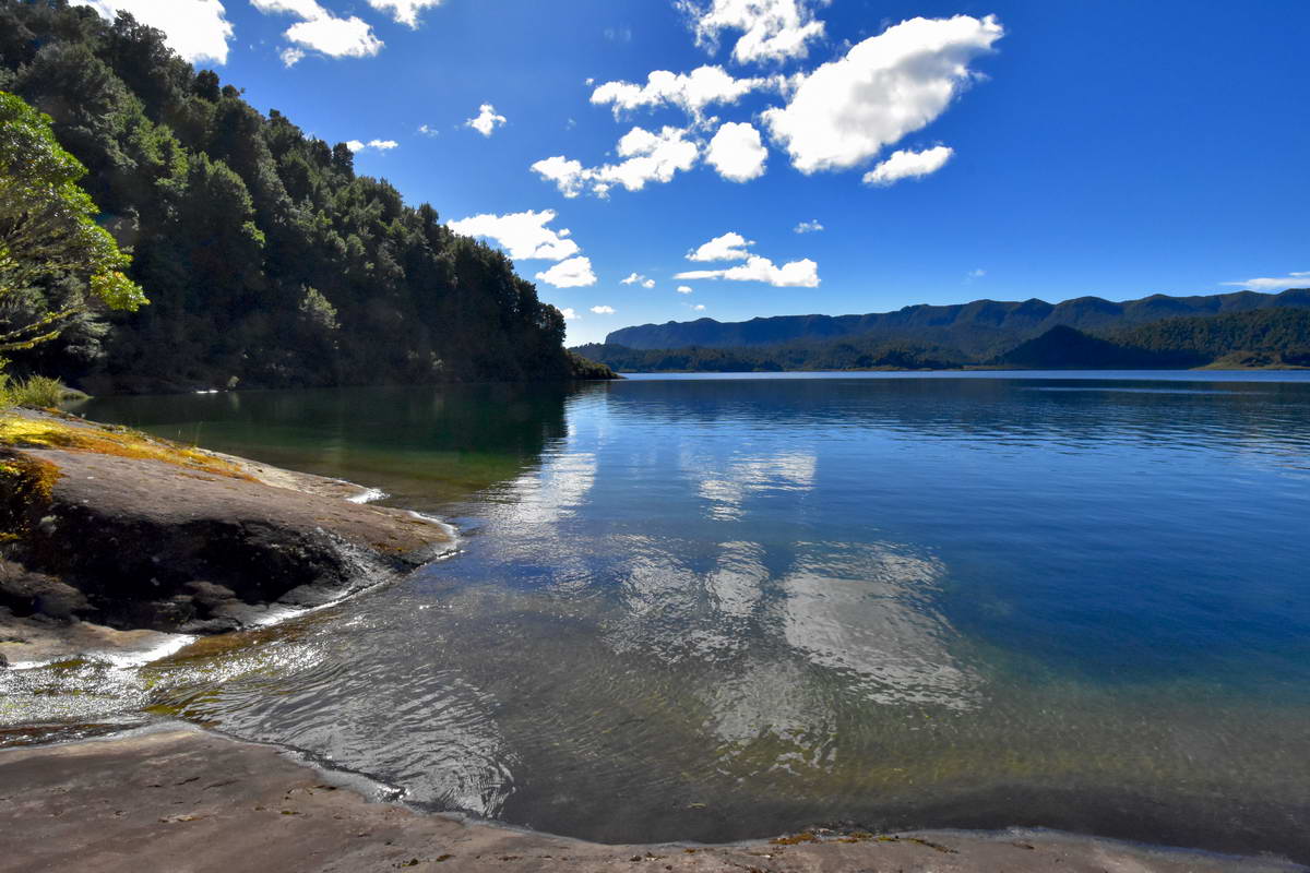
The ride in the water taxi provided some great views across the lake to the Panekiri bluff and various bays and inlets.
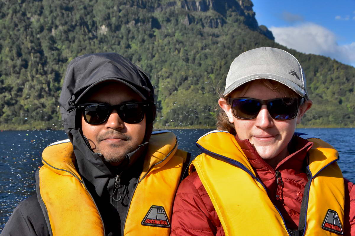
Sach and Sarah on the water taxi.
Panekiri bluff from the lake
The Whanganui inlet - just before we got dropped off at the start of the track.
It was about a 20 minute ride across the lake to the drop off point in the Whanganui inlet by the site of the now demolished Whanganui hut. Amongst many other pieces of information the water taxi driver warned us that the track would be a bit boggy after the recent rain with the Korokoro camp ground closed due to flooding.
We set off on the track around 8:45 headed for Marauiti hut which was a distance of approx 17km.
The first section of the track was fairly level, set back in the edge of the bush above the lake. There were multiple boggy and muddy patches but with careful foot placement we managed to keep our feet pretty dry. This section of the track was through mixed podocarp forest and there seemed to be plenty of birdlife about as we could hear the calls of koramako (bellbird), tui, riroriro (grey warbler), long tailed cuckoo as well as seeing miromiro (tomtit), piwakawawaka (fantail) and kereru.
Right from the start I enjoyed this track with the lake always being visible just off the track, the beautiful old bush and birdsong. After about an hour and a half we reached the Tapuaenui camp ground where the track climbed steeply over a peninsular before descending into Upokororo bay.
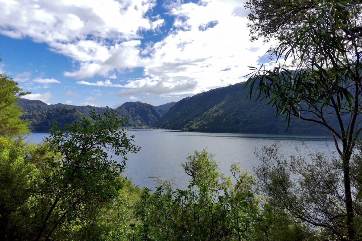
A view through the bush to Upokororo Bay
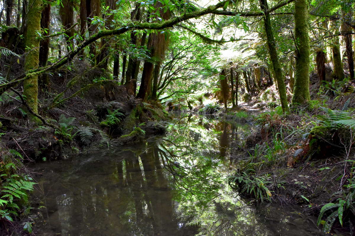
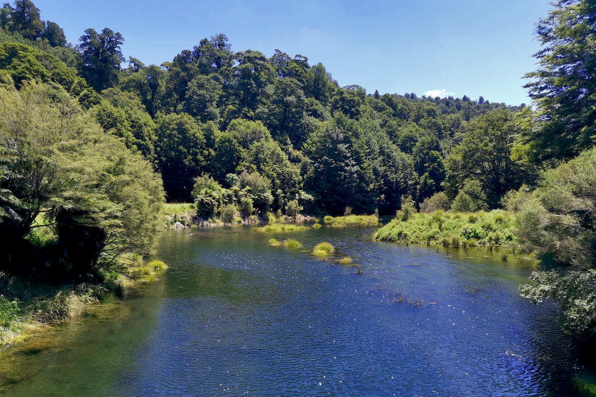
A stream crossing in the bush. The water was incredibly still providing great reflections of the bush above.
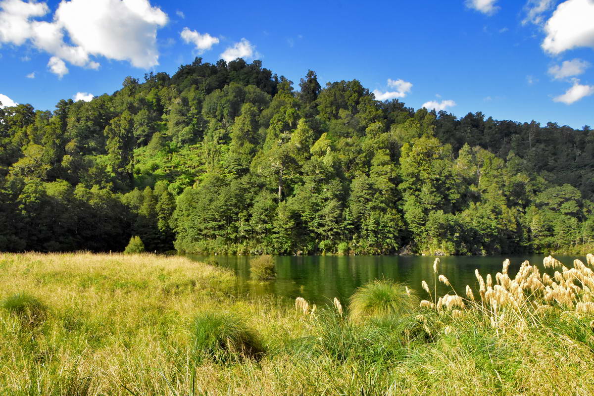
Soon after descending into Upokororo bay we crossed a swing bridge to arrive at Waiharuru hut after approx 2 hrs walking. This is a large new hut and looks to be really well set up with great views out over the lake from the hut. We took a brief rest break here before carrying on.
Views of the lake from Waiharuru Hut.
After Waiharuru Hut the track carried on around the lake edge and was generally pretty easy going though we still had to make our way carefully through multiple boggy sections. There were a couple of places where the papa went right down to the lake edge providing great views.
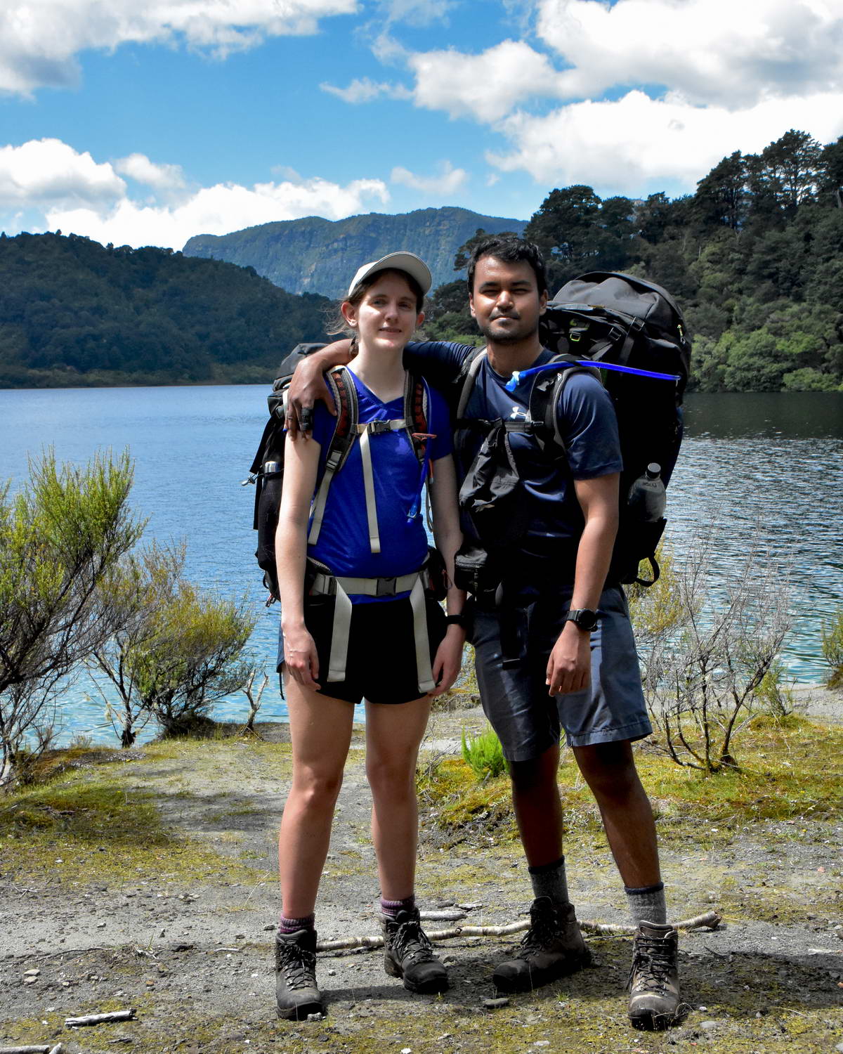
Sach & Sarah
Lake edge view at Ahimanu Bay - Panekiri bluff is in the background.
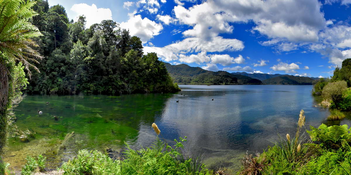
We stopped for lunch at one of these clearings on the lake edge and made the mistake of not going for a swim here thinking we would swim at the hut which was about another 30 minutes away. We came to realise that much of the lake edge is muddy, so when you find a place where the rock goes down into the water you should take your chance and go for a swim.
There were a couple of places along this section of track where the track and been washed out by the lake edge and you had to either clamber down to the waters edge or take a detour.
We reached Marauiti hut just before 1:00pm, approx 4 hrs after starting from Whanganui inlet.
Looking up the river from the swing bridge leading to Marauiti Hut
Marauiti Hut nestled at the edge of the bush. This is an older and smaller hut but well set up and very comfortable.
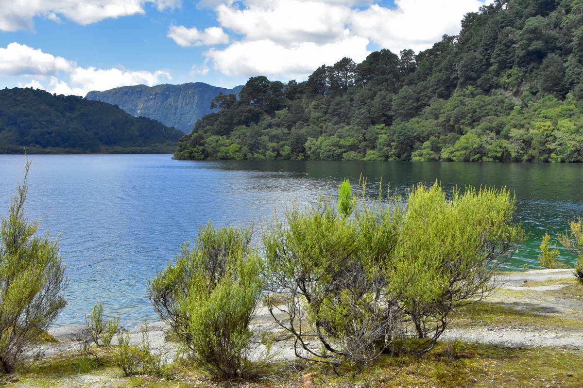
Looking Across Marauiti Bay towards Panekiri Bluff
A Story About A Lost Passport
We were the first group to arrive at the hut and after unpacking our bedding started thinking about going for a swim. We could see that the lake bed in front of the hut was a bit muddy but Sarah and I decided to swim at the hut. Sach headed off to look for a better spot further up the track.
After diving into the lake and stirring up the mud and silt, Sarah and I decided that it wasn't that pleasant afterall so put our boots back on and headed off after Sash, turning left from the hut as that's the way Sach said he was going. Heading in this direction the track heads over a small peninsula and though it was fairly obvious that Sach wouldn;t have kept going in this directio,n for some reason we carried on over the peninsula and then around the next bay to the Maraunui camp ground - about 20 minutes brisk walk from the hut.
There was a family who had come in by boat setting up camp who not surprisingly had not seen any sign of Sach but asked us which hut we were staying in as they had found a penny pouch with someones passport and credit cards in by the boat ramp and thought that this person was heading to Waiopaoa hut.
We then headed back to the hut by which time another couple of trampers had turned up. Sarah headed out to find Sach and have her swim (Sash had found a good swimming spot about 5 minutes back the other way) while I stayed and talked to the new arrivals. A German guy - Felix and a Canadian/NZ girl. After we had been talking for a while, Felix said something about not knowing how he had misplaced his passport but it was definitely no longer in his pack.
Thinking this is far too much of a coincidence I told him that there was a family over at Maraunui camp ground who had found a passport so off he went returning about an hour later with a big beaming smile and of course, passport and cards in hand.
It transpired that he had repacked his pack while waiting at the boat ramp for the water taxi and his penny pouch must have fallen out at this point. Fortunately for him, it was found almost immediately by the family launching their boat and by a random coincidence, Sarah and I had wandered off to the same camp ground and made the connection.
As the afternoon wore on, more people kept arriving generally coming from the Panekiri hut with multiple stories of how bad the track was (long boggy sections and a missing bridge over a stream) and how awful the Panekiri hut had been - though I think much of the complaints about the hut were more to do with the large group of undisciplined children who had been at the hut rather than the hut itself.
It was a pleasant evening in the hut with some great company and stories.
Evening view of the bush from Marauiti Hut
Day 2 Maruiti to Waiopaoa Hut
Saturday morning dawned clear and sunny and we had a fairly leisurely breakfast before heading off on the track. We were expecting this to be a pretty easy day as we only had 12km to walk and the distance looked fairly short on the map. We were looking forward to the side trip to Korokoro falls as everyone who had come through that way the previous day had said they were pretty spectacular especially with the river levels being high from the recent rain.
We soon realised that this section of track was far more ruggard than it looked from the map with numerous ups and downs zigzagging around inlets and over bluffs. Soon after passing the Maraunui camp ground we came to the stream crossing with no bridge that had been mentioned by trampers at the hut the night before. It was about a 5m stretch of knee deep water with a muddy bottom. This was probably flooded because of the high lake levels. Anyway we scouted around for a detour and climbed up above a small waterfall to rejoin the track with dry feet.
We got some great views of the lake through gaps in the bush. There were small sections of beech forest along this section of track interspersed with mixed podocarp forest and some magnificent old Rimu and Totara trees.
View From the Track Of the Wairau Arm of Waikaremoana
We stopped for a quick snack at this spot and then realised that the rock shelved straight into the lake below us so clambered down to investigate and found a great spot for a refreshing morning swim.
Our nice private swimming spot. The water was refreshingly cold though it was very slippery climbing back out with algae on the rocks below the surface.
After our refreshing break we carried on for about another 30 minutes until we came to the Korokoro falls track passing the flooded track to the Korokoro camp ground on the way. We left our packs at the track junction and headed up to the falls which was approx a 30 minute detour each way. The track up to the falls passed through what seemed a fairly young forest with lots of young beech and rimu trees.
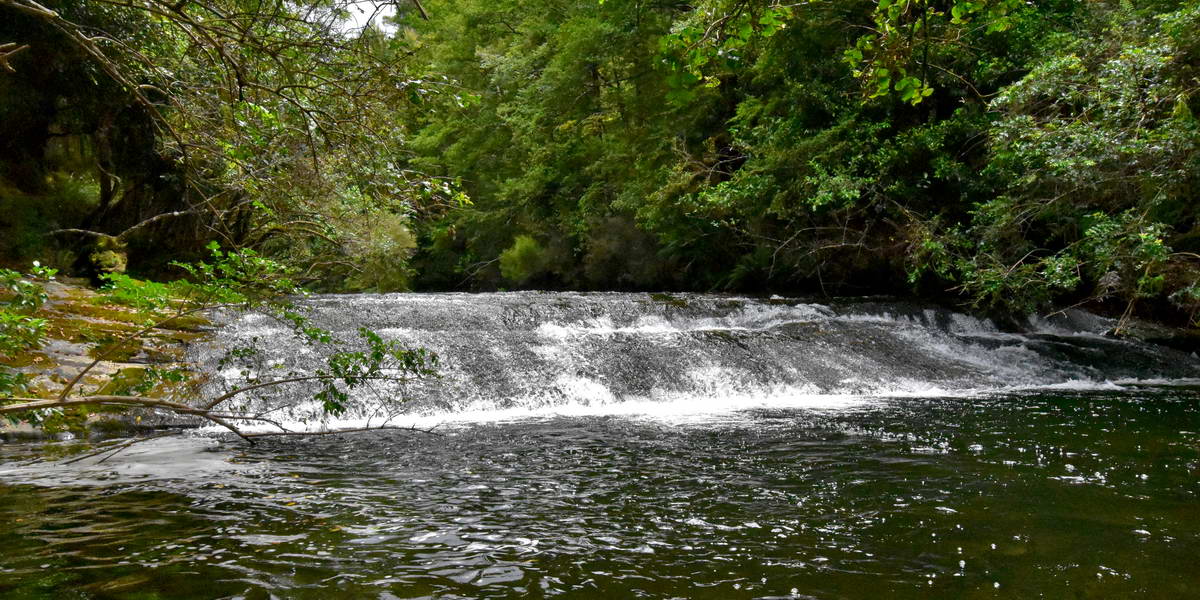
Some rapids on the korokoro river part way up to the falls.
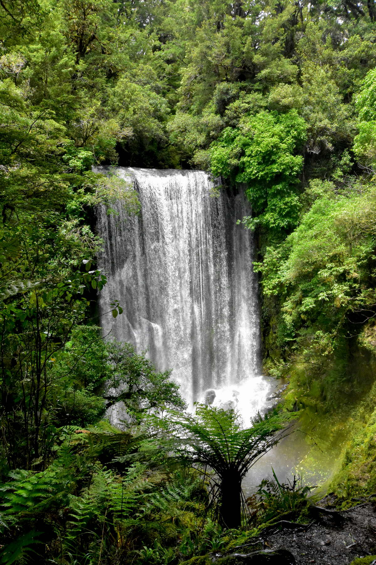
Koroforo Falls
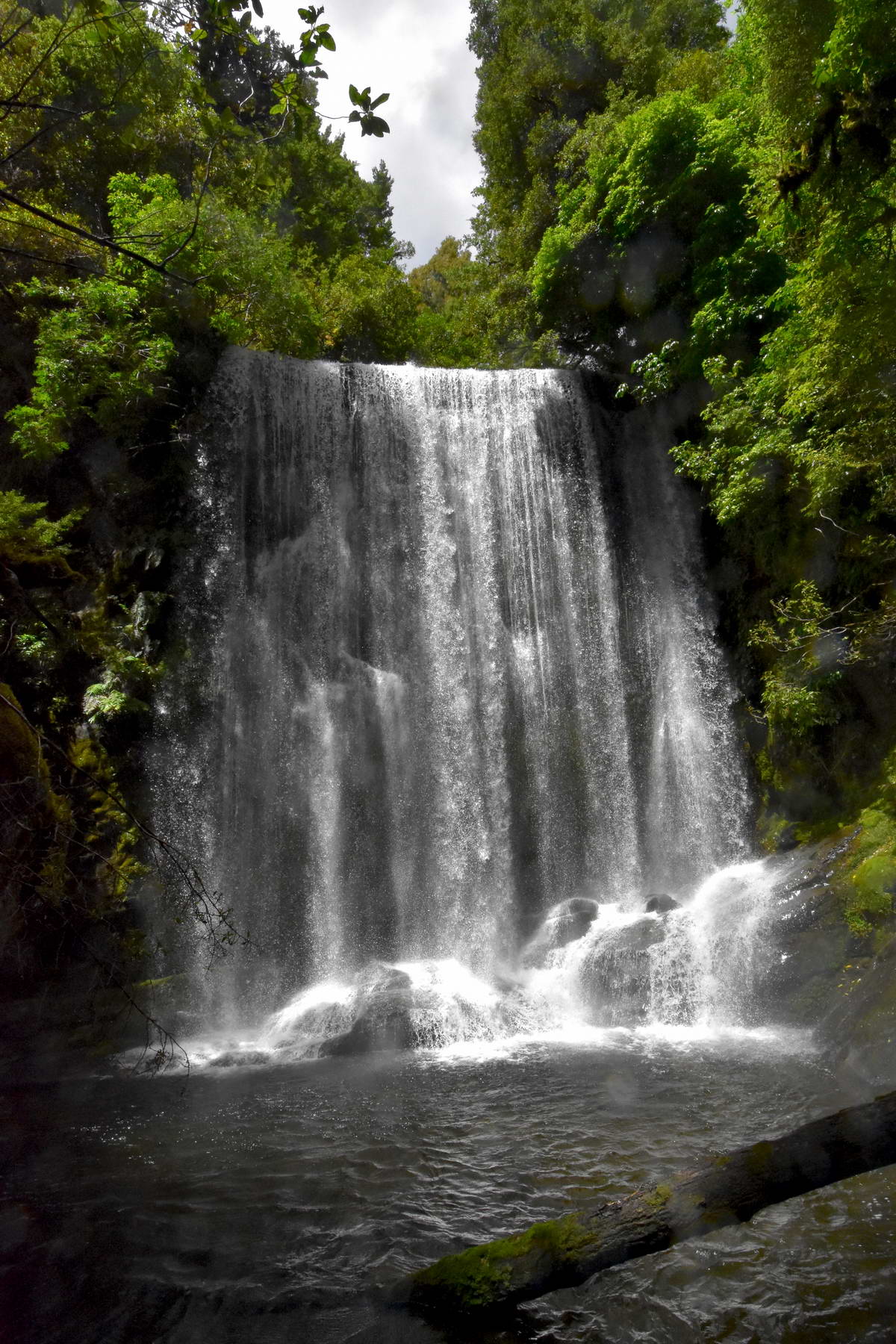
Looking up at the falls from the plunge pool.
The air was full of spray, particularly down by the plunge pool that my camera lense was soon covered in water making it impossible to take more photos.
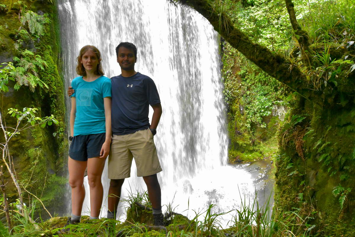
Sarah and Sach at korokoro falls
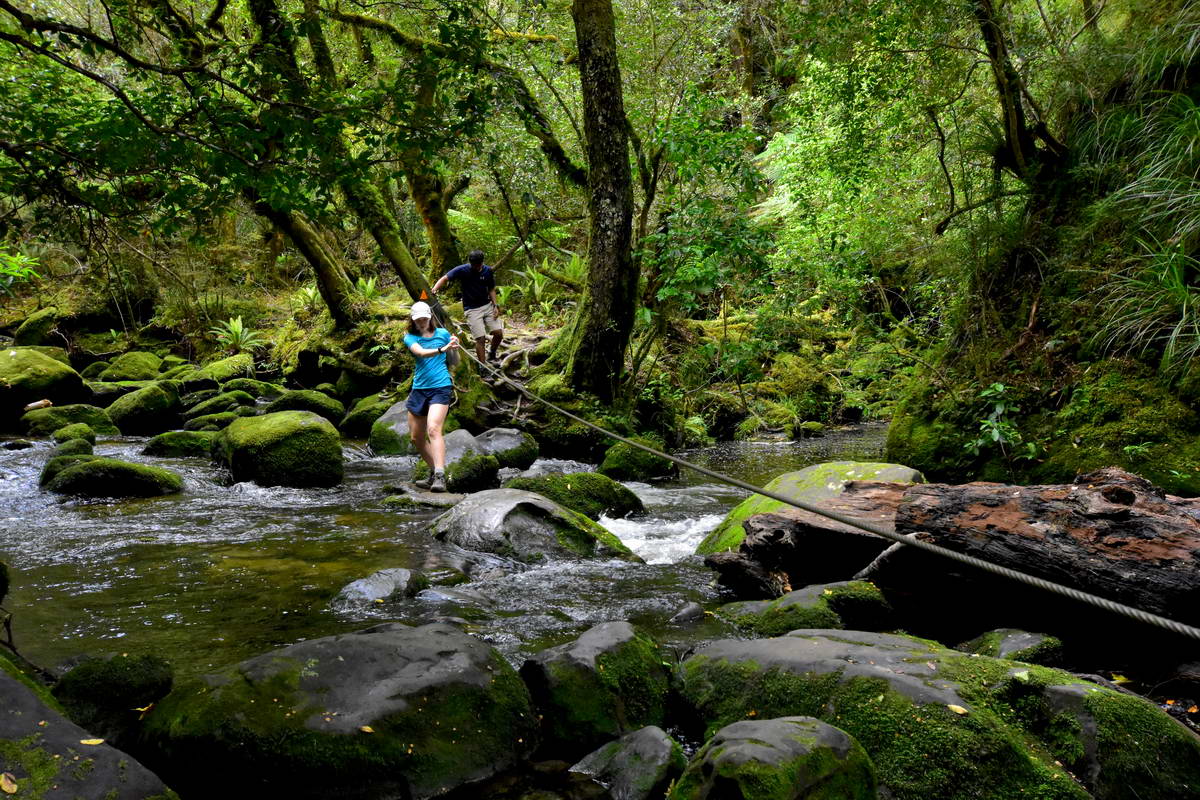
A steel wire has been rigged up as an aid to crossing the stream just below the falls
After returning to the main track and donning our packs we noticed that the cloud was closing in so instead of stopping for lunch we carried on to the Waiopaoa hut arriving as the drizzle set in for the afternoon.
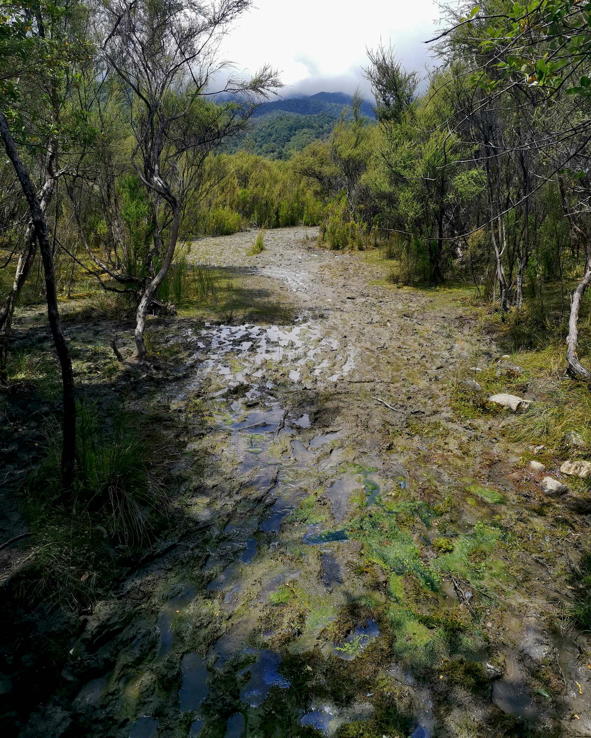
This section of track had the worst bogs ever.
The Waiopaoa Hut is relatively new and really nicely set up. We spent a pleasant afternoon watching the cloud sink lower over the lake and catching up with other trampers. We were the second group to arrive but by dusk the hut had nearly filled up.
The evening view over the lake from Waiopaoa Hut
We went to bed with light rain setting in for the night but ever hopeful that it would clear in the morning.
Day 3 Waiopaoa Hut To Onepoto
We weren't sure what to expect on this section of track. We had heard lots of reports from trampers coming the other way of how bad the track was and how difficult it was climbing up and over the Panekiri range. I had a long drive back to New Plymouth to look forward to so didn't want to be too late getting to Onepoto so we planned for an early start.
We were up at first light for breakfast and were pleased to see that the rain had stopped though the lake was still covered with thick low cloud and the bush was wet from the overnight rain. We set off at around 7:30 and made good progress climbing up towards the Panekiri ridge line on what we deemed to be one of the best sections of track on the whole walk. The track climbed up through some wonderful old beech forest and was in very good condition with hardly any muddy or boggy sections. We heard plenty of bird song and saw both tomtit and rifleman close to the track. The last section of track before gaining the ridge line was pretty steep with lots of wooden steps and one section where a small stream was flowing down over the steps.
The cloud was lifting as we climbed though ocassionally we were climbing in the mist which just added to the beauty of the ancient beech forest. We made good time up to the ridge line in around an hour and getting some great views out over the lake.
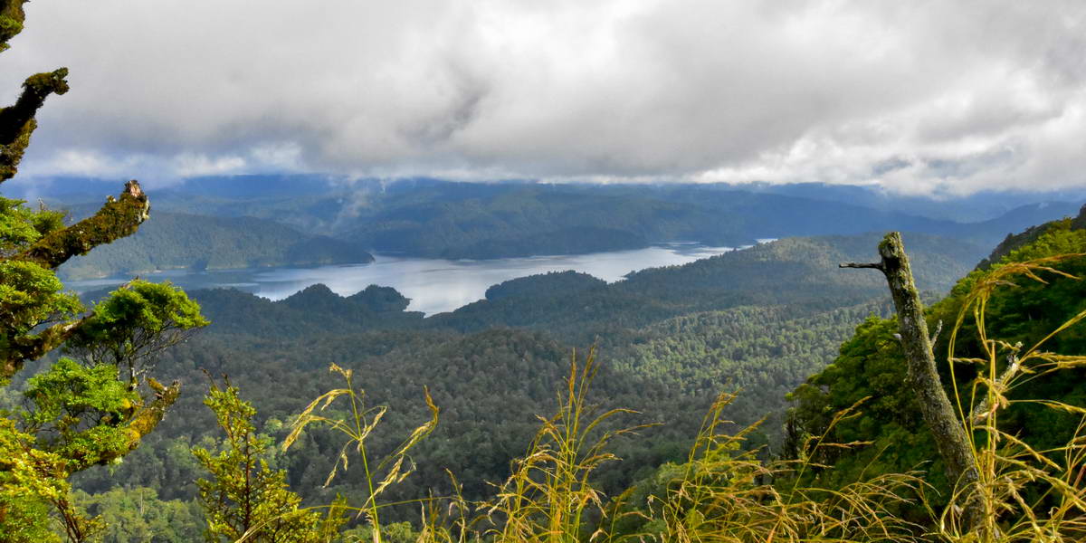
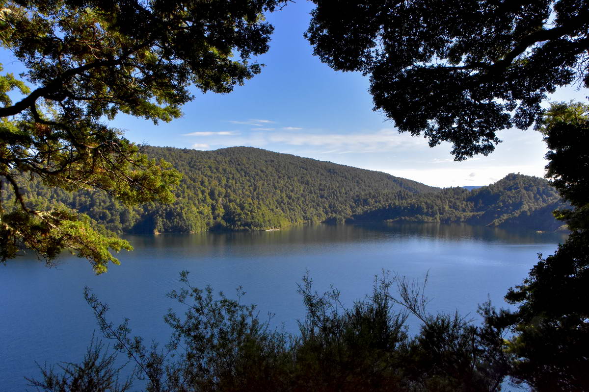
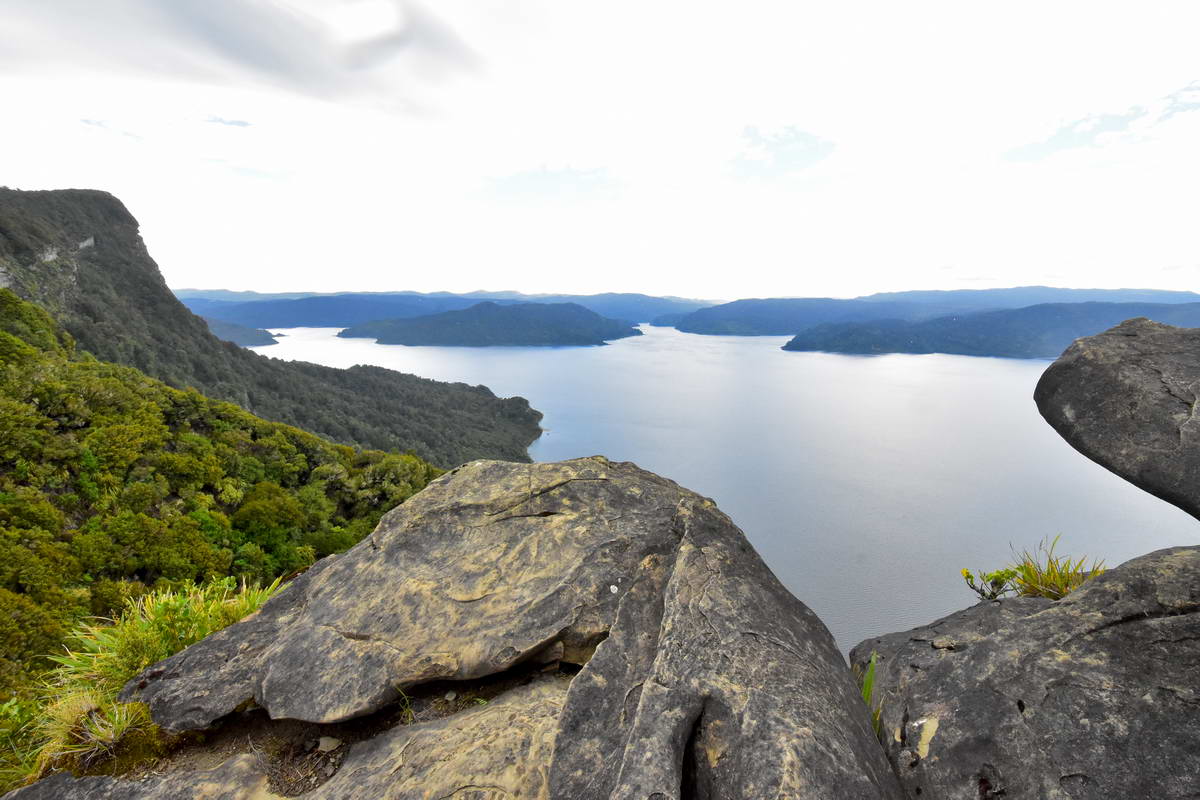
Waikaremona from the ridge line on the Panekiri range.
After gaining the ridge line the track there are a few ups and downs as the track climbs up towards Panekiri hut at 1180m. The whole ridge is covered in old beech forest wit the trunks and branches of the trees covered in moss. This is a really beautiful section of bush and a very enjoyable section of the track.
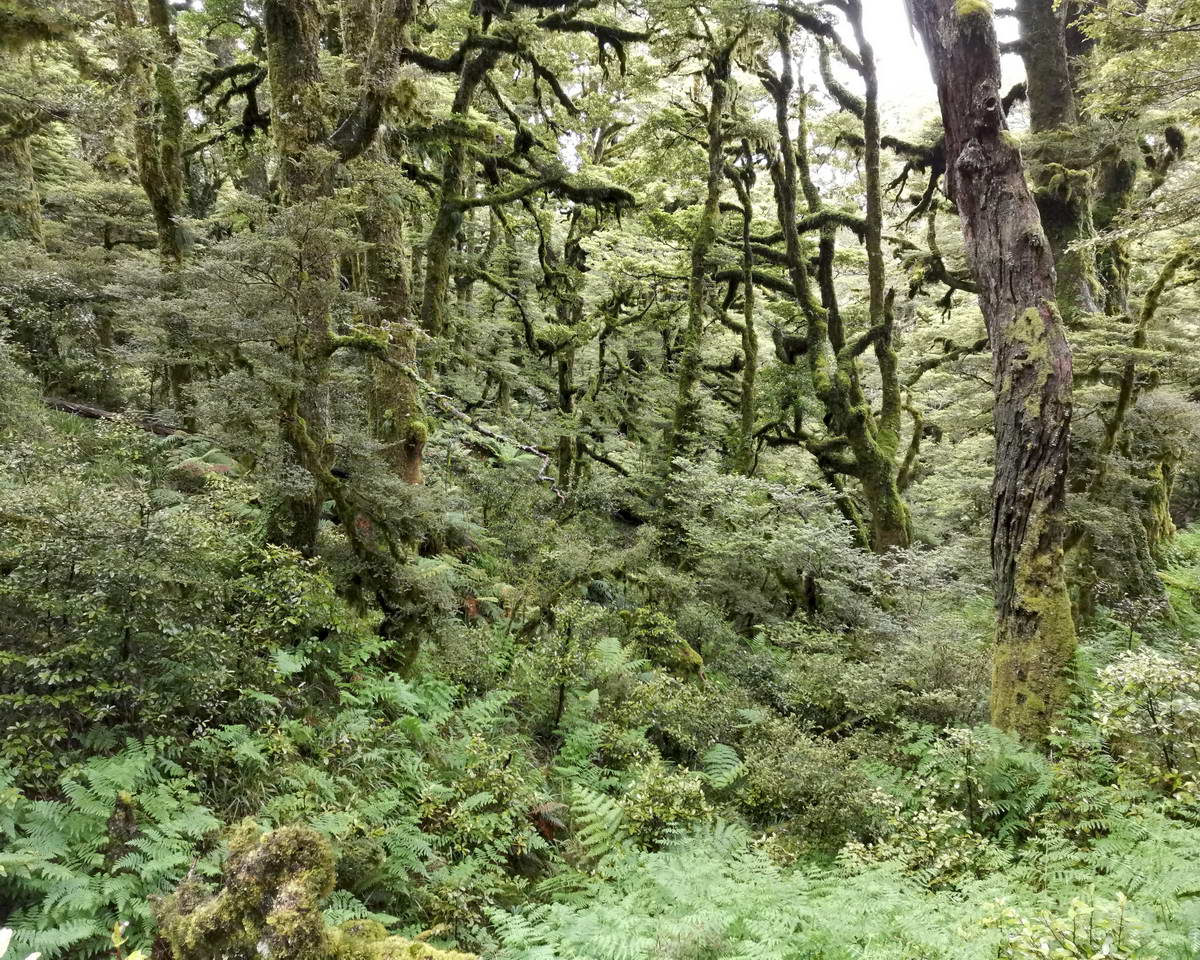
Beech Forest On the Panekiri Range
We reached Panekiri hut two and a half hours after leaving Waiopaoa hut and stopped to admire the views and have a brief rest.
The View From Panekiri Hut
From Panekiri hut the track carries on along the ridge through more beautiful old beech forest with a few more ups and downs. We had the odd light shower but never enough to bother stopping to put coats on.
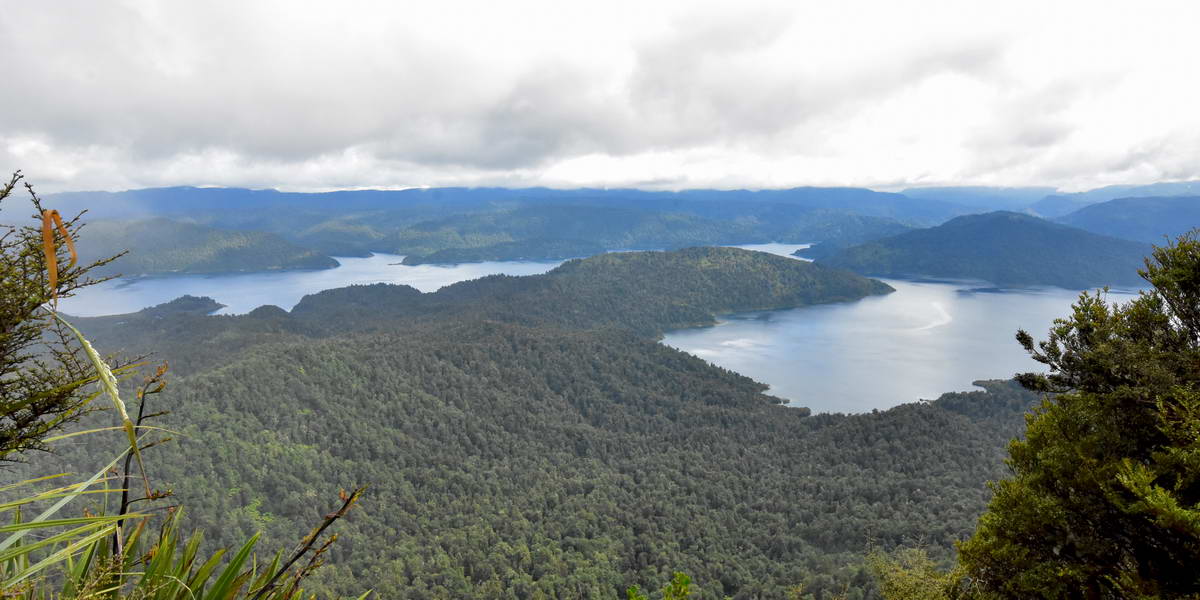
About an hour and a half past Panekiri hut we spotted a side track heading towards the lake and decided to explore. After a couple of minutes this emerged onto a rocky view point above Panekiri bluff with fantastic views over Waikaremoana. Plenty of sandstom=ne rocks to sit on so a great place to stop for lunch though it was a bit exposed to the strong wind that was blowing over the ridge.
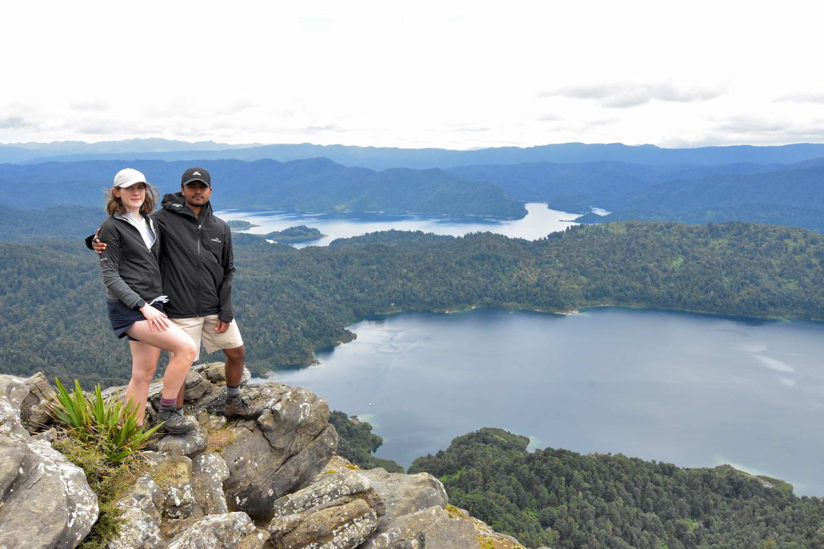
Sash & Sarah on the rocks above Panekiri Bluff.
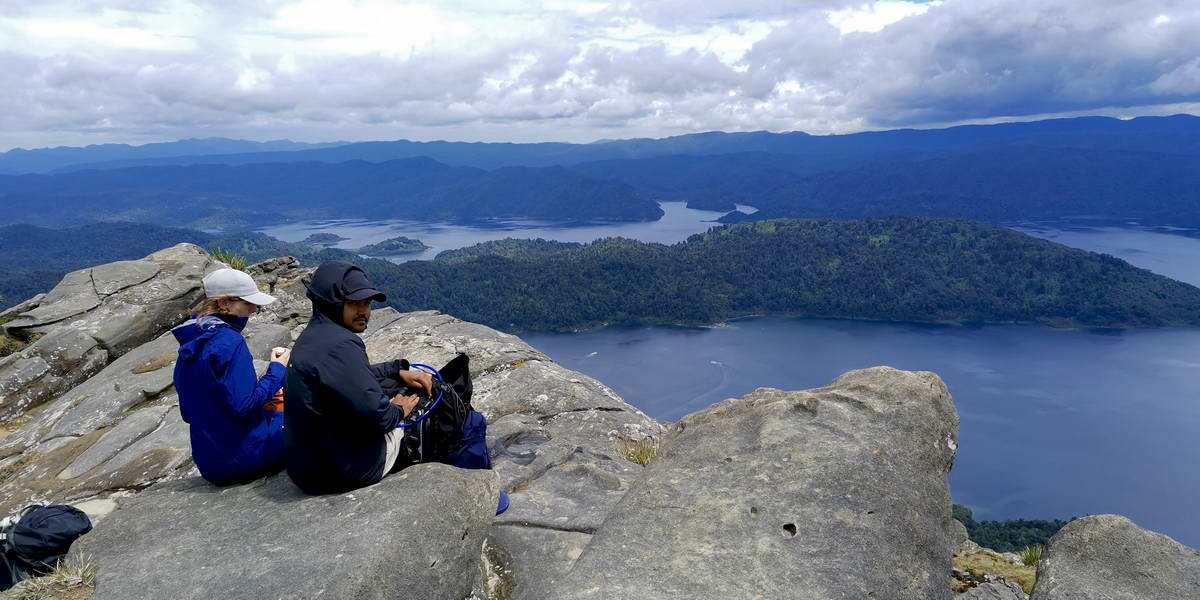
A great spot for lunch - fantastic views over Waikaremoana
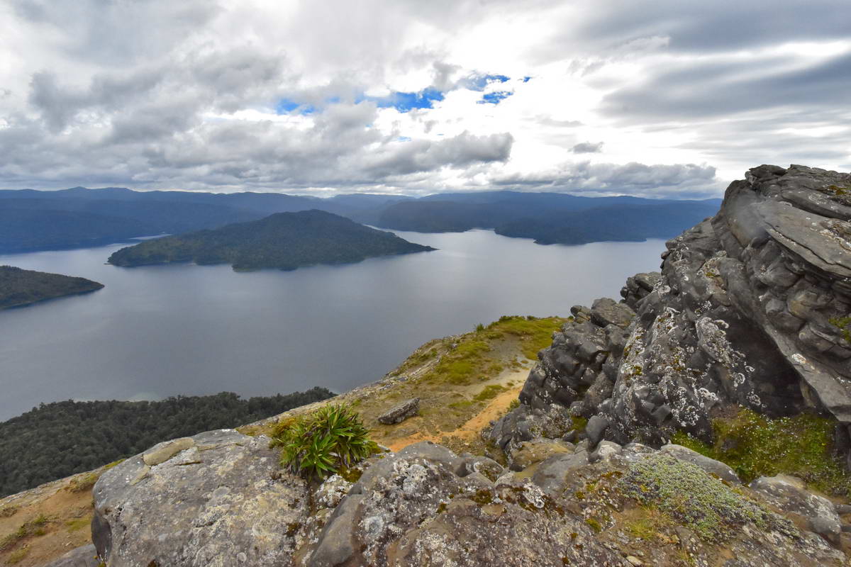
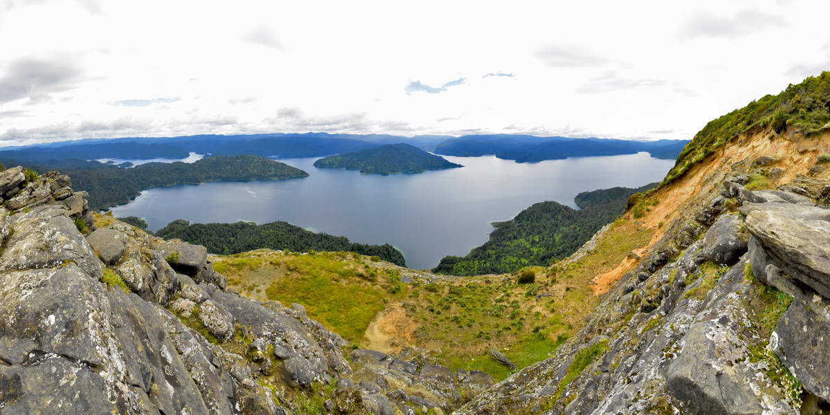
After lunch we carried on along the ridge line above Panekiri bluff with multiple points where we got great views out over the lake.
Looking down from Panekiri Bluff
A last view over the lake before the track started the descent to Onepoto.
It wasn't long before we reached the end of the ridge line and began our descent towards Onepoto. I was always have mixed feelings when approaching the end of a great walk. Sad that the time in the wilderness is over and wishing we could stay in the bush longer but also looking forward to the end o the track and heading home.
We eventually reached the Onepoto carpark at around 2:30, 7hrs after leaving Waiopaoa hut. The climb over Panekiri ridge was very enjoyable. The track was generally in good condition on this section and the climb relatively easy with beautiful bush and great views.
We thoroughly enjoyed the Waikaremoana great walk. The track is a bit rough in places (compared to other great walks) but it is a beautiful and remote part of the country and well worth the effort. I'm very glad that we got to do this walk, I wish my father had managed to get here - he would have loved it.
Recent Posts
-

The Milford Track
For the last few years my daughter Sarah, her fiance Sach and myself have been completing a great w …13th Feb 2024 -

The Waikaremoana Great Walk
We had originally planned to walk the Waikaremoana track in Februrary 2022 but with uncertainty over …31st Jan 2023 -

The Routeburn Track
We were going to walk the Waikaremoana Track this February but had concerns that the track might not …27th Feb 2022