
The Abel Tasman Track
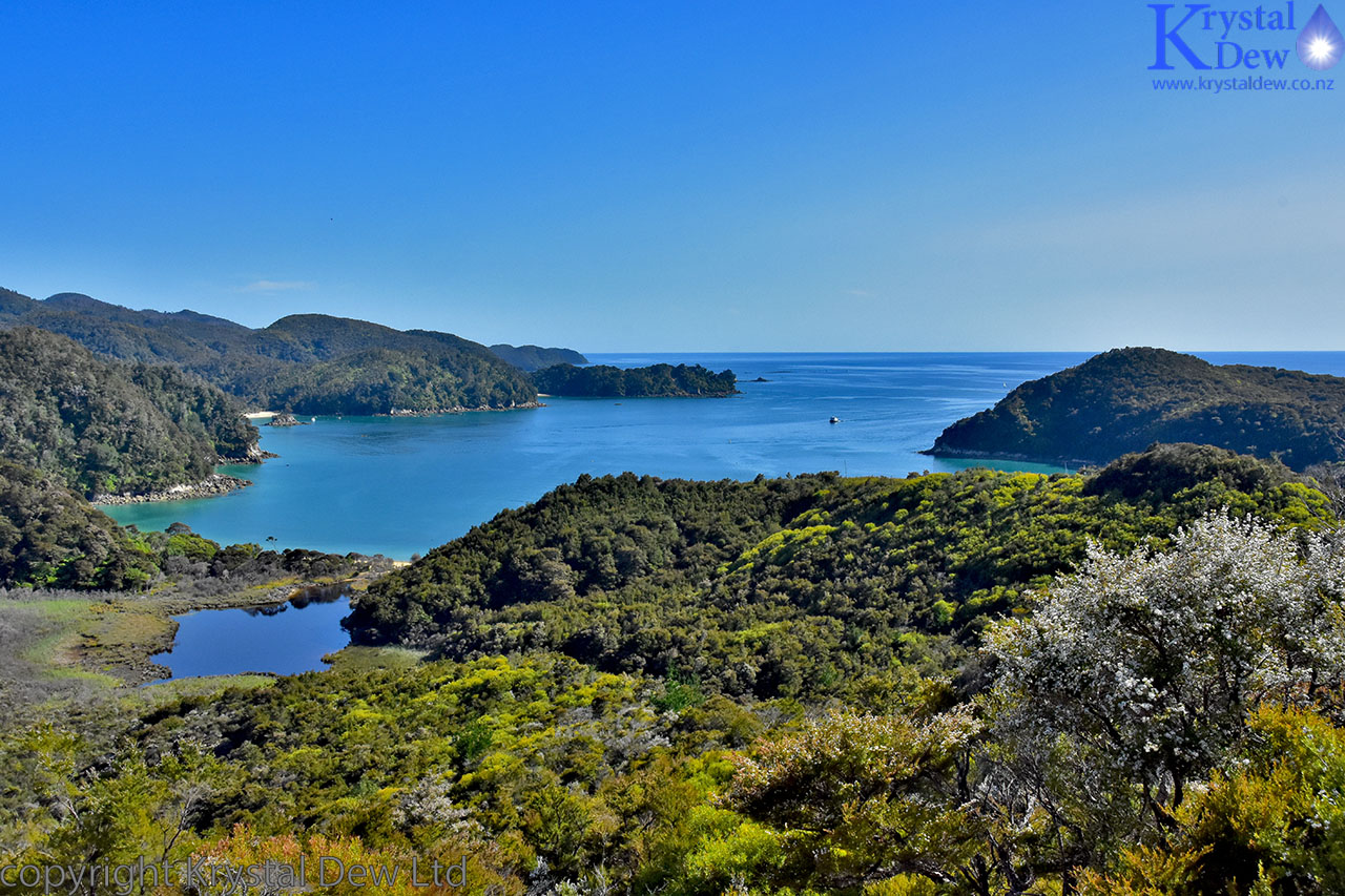
Last weekend I was lucky enough to have the opportunity to walk the Abel Tasman track with my daughter Sarah. We set off from Wellington on the 16th Jan catching the early morning ferry to Picton. It was a smooth crossing though heavily overcast as we came through the sounds. We stopped at Picton for lunch before heading off on the Queen Charlotte drive to make our way to Nelson. By this time the cloud had cleared and we got some stunning views of the sounds.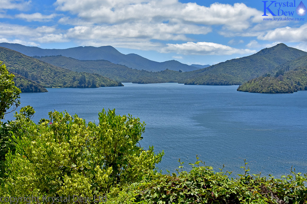
This is Queen Charlotte sound taken from one of the many lookout points on Queen Charlotte drive.
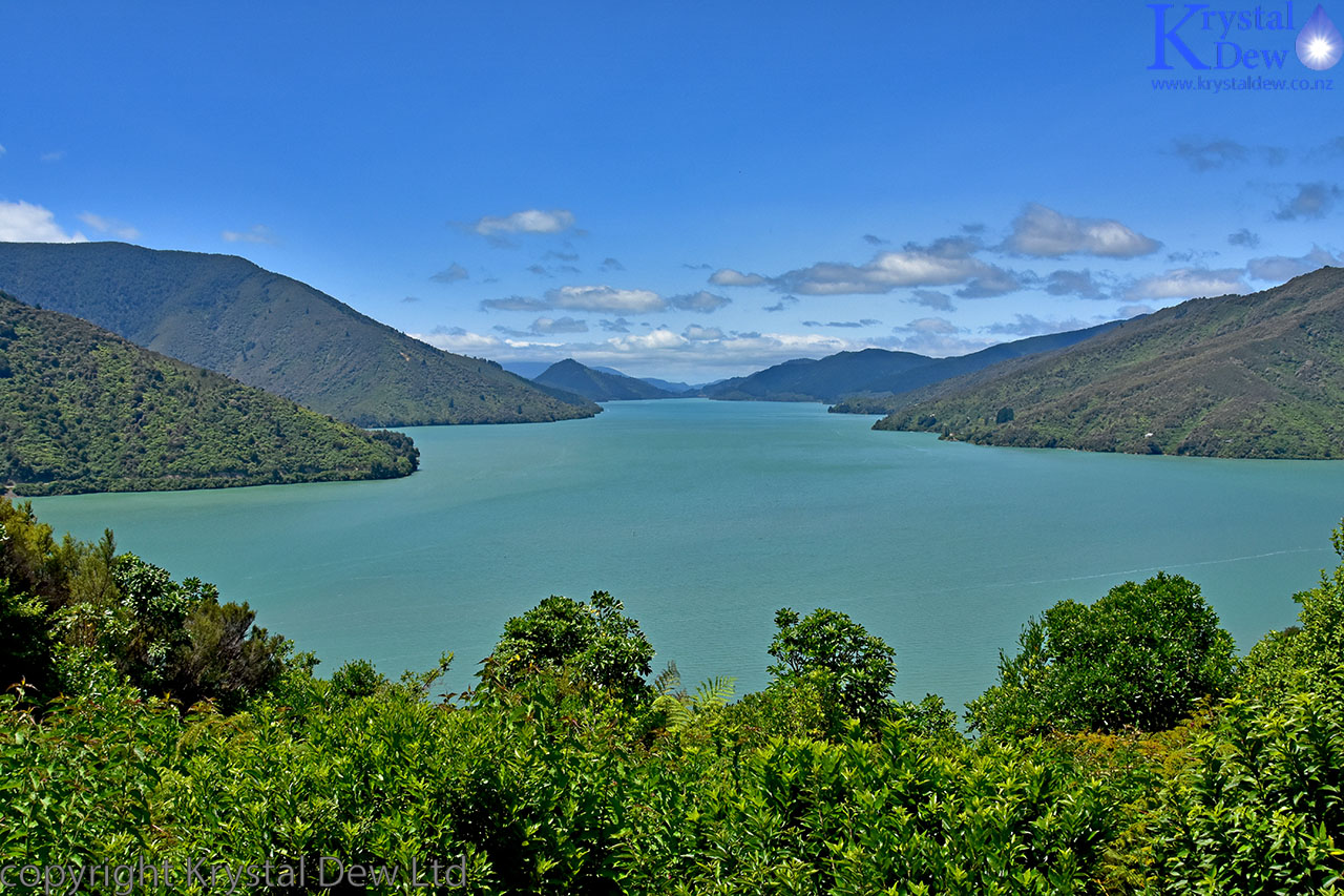
Mahou sound, at the southern end of Kenupuru sound, taken from Cullen point.
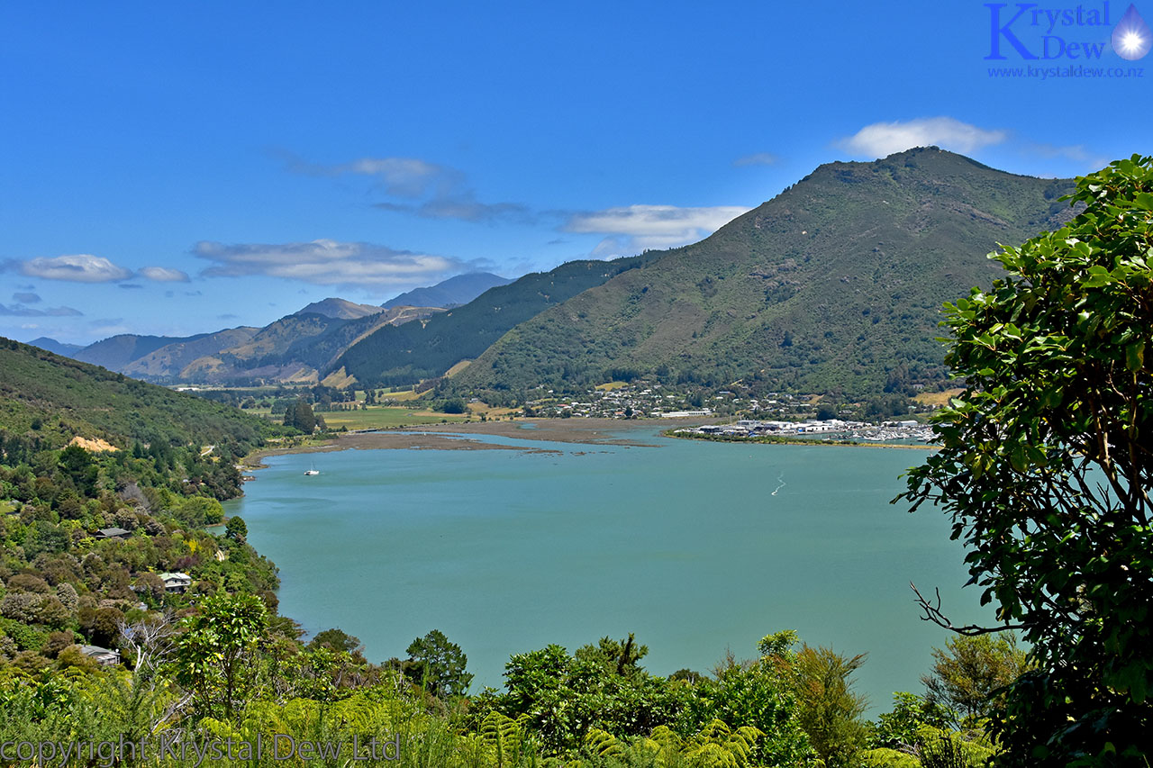
Looking across the water to Havelock from Cullen point.
We had a brief stop in Nelson to stock up on supplies for the walk then carried on to Riwaka where we had an Air B&B booked for the night. After checking in we headed off up the Riuwaka valley to the Riuwaka resurgence. A friend I work with had recommended this detour and it was well worth the effort. The Riuwaka resurgence is a beautiful and sacred spot where the Riuwaka river emerges out of a cave system believe a limestone bluff. THe water was incredibly clear and while we sat admiring the beauty of the river a bellbird came and sat inthe tree above us giving us the gift of its beautiful clear song.
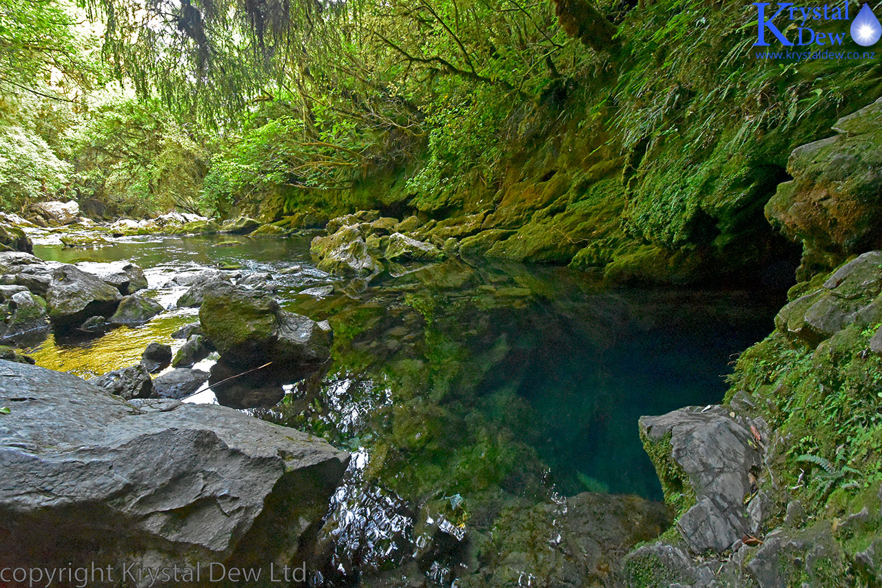
The Riuwaka resurgence. This is the point of resurgence where the river starts flowing from this clear pool under the limestone.
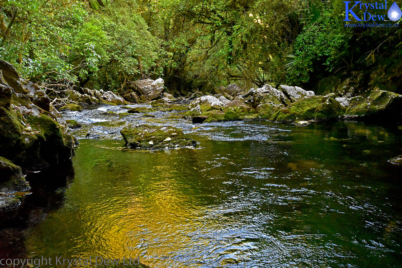
The Riuwaka river just down from the resurgence - I love the colour of the late evening light reflected on the water.
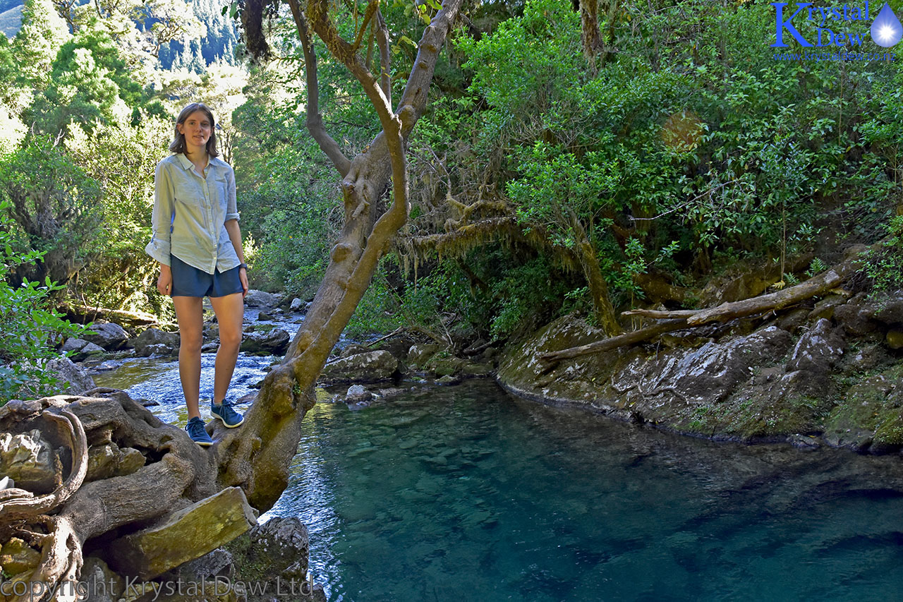
Sarah - refusing to jump in and make a splash.
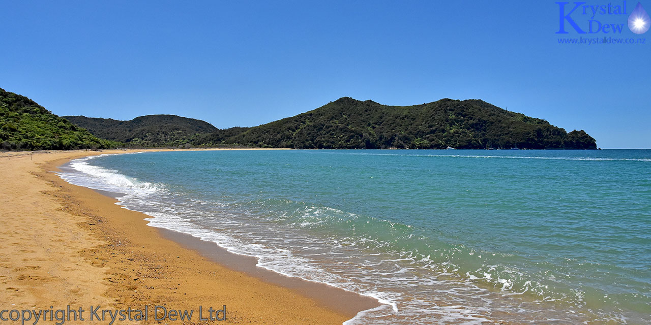
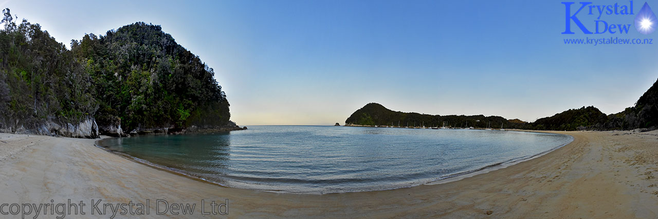
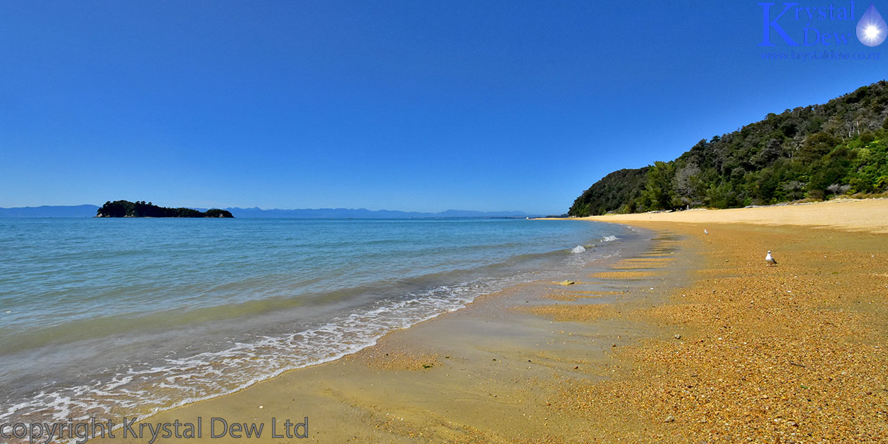
Friday the 17th. With great anticpation we got up and got our packs ready with everything we would need for the next two days and headed off to Marahou to catch the water taxi. We had a brief stop at Kaiteriteri on the way which has a stunning golden sand beach.
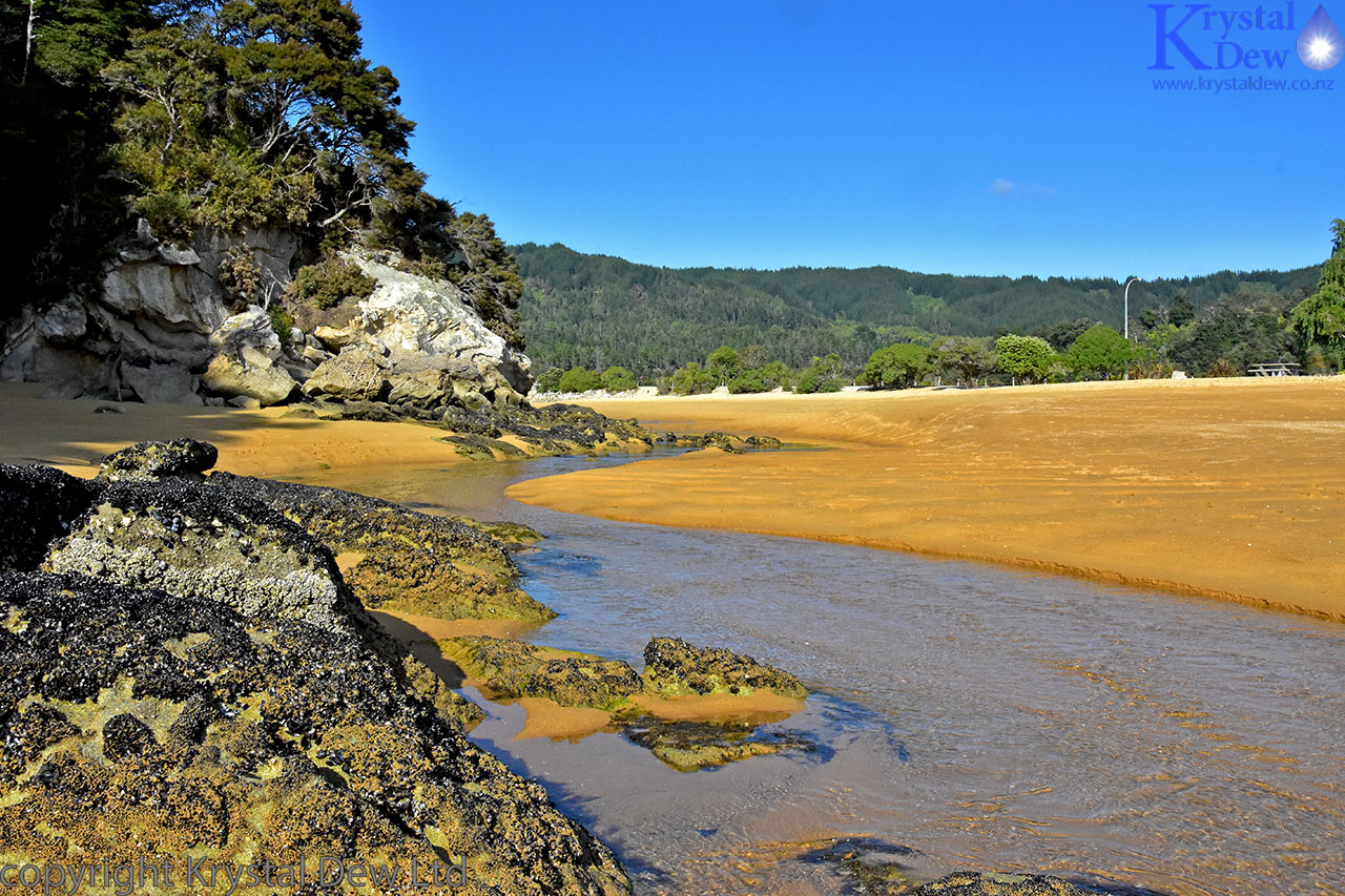
A stream flowing through the golden sands of Kaiteriteris beach.
We were booked on the 10:30 water taxi which would drop us at Awaroa at 12:00. It seemed to take forever waiting to board the water taxi but finally we were on board and being towed out to the beach by Horris the tractor to be launched out into Tasman Bay. It was great to be finally on our way and we got some spectacular views of the coast and some of the interesting landmarks as the water taxi made its way around the bays to our drop off point.
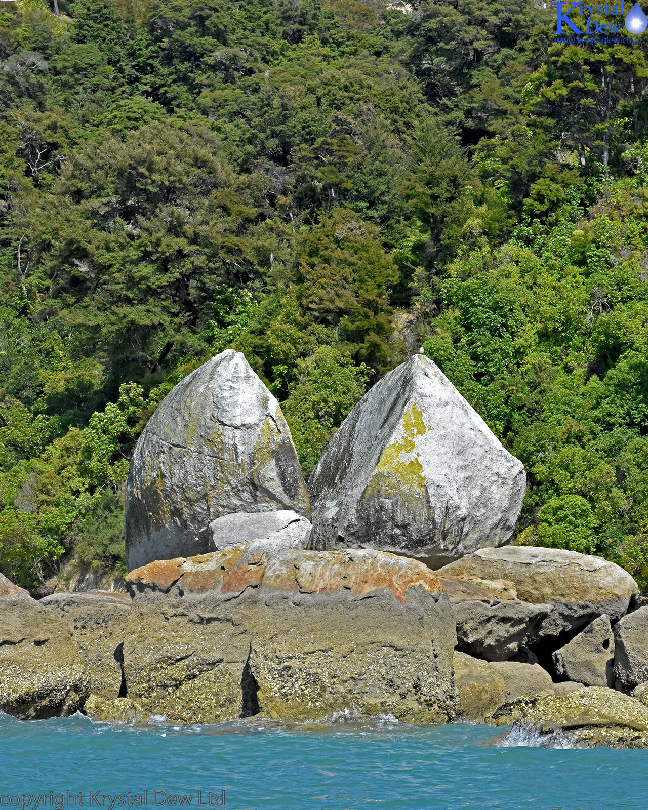
Split Apple Rock or Tokongawha
Sandfly Bay - from teh water taxi.
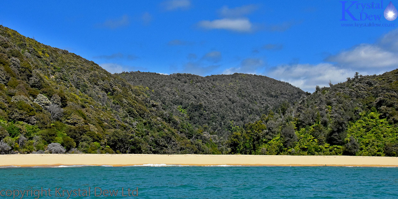
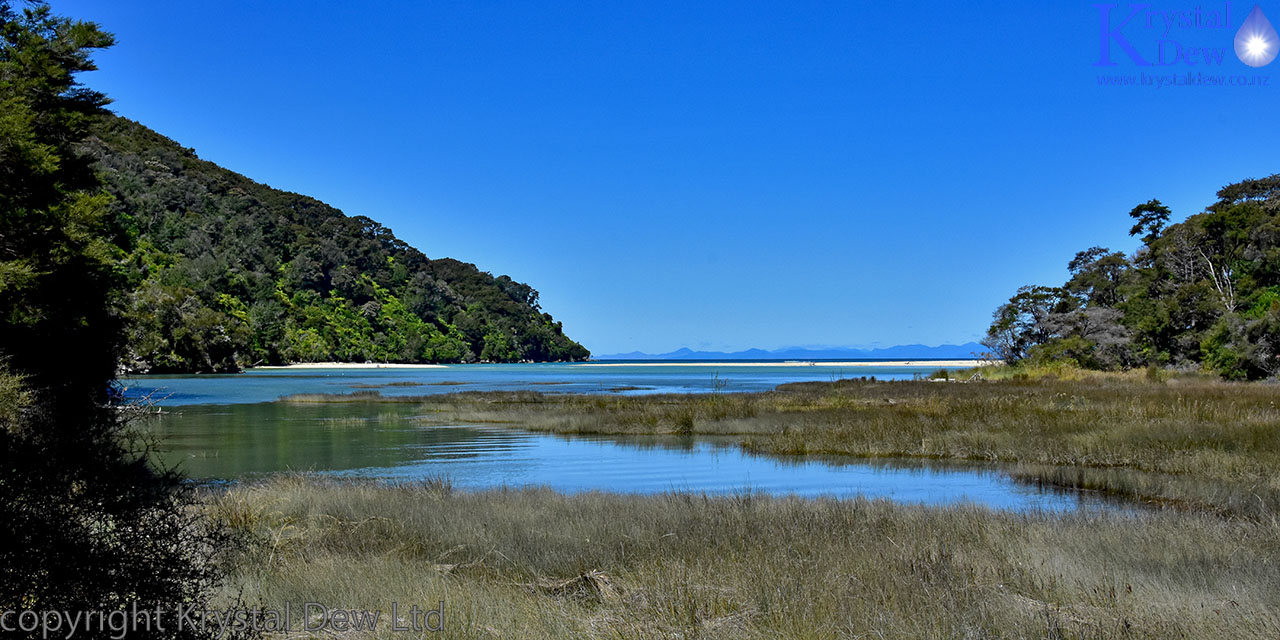
Finally we were dropped off at Awaroa which was our starting point. It was just after midday when we were dropped off so we sat on a log and had our lunch before setting of. Awaroa bay has an expansive beach. It is the one place on the track where their is an estuary crossing that must be crossed at low tide as there is no inland "high tide" track. It was the timing of the tides that meant we couldn't start any furhter north.
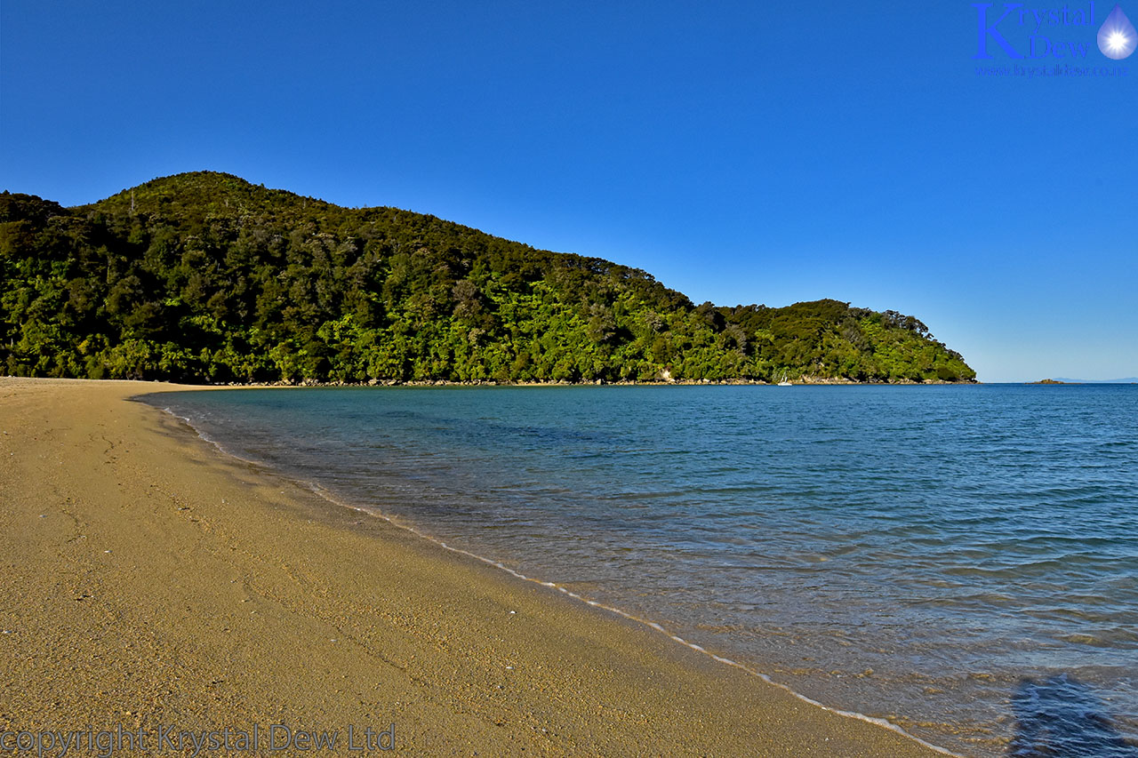
Awaroa Bay - one of the many stunning beaches along the Abel Tasman coast.
Lunch over we donned our packs and set off along the track through the bush towards Bark bay. From Awaroa the track climbs through mixed podacarp forest to the ridge line before descending into Onetahuti beach. Throughout the whole walk we could nearly always hear beelbird singing either close by or in the distance.
Onetahuti beach from the ridge line.
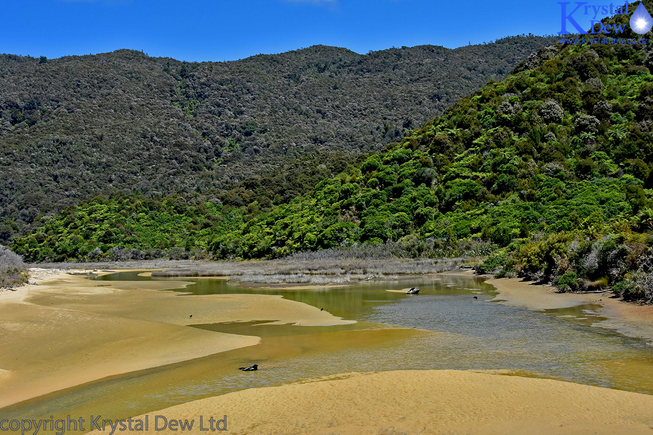
A small river estuary behind Onetahuti beach.
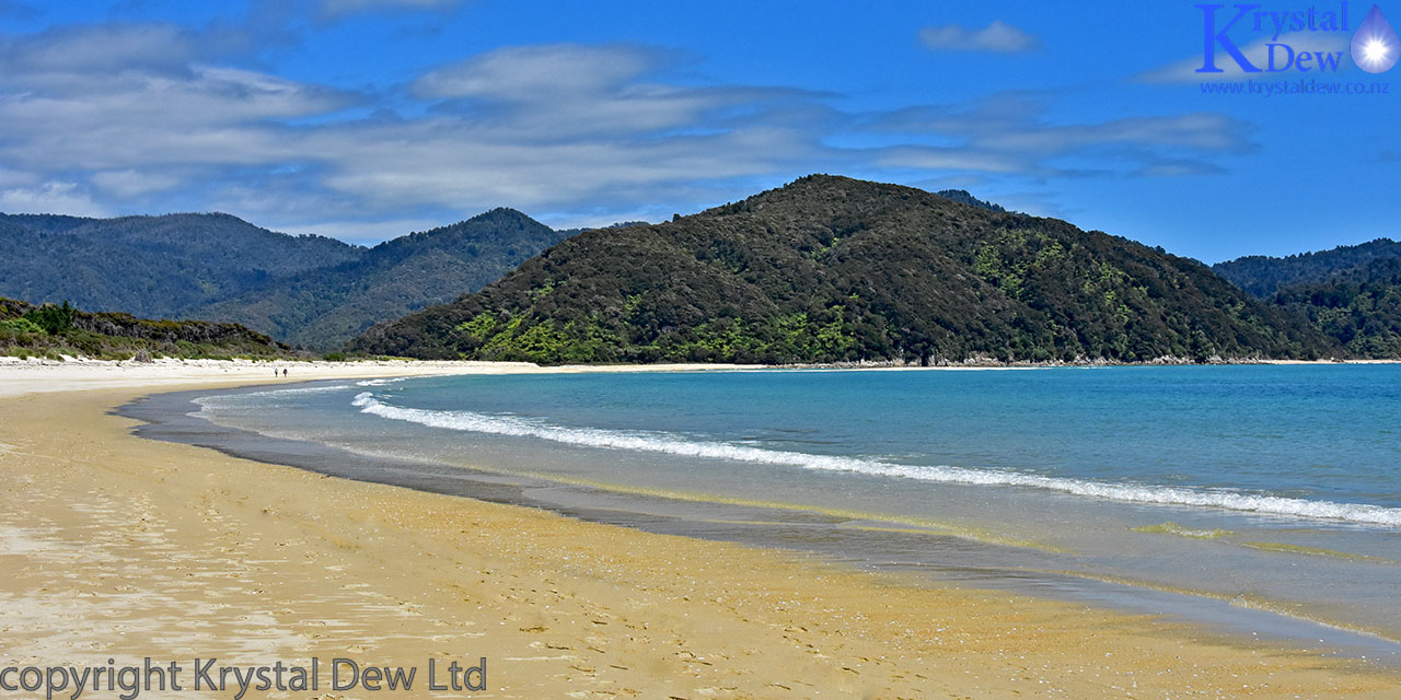
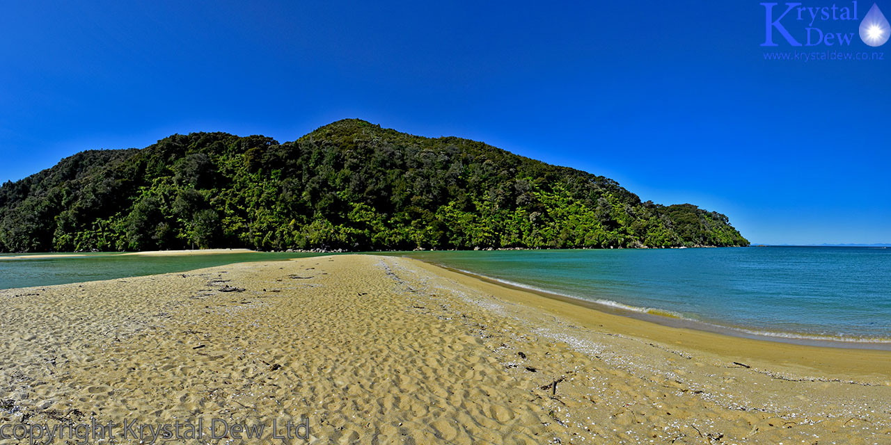
Onetahuti beach - we walked the length of this beach. Hard work walking on the sand carrying a heavy pack.
From Onetahuti the track winds around the coast to the next beach before another steep ridge crossing to reach Bark Bay. Whenever we stopped for a drink or to admire the view a weka would pop up out of the undergrowth and come and investigate.
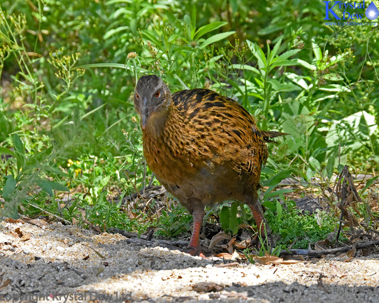
A friendly and inquisitive weka.
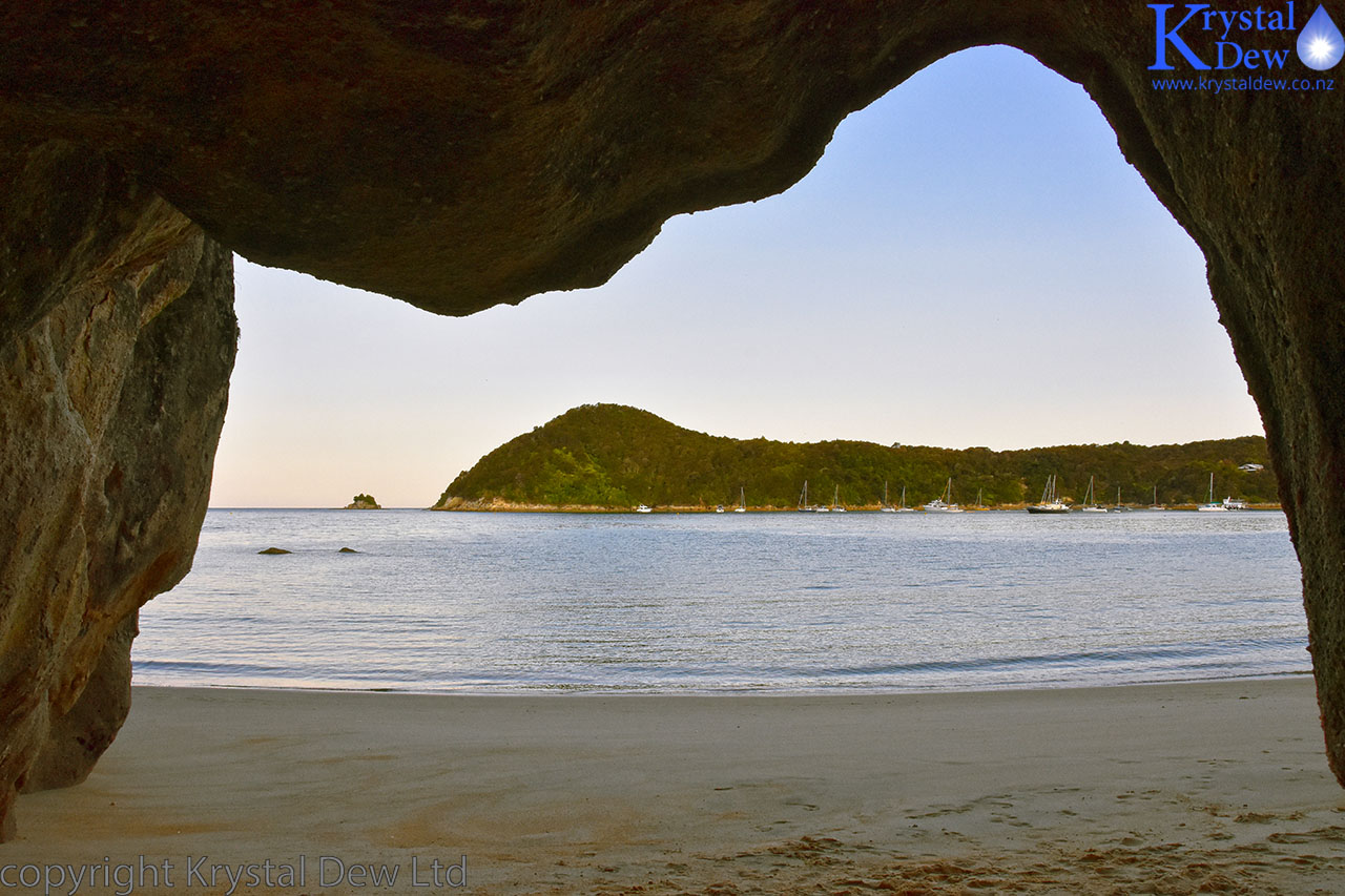
A view through the bush looking down on Bark bay. This was our campsite for the first night.
By the time we arrived at Bark Bay it was nearing high tide so we had to take the inland high tide track to go around the estuary to reach the camp ground. The cap gound was well set up with a treated water supply, flush toilets and a covered kitchen area with benches for cooking and sinks for washing up.
We spent a very pleasant evening walking along the beach, swimming (though very briefly because the water was freezing) and watching how the beach changed as the tide went out and the sun began to set. Most of the other people in the camp ground were European travellers.
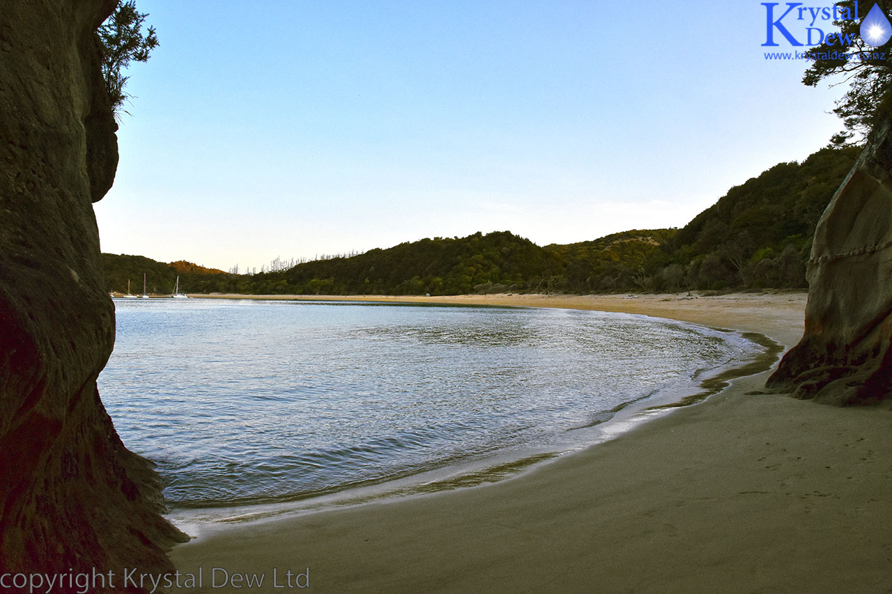
Bark Bay Estuary at high tide
Looking along the sand spit.
Bark Bay beach just before sunset.
Standing in the estuary at low tide
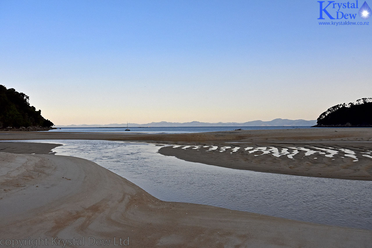
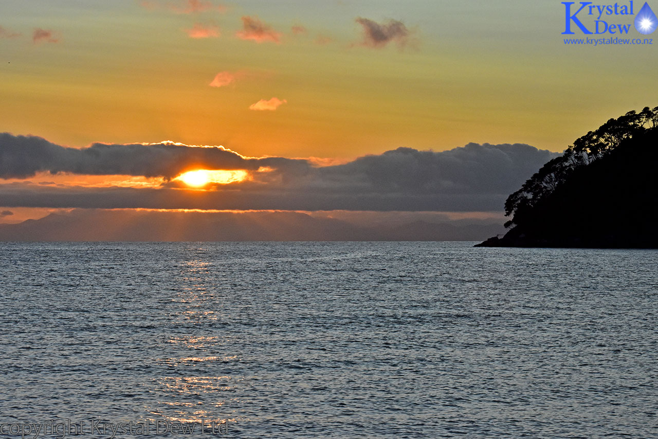
Looking out to see from the camp ground at dusk.
It was a clear evening and the milkyway showed out clearly above the bay as night set in. I had brought a small (6" high) tripod so set about trying to get some night time panoramas of the milk way. Wasn't quite the right tool to use for this type of photography but I was quite pleased with the results.
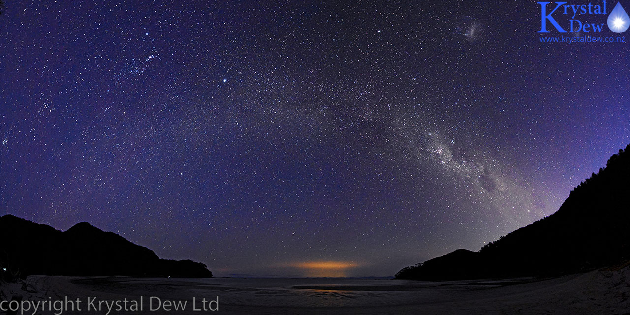
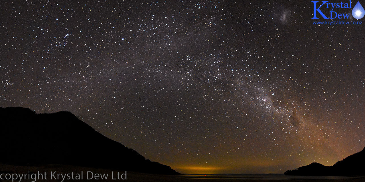
The milky way above Bark Bay. The glow on the horizon is due to light from Picton in the far distance lighting up some low cloud. The southern cross is low down on the right hand side and orions belt is high up on the right in both these photos.
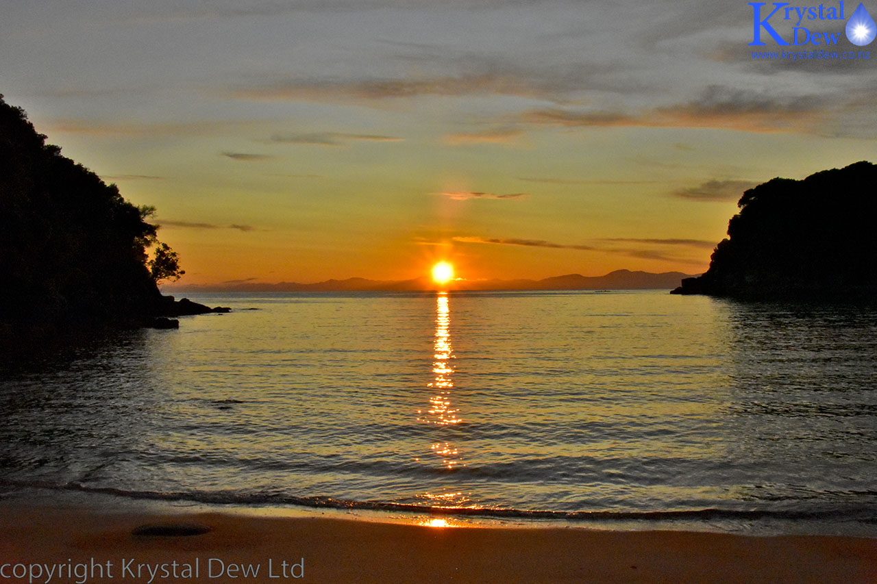
It was pitch dark when we went to bed in our little tent. I was so eager to get up and watch the sunrise that when I awoke and saw that it seemed to be getting light, I got dressed quietly, gathered my camera gear and it wasn't until I poked my head out of the tent that I realised the light was from the moon rising at around 3:00am in the morning. So back into the sleeping bag for another few hours sleep before getting up to take some dawn photos and watch the sunrise over the bay.
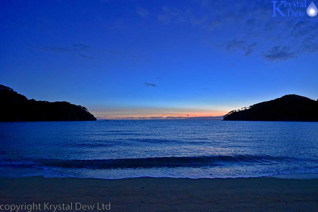
Dawn at Bark Bay
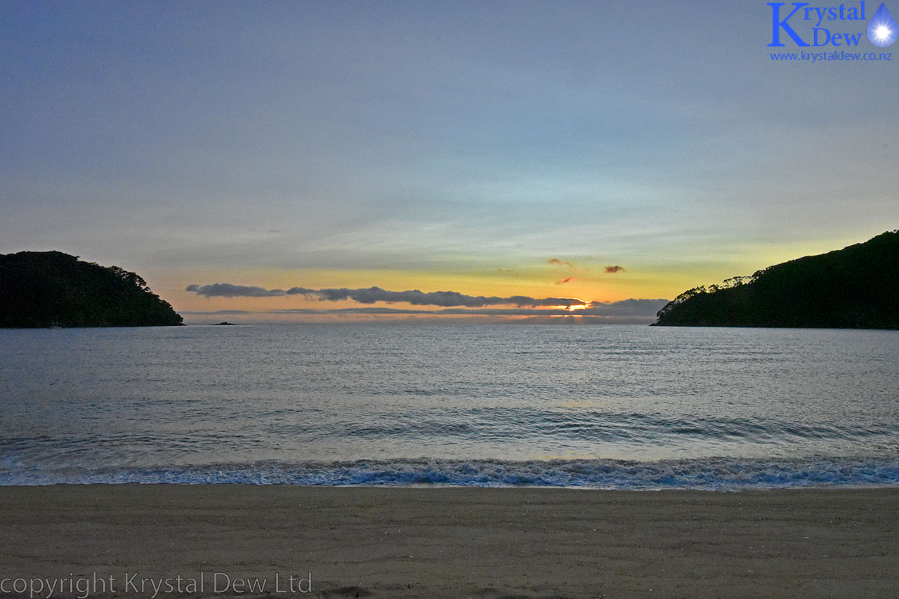
Sunrise
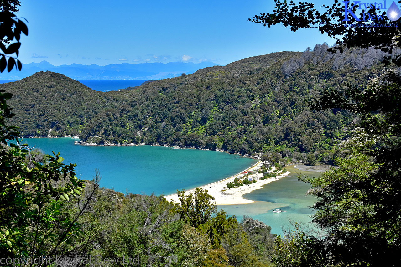
I got pretty cold sitting out on the beach watchingh the sunrise and ended up getting back n my sleeping bag to warm up before we had breakfast. We broke camp around 9:00 and then set off on the next leg of the track to Anchorage. It wasn't a huge distance to Anchorage. Our plan was to set up camp at midday, have lunch then head off on a side track to Cleopatras pool. We made it to Torrents bay in time to take the low tide crossing across the estuary (the inland track is more than an hours detour) so made it to Anchorage soon after 12:00. Anchorage is sheltered bay very popular for yachts.
We had our pick of tent sites at the Anchorage bay camp ground and picked what we thought was an idylic spot above the beach next a picnic table. After setting up camp we had lunch then set off on our side trip to Cleaopatras pools - about a 40 minute walk.
Cleaopatras pools are a couple of large pools in the Torrent river and are a popular swimming spot. We unfortunately hadn't thought to take our togs with us but couldn't resist the cold refreshing water so stripped off to our underware for a quick dip in the river.
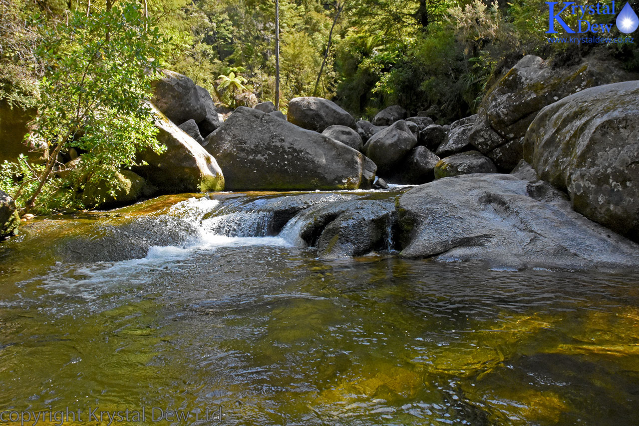
Cleaopatras Pools in the Torrent River
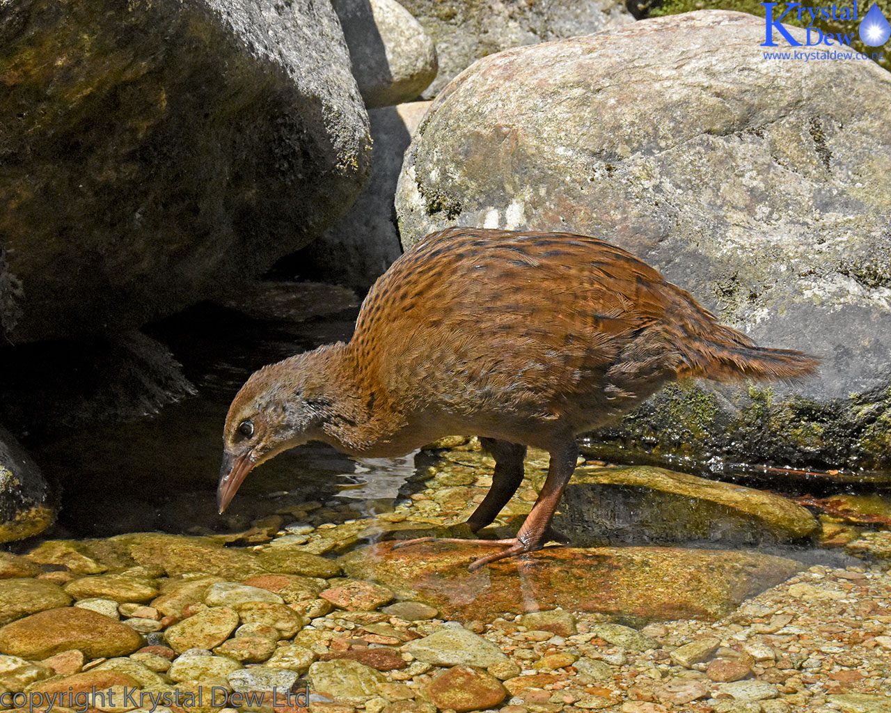
There were a couple of weka foraging in the river quite oblivious to all the tourists.
After a relaxing and enjoyable afternoon at the pools we returned to the campground to discover our idyllic camp site was now surrounded by a large group of danes who had come in by kayak. They were a friendly group but made a lot of noiseand had taken over our picnic table so we had to go and find somewhere else to cook our dinner.
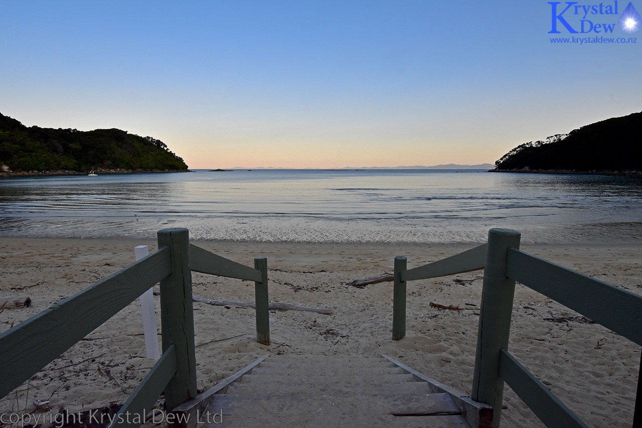
It was low tide in the evening and had a very enjoyable walk along the beach and fossicking in the caves at the far end.
Anchorage Bay
A little cave in the rocks at the northern end of the beach.
Looking along Anchorage beach. The camp ground is at the far end of the bay from here - in the trees above where the yachts are.
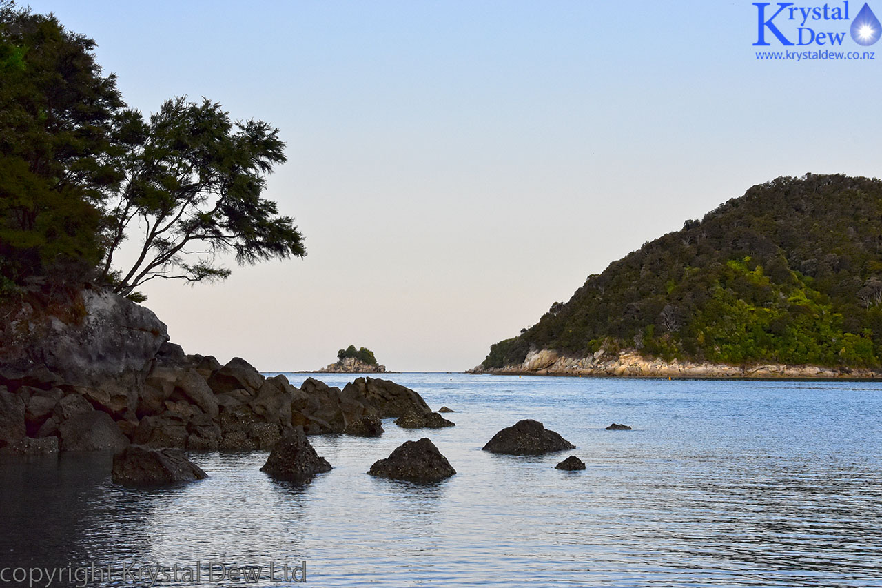
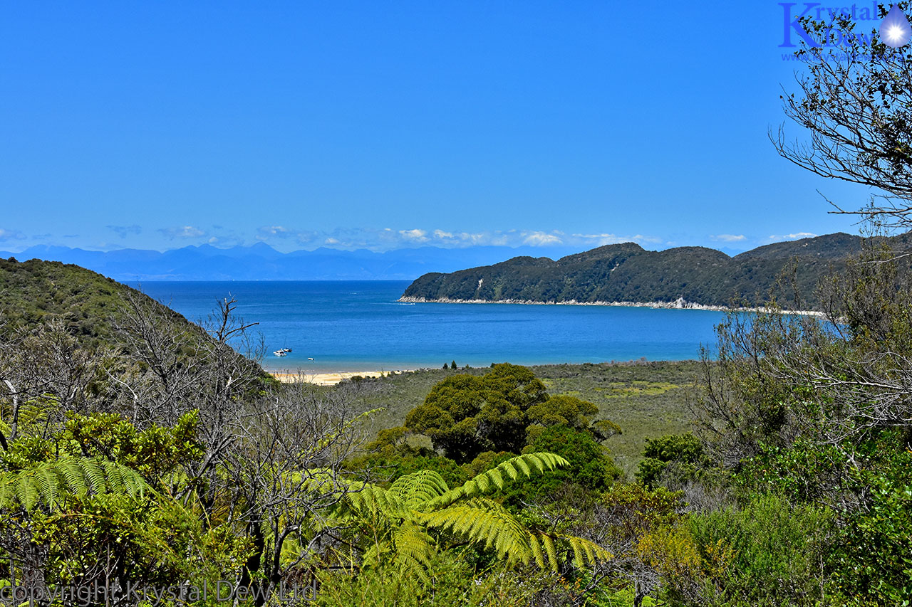
Looking out to the mouth of Anchorage Bay
Sunday 19th Jan.
Again I was up early to see the sunrise. I set of to Te Pukatea bay, I quiet and peaceful bay on the other side of the headland from Anchorage and spent a very peaceful hour watching the dawn colours change over the water before the sun finally rose.
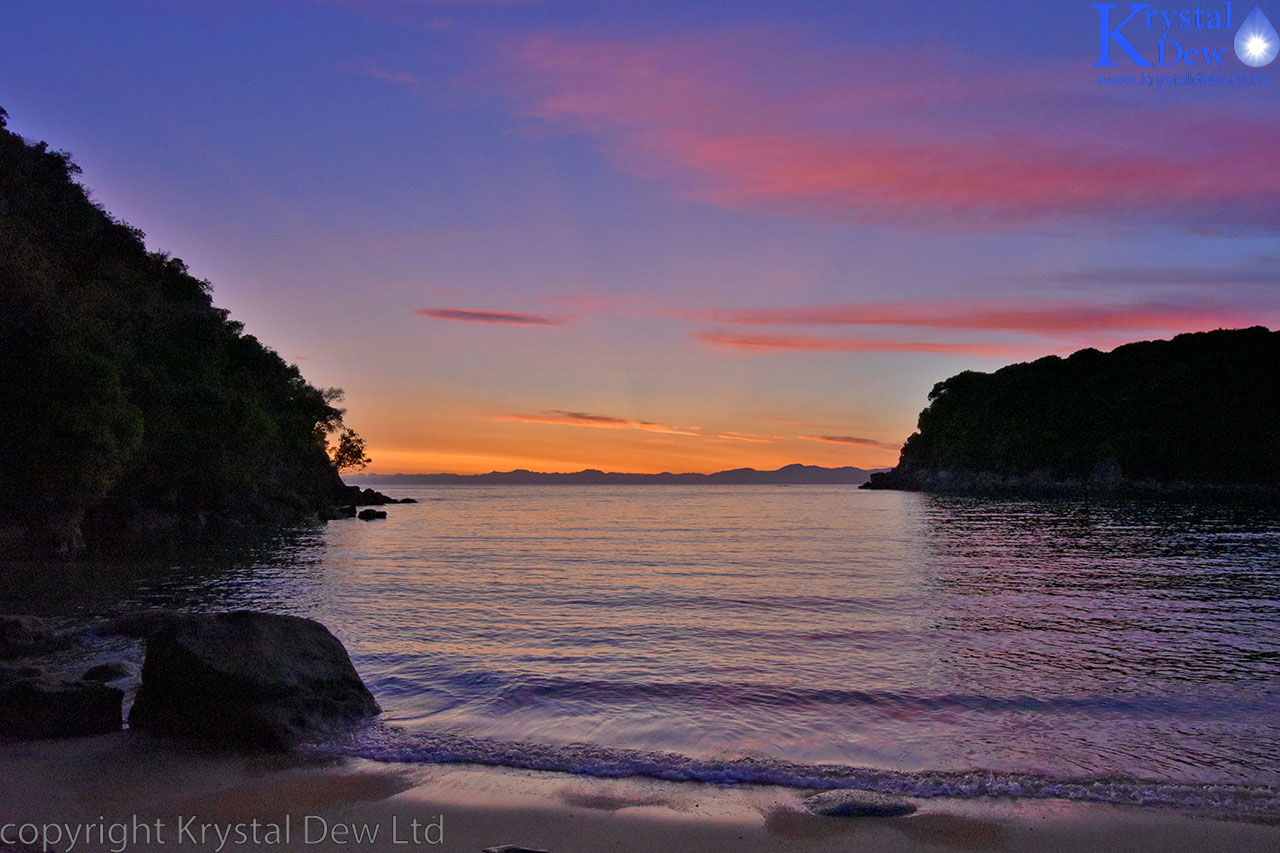
Dawn at Te Pukatea bay
Sunrise - Te Pukatea bay.
We broke camparound 9:00and set off on the last section of the track back to Marahou. The track climbs quite steeply out of Anchorage onto the ridge line with some stunning views of Anchorage and Torrents Bay.
The view fromteh ridge over Anchorage and Torrents Bay. There was lots of Manuka and Kanuka forrest on this section of track all in flower.
After the climb over the ridge the track drops down and winds around the hills behind the series of beautiful golden beach bays on the way back to Marahou. Mostof these bays have small campgrounds. We took a break at Apple Tree Bay.
Apple Tree Bay.
Then, before we knew it we were back in Marahau and the walk was over.
The Abel Tasman really is one of the most beautiful parts of the country and a fantastic walk.
We took a detour to Nelson lakes onthe way back to Picton and had a swim in the cold but refreshing waters of Lake Rotoiti.
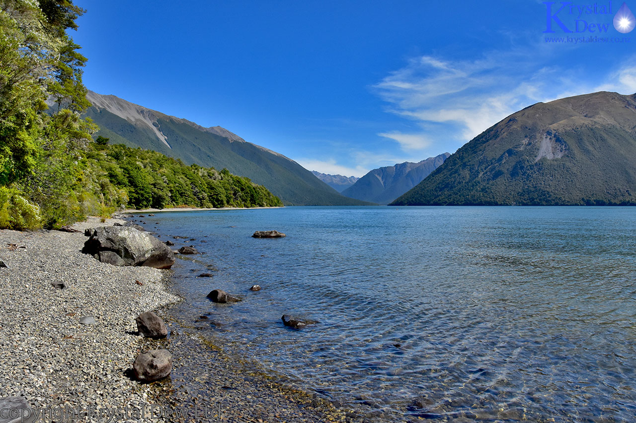
Lake Rotoiti - Nelson Lakes.
Recent Posts
-

The Milford Track
For the last few years my daughter Sarah, her fiance Sach and myself have been completing a great w …13th Feb 2024 -

The Waikaremoana Great Walk
We had originally planned to walk the Waikaremoana track in Februrary 2022 but with uncertainty over …31st Jan 2023 -

The Routeburn Track
We were going to walk the Waikaremoana Track this February but had concerns that the track might not …27th Feb 2022